Overview of 3d Drone Photography
3d drone photography represents a cutting-edge technological advancement that combines aerial drone imaging with three-dimensional mapping and visualization. This innovative method allows for capturing highly detailed, accurate, and comprehensive spatial data from the air, providing a richer perspective than traditional photography or videography. It is extensively utilized across various industries—from real estate and construction to urban planning and cultural heritage preservation—due to its ability to deliver precise topographical information and immersive visual experiences.
At the core of 3d drone photography is the integration of sophisticated drone hardware with advanced imaging sensors capable of capturing high-resolution images from multiple angles. These images are then processed to generate three-dimensional models, maps, and point clouds that serve a multitude of practical applications. Unlike conventional methods, it offers a rapid, cost-effective means to survey large areas with minimal human intervention, making it incredibly versatile and adaptable to diverse project requirements.
One significant advantage of this technology is its capacity to create highly accurate measurements and detailed spatial analyses without the need for physical access or extensive manual surveying. By facilitating real-time data collection and processing, it enhances decision-making processes, reduces project timelines, and improves overall efficiency. These qualities demonstrate why 3d drone photography has become an invaluable tool across multiple sectors, especially in regions that demand high precision and comprehensive spatial insights, such as Miami.
Additionally, the ability to produce photorealistic 3d visualizations helps stakeholders better understand proposed developments, assess environmental impacts, and plan future projects. As drone technology advances, the potential for 3d drone photography continues to expand, offering even greater detail, accuracy, and application scope to professionals seeking innovative spatial solutions.
Technologies Behind 3d Drone Imaging
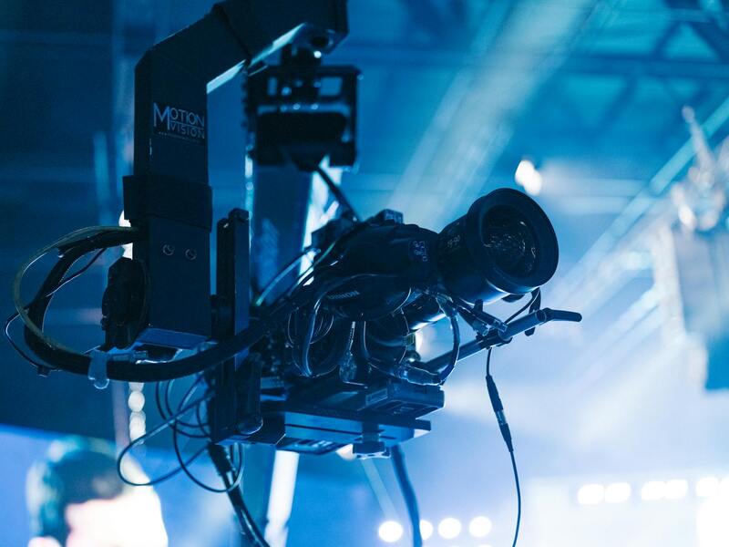
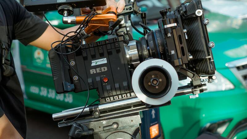
The foundation of high-quality 3d drone photography lies in the sophisticated integration of various technological components. Drones equipped with advanced multispectral or high-resolution cameras capture detailed aerial images from multiple vantage points. These cameras must offer precise georeferencing capabilities to ensure spatial accuracy across data sets. Additionally, stabilization systems such as gimbal mounts are essential to minimize motion blur and maintain image clarity during flight, especially in windy conditions or complex environments.
Core to the process are powerful 3D mapping software platforms that process the collected images. These software tools utilize photogrammetric algorithms to analyze overlapping images to identify common features. Through this analysis, they generate dense point clouds, textured meshes, and orthomosaic maps, which collectively create comprehensive three-dimensional models of the surveyed area.
Imaging techniques, including oblique and nadir photography, are employed to capture various perspectives and enhance model detail. Data collection can be further refined with pre-programmed flight paths and automatic triggering, ensuring consistency across multiple surveys.
Post-flight processing involves the use of sophisticated software that stitches the images, aligns the data, and constructs three-dimensional models. Algorithms optimize for accuracy, resolution, and detail, to produce models suitable for engineering analysis, environmental monitoring, or urban planning.

Emerging innovations continually enhance these technological aspects. High-speed processors, AI-driven image recognition, and real-time processing capabilities are expanding the potential of 3d drone imaging. Moreover, the integration of GPS and inertial measurement units (IMUs) ensures precise georeferencing, which is vital for accurate measurement and spatial analysis.
Expanding the Capabilities of 3D Drone Photography in Miami
Advancements in 3d drone photography have significantly transformed how professionals capture and analyze physical environments in Miami. One of the core strengths of these technologies lies in their ability to generate highly detailed and accurate three-dimensional representations of complex terrains, architectural structures, and urban developments. Accurate modeling hinges on the integration of various imaging techniques, such as oblique and nadir shots, combined with precision flight planning. These methods allow data collection over multi-angle perspectives, which is essential in creating comprehensive models that reflect real-world intricacies.
Processing this rich visual data demands sophisticated photogrammetric software that leverages cutting-edge algorithms. These platforms interpret the geometric relationships among overlapping images to produce dense point clouds—a foundational step in 3D modeling. Once these point clouds are generated, subsequent processes craft textured meshes and orthomosaic maps, which together deliver visually rich, scalable 3D models suitable for detailed analysis or presentation.
Emerging innovations in hardware and software continue to push the boundaries of what 3d drone photography can achieve. High-performance processors facilitate rapid data processing, enabling near-real-time model generation essential for time-sensitive applications. Concurrently, AI-driven pattern recognition and machine learning algorithms enhance feature detection, which improves the accuracy of models, especially in cluttered or heavily built-up areas.
The integration of GPS modules and inertial measurement units (IMUs) is fundamental to precisely georeferencing collected data. This geospatial accuracy ensures that models are not only visually detailed but also meet the spatial accuracy requirements needed for engineering, environmental monitoring, or architectural purposes. Moreover, the automation of flight paths and image capture triggers reduces human error, creating consistent and repeatable results across multiple surveys.
These technological strengths make 3d drone photography an invaluable tool for a wide array of Miami-based projects. From urban development and infrastructure inspections to ecological studies and real estate marketing, the capabilities of detailed, accurate 3D models are transforming industry standards. As technology continues to evolve, professionals can expect even faster data acquisition, higher resolution outputs, and increased automation, further enhancing the scope and precision of 3d drone imaging initiatives in Miami.
Legal and Safety Considerations in 3D Drone Photography
Implementing 3D drone photography in Miami requires adherence to established procedures that ensure both operational safety and data integrity. Professionals must adhere to comprehensive flight planning that accounts for local airspace regulations, community privacy preferences, and environmental constraints. Proper pre-flight risk assessments are vital to identify potential hazards such as crowded urban areas, sensitive infrastructure, and wildlife habitats.
Operational protocols include conducting detailed site surveys to determine the optimal flight paths, altitudes, and sensor configurations. These preparations help mitigate risks associated with drone crashes or inadvertent interference with other aerial activities. Additionally, maintaining clear communication channels with local authorities and property owners can facilitate smooth operations and prevent misunderstandings. Using geo-fencing technology and automatic flight restrictions further enhances safety by preventing drones from entering restricted zones.
Data security is another critical aspect of responsible 3D drone photography. Ensuring that collected imagery and 3D models are securely stored and encrypted protects client confidentiality and project integrity. Furthermore, implementing rigorous data validation procedures guarantees that the captured information accurately reflects real-world conditions, which is especially important for applications such as structural inspections, urban planning, or ecological monitoring in Miami’s diverse ecosystems.
By implementing these protocols, professionals can maximize the potential of 3D drone imaging while maintaining safety, security, and compliance with local standards, thus establishing trust with clients and the community alike.
Overview of 3d Drone Photography
3D drone photography represents a groundbreaking approach that combines high-resolution aerial imaging with advanced spatial data collection techniques, producing highly detailed three-dimensional models of terrains, structures, and urban landscapes. Utilizing sophisticated sensors, such as LiDAR and photogrammetry cameras, this technology captures precise spatial information from multiple vantage points, allowing for the creation of immersive and accurate 3D representations. This method surpasses traditional aerial photography by providing actionable spatial insight, which is invaluable across numerous industries in Miami.
Unlike standard 2D images, 3D drone photography involves capturing overlapping images or laser scans that are processed using specialized software to create detailed models. These models are interactive, allowing users to explore structures or terrains from any angle, which enhances assessment accuracy and decision-making efficiency. The advent of high-quality drone hardware combined with robust processing software has democratized access to this technology, enabling professionals across fields such as construction, environmental management, and real estate to leverage its full potential.
Technologies Behind 3d Drone Imaging
The core technologies underpinning 3D drone photography include advanced sensors, innovative imaging techniques, and sophisticated processing algorithms. Each component plays a critical role in achieving high-precision output:
- LiDAR Sensors: Light Detection and Ranging sensors emit laser pulses to measure distances to surfaces, creating dense point clouds that accurately depict complex geometries, even in low-light or challenging conditions.
- Photogrammetry Cameras: High-resolution digital cameras capture overlapping images from multiple angles, which are then processed via photogrammetric algorithms to generate 3D models and orthomosaics.
- GPS and IMU Systems: Precise positioning data ensures that each image or scan is georeferenced accurately, crucial for applications requiring spatial precision.
- Processing Software: Specialized software converts raw sensor data into detailed 3D models, allowing for measurements, annotations, and analysis within user-friendly interfaces.
These technological advancements collectively provide the foundation for producing detailed, accurate, and actionable 3D models, empowering Miami’s professionals to undertake complex analysis and planning tasks with confidence and precision.
Legal and Safety Considerations
When engaging in 3D drone photography, especially within the vibrant environment of Miami, it is essential to adhere to established procedures that ensure safe operation and responsible data collection. Operators should always be familiar with local regulations concerning drone flight restrictions, airspace classifications, and privacy expectations. Obtaining the necessary permits and clearances, particularly for operations over private property, densely populated areas, or sensitive environments, is a crucial step to prevent disruptions or legal complications.
Prior to deploying a drone for 3D imaging tasks, a comprehensive risk assessment should be conducted. This includes evaluating weather conditions to prevent accidents caused by wind, rain, or other adverse factors. A pre-flight checklist encompassing equipment safety, battery levels, signal integrity, and fail-safe mechanisms helps mitigate risks during the operation.
Responsible drone operation also involves respecting the privacy rights of individuals and entities within the capture zone. Operators are advised to avoid unnecessary exposure to private spaces and to notify stakeholders when conducting large-scale surveys or inspections. Maintaining logs of flight paths and data collection activities fosters accountability and transparency.

Moreover, continuous training and certification can enhance operational competence. Many jurisdictions offer specialized courses that cover drone safety standards, air traffic management, and ethical considerations. Keeping abreast of evolving regulations and technology updates ensures that professionals maintain best practices for efficient, secure, and compliant data collection.
Integrating these safety and procedural measures allows Miami professionals to harness the full capabilities of 3D drone photography while ensuring the well-being of the public, the environment, and their own teams. Establishing a disciplined workflow not only minimizes risks but also enhances the accuracy and credibility of the collected data, ultimately supporting successful project outcomes in construction, urban planning, real estate, and environmental monitoring.
Choosing the Right Equipment and Software
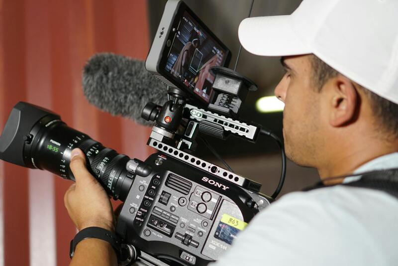
To achieve high-quality 3d drone photography, selecting the appropriate equipment and software is essential. This involves understanding the specifications required for capturing detailed, accurate images suitable for 3D modeling, mapping, and analysis. The drone itself should be equipped with a high-resolution camera capable of capturing images with precise georeferencing capabilities. Gimbals ensure stability during flight, reducing motion blur and enhancing image clarity. For detailed 3D reconstructions, the drone must support autonomous flight modes and waypoint navigation to systematically cover large areas.
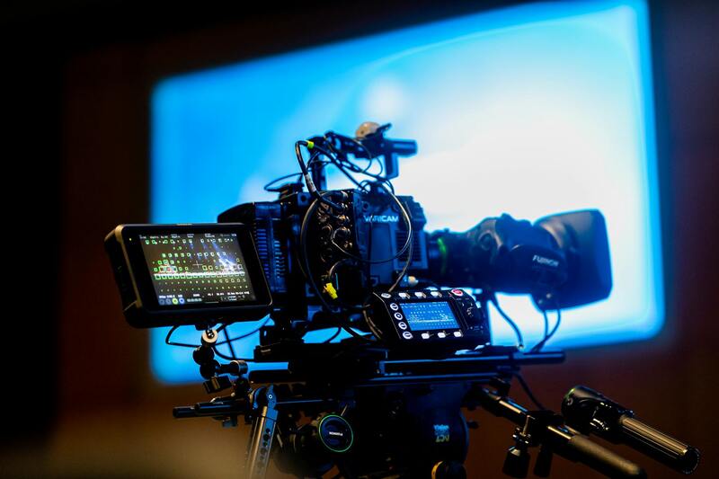
Beyond the drone hardware, the selection of photogrammetry software plays a crucial role in processing the captured images into usable 3D models. Software options such as Agisoft Metashape, Pix4D, and DroneDeploy offer robust features for stitching images, aligning datasets, and generating textured 3D meshes. These platforms facilitate efficient processing workflows, from initial data import to final model export.
Camera specifications are particularly critical: opt for lenses with appropriate focal lengths and sensors that excel in capturing detailed textures and depth information. Incorporating multispectral or thermal sensors expands applications into environmental monitoring and infrastructure inspection, providing additional data layers for comprehensive analysis.
Calibration and Data Management
Proper calibration of cameras ensures spatial accuracy in the resulting models. Regular calibration routines, including lens distortion corrections and forward/backward calibration checks, are vital for maintaining data integrity. Additionally, managing large datasets requires organized workflows, including data backups, metadata documentation, and standardized naming conventions to streamline processing and future analysis.
Technological Integration
Integrating GPS and IMU data with high-frequency image capture can improve the accuracy and consistency of 3D reconstructions. Modern drones often come with onboard sensors that facilitate simultaneous localization and mapping (SLAM), which is crucial for applications requiring real-time or near-real-time data collection. Additionally, cloud-based platforms enable collaborative workflows, allowing teams to access and analyze data remotely, accelerating project timelines.
Legal and Safety Considerations
Implementing 3D drone photography in Miami requires adherence to established safety and operational standards that ensure effective and responsible data collection. Professionals must be well-versed in regional airspace regulations and obtain any necessary clearances or permits prior to flight operations. This includes coordinating with local authorities to avoid interference with manned aircraft, especially in busy urban environments or near restricted zones. Safe drone operation also involves maintaining visual line of sight, respecting altitude restrictions, and avoiding flight over crowds or private properties without proper authorization.
Equipment safety protocols are equally important. Regular maintenance and pre-flight checklists help prevent mechanical failures. Operators should also stay updated on weather conditions, as adverse weather such as high winds, rain, or fog can compromise both safety and data quality. Battery management and emergency procedures should be thoroughly understood to prevent incidents during flight sessions.
Furthermore, professionals engaged in 3D drone imaging need to consider privacy implications rooted in community standards and personal rights. While explicit mentions of legalities are not necessary, respecting the privacy of individuals and property is crucial to maintain trust and professionalism. Using tools such as geofencing technology can prevent drones from entering sensitive areas inadvertently, contributing to an ethical operation environment.
From a technical perspective, employing advanced collision avoidance systems and redundant GPS modules can enhance flight safety, especially when operating in complex environments like downtown Miami or near dense infrastructure. These features help detect obstacles and adapt flight paths dynamically, reducing the risk of crashes or data loss. It is also vital to maintain comprehensive documentation of flight logs, calibration records, and software updates to track operational history and ensure data consistency.
By following these structured safety measures, professionals can execute successful 3D drone imaging projects that meet high standards of performance, reliability, and community responsibility. Such disciplined approaches lay the foundation for expanding the scope and sophistication of drone applications across different sectors in Miami, fostering innovation while safeguarding public confidence.