Overview of Drone RealEstate Photography
Drone real estate photography has revolutionized the way properties are showcased in the Miami housing market. By utilizing unmanned aerial vehicles equipped with high-resolution cameras, real estate professionals can capture stunning aerial views, expansive property landscapes, and unique architectural details that ground-level photos often miss. In vibrant and diverse markets like Miami, where waterfront properties, luxurious estates, and sprawling developments are prevalent, drone photography provides an unparalleled perspective that enhances the overall appeal of property listings.
Traditional real estate photography, while valuable, is limited to ground-level shots which can sometimes obscure the full scope of a property’s features or its surroundings. Drones bridge this gap by offering dynamic, high-quality images and videos that highlight a property’s proximity to notable landmarks, scenic views, and outdoor amenities. These visual assets play a crucial role in capturing potential buyers’ attention and encouraging virtual and physical visits. Furthermore, drone footage adds an element of modernity and sophistication to listings, setting them apart in competitive markets.
As Miami continues to attract both domestic and international buyers, the integration of drone technology into real estate marketing strategies is becoming increasingly popular. Realtors leverage aerial imagery to showcase the full extent of expansive estates, waterfront properties, and luxurious amenities. This approach not only garners more interest from prospective buyers but also offers a comprehensive visual understanding of property layouts and surroundings, which are often difficult to appreciate from traditional photographs alone.
For real estate listings that aim to stand out in Miami’s competitive environment, drone imagery provides an innovative and effective tool to communicate the true value of a property. By incorporating aerial shots, agents can effectively highlight location benefits, such as nearby beaches, parks, and iconic Miami skylines, thereby creating a compelling narrative around each property. As technology advances, the quality and usability of drone photography continue to improve, making it an indispensable asset in modern real estate marketing pipelines.
Types of Drone Shots for RealEstate Listings
Choosing the right drone shots is essential for maximizing the visual appeal and informational value of a property listing. Different types of aerial images serve distinct purposes, whether to highlight the property's scale, surroundings, or special features. Here are the most common drone shot types used in real estate marketing:
- Overview Shots: Wide-angle shots capturing the entire property and its immediate environment provide potential buyers with a comprehensive understanding of the estate layout and its spatial relations to nearby amenities or natural features.
- Property Details: Close-up shots from an aerial perspective focusing on distinctive architectural elements, landscaping, or unique features such as pools, outdoor kitchens, or garden designs enhance the property's appeal.
- Neighborhood Views: Elevated images showcasing the neighborhood, proximity to beaches, parks, schools, or commercial centers help prospective buyers gauge the lifestyle offered by the location.
- Sunset and Sunrise Shots: Filming during golden hours captures the property with warm natural lighting, emphasizing its ambiance and creating a captivating visual story.
- Highlighting Outdoor Amenities: Aerial footage focusing specifically on outdoor living spaces, such as patios, terraces, or recreational areas, aids in demonstrating the full scope of usable outdoor space.
- Point-of-Interest Shots: Drone captures of nearby landmarks, rivers, or skyline views enrich the listing's narrative, positioning the property within an attractive local context.

Strategic selection of these shot types ensures that the listing presents a comprehensive, engaging, and attractive view of the property, tailoring visual content to highlight its best features and contextual advantages. When executed with expertise, these drone shots can dramatically elevate the marketing impact and draw in more prospective buyers who value detailed and immersive visual content.
Legal and Regulatory Considerations in Miami
When engaging in drone real estate photography within Miami, adhering to established policies ensures that the captured footage maintains professionalism and avoids disruptions. Operators must be aware of the specific requirements surrounding airspace utilization, including restricted zones and designated flight corridors. Proper authorization is often obtained through official channels, which may involve submitting flight plans and obtaining necessary permits from relevant authorities. This process guarantees that aerial footage is captured safely and complies with local guidelines.
Operators should also stay informed about operational altitude limits and privacy protocols. Respecting neighboring properties and avoiding intrusive flying behaviors uphold the standards of responsible drone use. Additionally, maintaining up-to-date insurance coverage for equipment and liability purposes provides added assurance for clients and operators alike. By following these best practices, real estate professionals can confidently utilize drone technology to enhance property marketing without unexpected interruptions.
Focus on precision and safety during drone flights ensures high-quality footage that captures the property’s features effectively. For example, pre-flight checklists, secured flight paths, and real-time monitoring help mitigate potential mishaps or accidental interference with other airspace activities. This meticulous approach contributes to a seamless viewing experience for potential buyers, emphasizing the property's appeal through compelling aerial visuals.
Furthermore, when planning drone shoots, consider weather conditions to avoid wind or rain that could compromise footage quality or drone stability. Clear skies and optimal lighting conditions, especially during early mornings or late afternoons, result in more vivid and attractive imagery. By adhering to comprehensive operational standards, real estate professionals can leverage drone technology responsibly and effectively in Miami’s dynamic real estate market.
Legal and Regulatory Considerations in Miami
In Miami, conducting drone operations for real estate photography requires adherence to specific procedural protocols designed to ensure safety and compliance. These include obtaining necessary permissions from relevant authorities, such as aviation or municipal agencies, which oversee airspace use within the city. It is essential to familiarize oneself with local policies that govern drone flights in different zones, especially those near airports, restricted airspaces, or densely populated areas.
Operators should implement comprehensive safety measures, such as conducting pre-flight risk assessments, establishing secure flight paths, and maintaining clear communication with team members and property owners. Prior to each shoot, detailed planning ensures that drone paths are well-defined, avoiding interference with private property rights or public gatherings. The use of updated maps and airspace awareness tools can assist in planning flights that respect existing air traffic structures and no-fly zones.
Maintaining current documentation, including insurance coverage for aerial equipment and liability agreements, provides assurance for clients and facilitates smoother approval processes. Conducting regular equipment inspections and updates also helps in obtaining any necessary certifications or approvals, which can be crucial when operating within regulated environments.
Understanding and applying these procedural standards fosters a professional approach to drone photography, enabling real estate agents and photographers to showcase properties effectively while respecting local airspace guidelines. Careful attention to these operational details not only streamlines workflows but also enhances the credibility and reputation of the professionals involved in drone-based marketing efforts.
By aligning drone operations with official protocols, professionals maximize the impact of their aerial visuals and provide clients with compelling, legally compliant visual content that highlights the unique features of Miami properties.
Legal and Regulatory Considerations in Miami
For professionals engaged in drone real estate photography within Miami, understanding the established guidelines and procedures that govern aerial operations is essential. This involves detailed planning and coordination with relevant authorities to ensure that drone flights align with the local airspace management protocols. Prior to any aerial shoot, a comprehensive assessment of the property location, surrounding airspace restrictions, and no-fly zones is necessary to avoid disruptions or potential conflicts.
Operators should utilize updated geographic and airspace maps, along with real-time air traffic information, to chart safe flight paths. This proactive approach minimizes risks and ensures that drone operations do not interfere with other aerial activities. Additionally, maintaining current insurance certificates covering aerial equipment and liability is crucial, providing a layer of security and professional accountability.
In Miami, specific airspace considerations include proximity to busy urban areas, airports, and flight corridors. It is recommended to obtain any official permissions or notices that might be required for operating within designated zones. Using appropriate drone technology, such as geofencing features and automatic flight restrictions, can further prevent accidental incursions into restricted airspace.
Ensuring operational standards align with regulatory expectations enhances safety and professionalism. This diligence fosters trust with clients and property owners, emphasizing a commitment to responsible aerial imaging. When preparing for drone assignments, thorough documentation of flight plans, permissions, and safety measures should be systematically organized. This documentation not only streamlines the approval process but also demonstrates the adherence to official procedures.
Furthermore, personnel involved in drone operations should possess the necessary certifications and training, demonstrating competence in handling sophisticated equipment and managing aircraft safely within the urban environment of Miami. Through diligent adherence to these guidelines, real estate professionals can effectively incorporate drone footage into their marketing strategies, ensuring their visual content remains both impactful and compliant.
Choosing the Right Drone Equipment and Technology
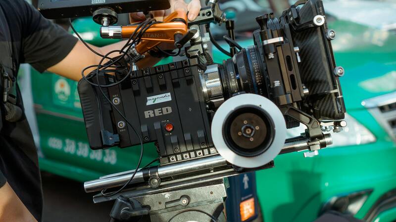
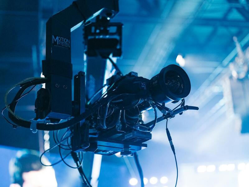
Selecting appropriate drone equipment is a fundamental step in ensuring high-quality, safe, and reliable real estate imagery. For professionals engaged in drone real estate photography, investing in a drone equipped with a high-resolution camera is essential. Cameras capable of capturing 4K or higher resolution images allow potential buyers to appreciate intricate details of properties, from architectural textures to landscaped gardens. Additionally, gimbals are critical components that stabilize the camera, enabling smooth, jitter-free footage even in windy conditions or during rapid maneuvers.
Beyond the camera system, drone specifications should include an adequate flight time—preferably 25-30 minutes—to complete comprehensive property scans without frequent battery changes. This ensures efficient coverage of large estates or extensive properties, minimizing operational disruptions. Flight controllers featuring GPS and automatic return-to-home capabilities contribute significantly to operational safety and ease of use, especially for those less experienced in aerial drone operation.
Advanced technology integrations such as obstacle avoidance sensors are invaluable for navigating complex environments, especially around trees, power lines, or dense urban settings. These sensors provide real-time feedback, preventing accidental collisions and safeguarding valuable equipment. Additionally, software for flight planning is critical; tools that allow pre-programmed flight paths and randomized coverage patterns can ensure consistent, professional footage and streamline the post-production process.
When selecting equipment, it is advisable to choose models with proven performance records and manufacturer support. Regular firmware updates can improve features and safety protocols, ensuring the drone operates at the highest standards. For those operate in Miami's dynamic and crowded airspace, equipment with sophisticated geofencing capabilities can automatically restrict flight in unauthorized zones, maintaining compliance and operational reliability. Embracing these technological advancements not only elevates the quality of visual content but also reinforces a professional image rooted in precision, safety, and strategic foresight.
Choosing the Right Drone Equipment and Technology
When it comes to capturing stunning real estate imagery through drone photography, selecting the appropriate equipment is pivotal. High-resolution cameras capable of shooting in 4K or even 8K resolution are essential to produce crisp, detailed images that highlight every feature of a property. These cameras should be integrated with gimbal stabilization systems, ensuring steady footage that accurately captures the grandeur of large estates or intricate architectural details.
Modern drone designs prioritize durability and ease of control, making them suitable for diverse Miami environments, from coastal homes to dense urban neighborhoods. For properties situated near water, rugged construction allows drones to withstand humid conditions and salty air, which can impact sensitive electronic components. Additionally, drone models equipped with longer battery lives enable more extensive flight sessions, allowing comprehensive coverage of sprawling properties without frequent recharging.
Advanced Features Enhancing Aerial Photography
- Obstacle Avoidance Sensors: Essential for navigating complex environments, these sensors detect obstructions in real time, preventing accidental collisions with trees, power lines, or structures.
- Geofencing Capabilities: Geofencing restricts drone flight within designated zones, safeguarding operations in restricted airspace or sensitive locations within Miami.
- Automated Flight Planning Software: Programs that allow for pre-set flight paths and randomized coverage ensure comprehensive and consistent footage, reducing post-processing time.
- Image Stabilization and Gimbal Technology: These features maintain camera stability during flight, delivering smooth footage pivotal for high-quality real estate presentations.
Technological Considerations for Miami’s Aerial Environment
Miami's vibrant cityscape and diverse terrain require drones capable of adapting to varying flight conditions. Equipment with sophisticated GPS systems can facilitate precise positioning, while sensors designed for bright lighting conditions prevent glare and overexposure. Moreover, incorporating software updates and firmware upgrades ensures that the technology remains current with the evolving requirements of aerial property imaging.
Given the intricacies of Miami's urban airspace, equipment with robust geofencing ensures compliance with local regulations by automatically restricting flights within designated zones, especially near airports or sensitive infrastructure. This adherence to safety standards is crucial for maintaining professional service quality and operational efficiency.

Advanced Techniques and Future Trends in Drone RealEstate Photography
To elevate the visual appeal of real estate listings via drone photography, professionals are increasingly adopting innovative techniques that push the boundaries of traditional aerial imagery. These approaches include the use of high-dynamic-range (HDR) imaging, which captures a broader spectrum of light, providing vibrant and detailed photographs even in challenging lighting conditions. Combining HDR with seamless panoramic stitching results in expansive, immersive views that help prospective buyers appreciate the full scale and beauty of a property.
Another emerging technique involves the integration of cinematic flight movements and shot compositions resembling professional filmmaking standards. Smooth, controlled drone movements—such as orbit shots, reveal shots, and upward tilts—add drama and engagement to property videos and images, ultimately creating a more compelling narrative for viewers. Utilizing robotic gimbals and advanced stabilization technology ensures these cinematic sequences are steady and visually appealing, free from jitters or unwanted motion artifacts.
Furthermore, 3D mapping and photogrammetry are transforming drone-assisted real estate marketing by offering detailed, interactive models of properties and surrounding landscapes. These detailed visualizations enable potential buyers to explore the property's layout and topography remotely, contributing to a more engaging and informative viewing experience.
Leveraging Technological Advancements for Future Success
Looking forward, the integration of artificial intelligence (AI) and machine learning algorithms is poised to revolutionize drone real estate photography. These technologies can automatically optimize camera settings based on environmental conditions, select the best angles, and even plan flight paths that maximize coverage and aesthetics—all with minimal human input. This automation increases efficiency while ensuring consistency and high quality in each capture session.
Additionally, advancements in multispectral and thermal imaging technology will expand the scope of drone photography to include environmental assessments, energy efficiency evaluations, and thermal leak detection, adding valuable layers of data for sophisticated property marketing and management.
Impact of Emerging Trends on the Miami Market
In Miami's dynamic and visually rich environment, these cutting-edge tools and techniques enable real estate professionals to stand out in a competitive market. From capturing stunning sunset views over beachfront properties to showcasing the intricate layouts of modern urban developments, the latest drone innovations facilitate storytelling that resonates with high-end clientele and discerning buyers.
As the field continues to evolve, staying informed about technological developments and continuously refining operational practices are essential for maintaining an edge in Miami's real estate sector. Appropriately harnessed, these advancements will shape the future of drone real estate photography—making it more immersive, precise, and impactful than ever before.