Overview of 3D Property Photography
3D property photography has revolutionized the way real estate properties are showcased online. Unlike traditional photos, which capture static images of a space, 3D photography creates immersive, three-dimensional representations that allow prospective buyers to explore properties virtually. This technology involves capturing multiple images and data points around a property, which software then stitches together to form an interactive digital model.
The primary purpose of 3D property photography is to enhance the online listing experience, providing a comprehensive view of the property that static images cannot offer. In a competitive real estate market such as Miami’s, distinguished visuals are essential for attracting serious buyers. By giving potential clients the ability to virtually walk through a home, 3D virtual tours foster a deeper understanding of the space, layout, and flow, leading to increased engagement and higher conversion rates.
This advanced visual method benefits both real estate agents and property owners. It reduces the need for multiple physical visits, saving time and resources, while also offering a detailed and accurate depiction of the property’s features. The technology employed in 3D property photography has become increasingly accessible and affordable, enabling more real estate professionals in Miami to incorporate this innovative approach into their marketing strategies.
As the Miami real estate landscape continues to evolve, 3D property photography has proven to be an invaluable tool for standing out in a crowded market. Its ability to deliver detailed, interactive views of properties makes it a preferred choice for showcasing high-end condos, luxury homes, and commercial spaces. With quick advancements in digital imaging, this technology is becoming an essential component of modern real estate marketing, ensuring listings are compelling and easy to access from anywhere in the world.
Technologies and Equipment Used in 3D Photography
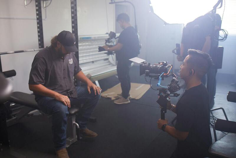
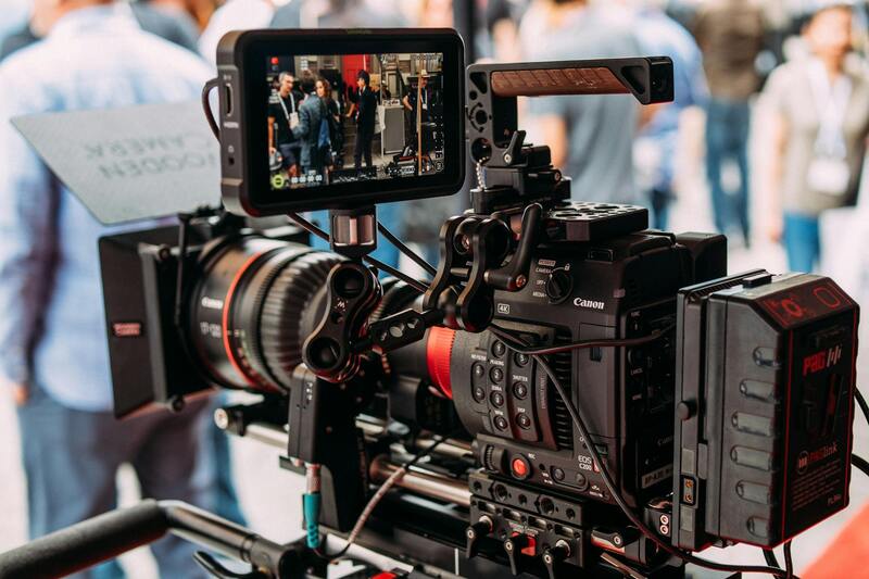
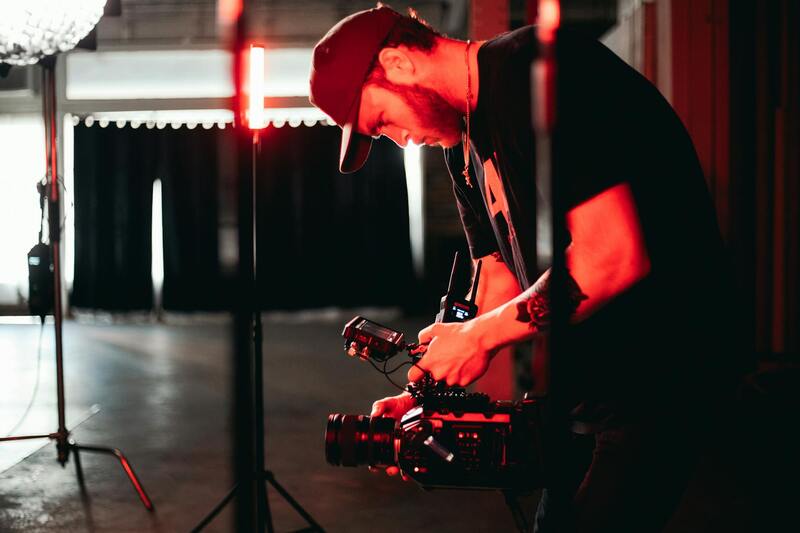
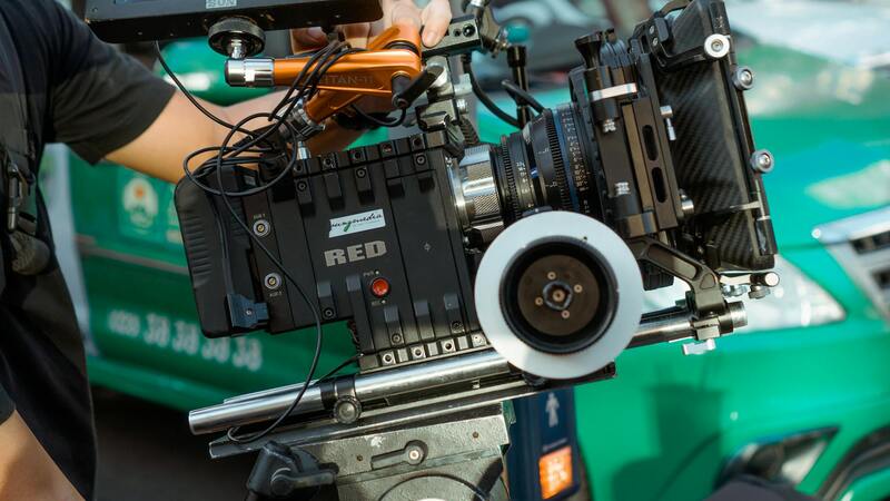
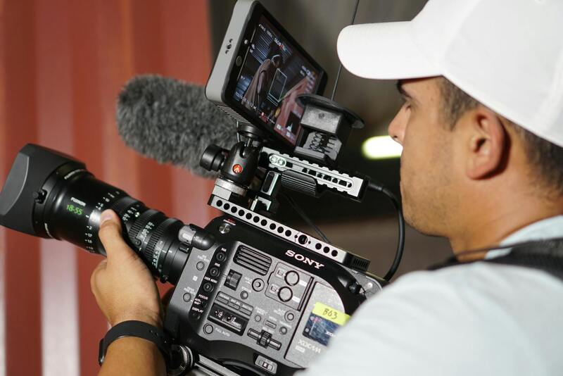
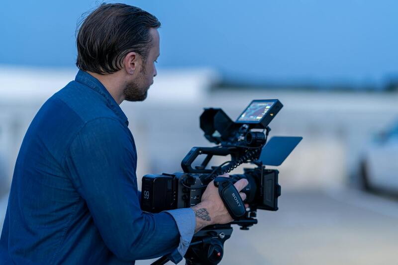
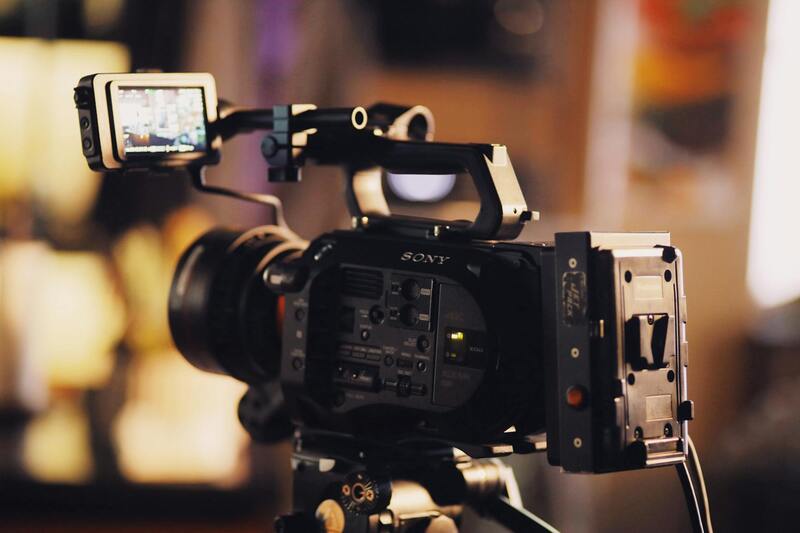
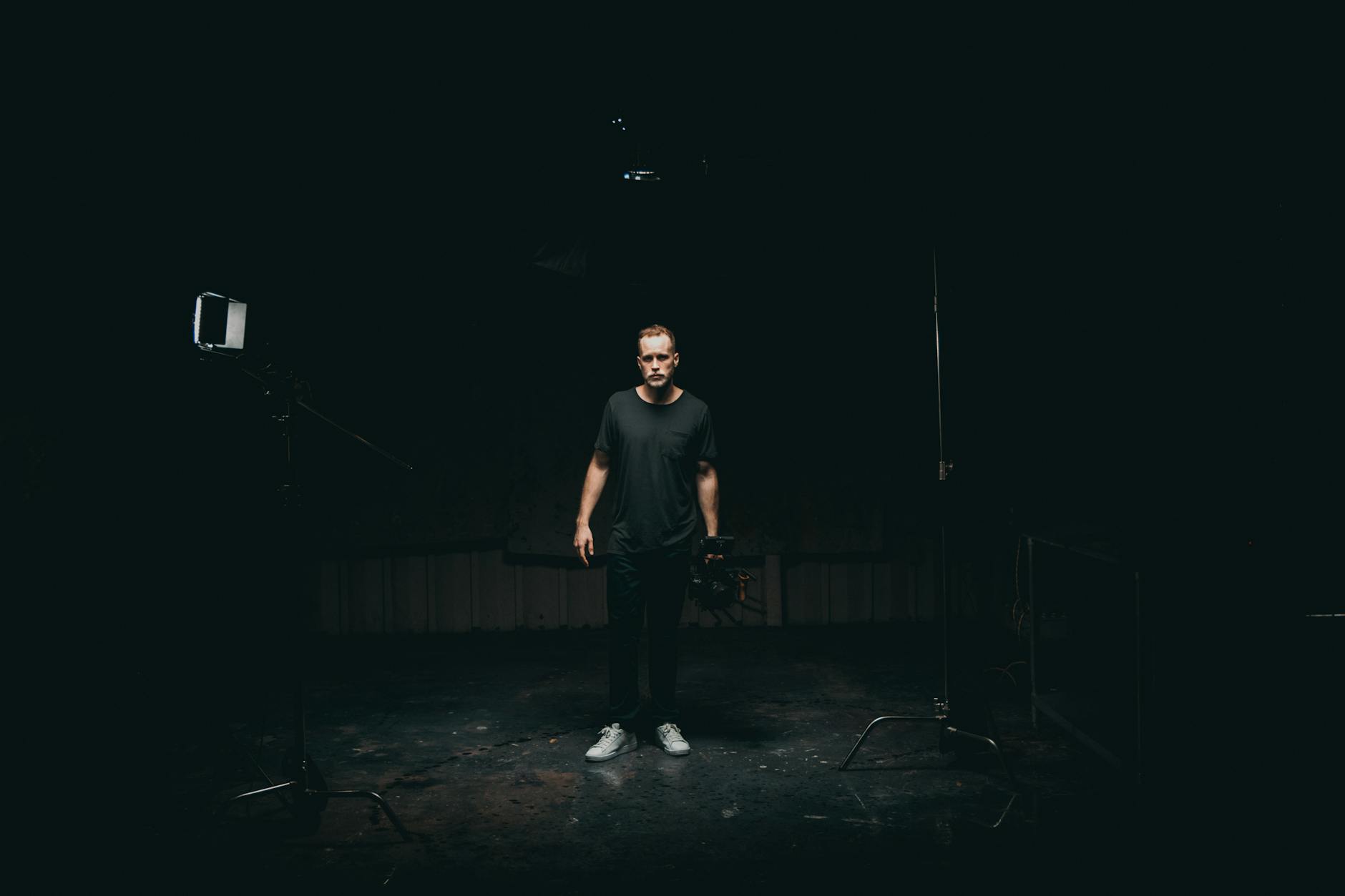
Implementing high-quality 3D property photography relies on cutting-edge technology and specialized equipment that enhance image accuracy and immersive experiences. Modern 3D capture begins with the use of advanced camera systems, often incorporating panoramic and fisheye lenses capable of capturing wide-angle views, which are essential for creating comprehensive virtual tours. These cameras are typically mounted on tripods or stabilization rigs to ensure stability and precision during the shooting process.
One of the core components of 3D photography is the use of high-resolution 360-degree cameras, which record the entirety of a space in a single shot, allowing for seamless virtual navigation. These devices are complemented by laser scanning and photogrammetry equipment, which generate detailed spatial data of interiors and exteriors. Such data is vital for accurately rendering the size, shape, and volume of different features within a property.
Furthermore, sophisticated software solutions process the captured data to produce interactive, photographic-quality 3D models. Some of these platforms merge the images with spatial measurements, creating detailed virtual walkthroughs that faithfully represent the property's dimensions. Drones equipped with high-resolution cameras are also increasingly used to capture exterior shots and hard-to-reach areas, providing comprehensive coverage for larger properties or commercial spaces.
The Process of Creating 3D Property Images
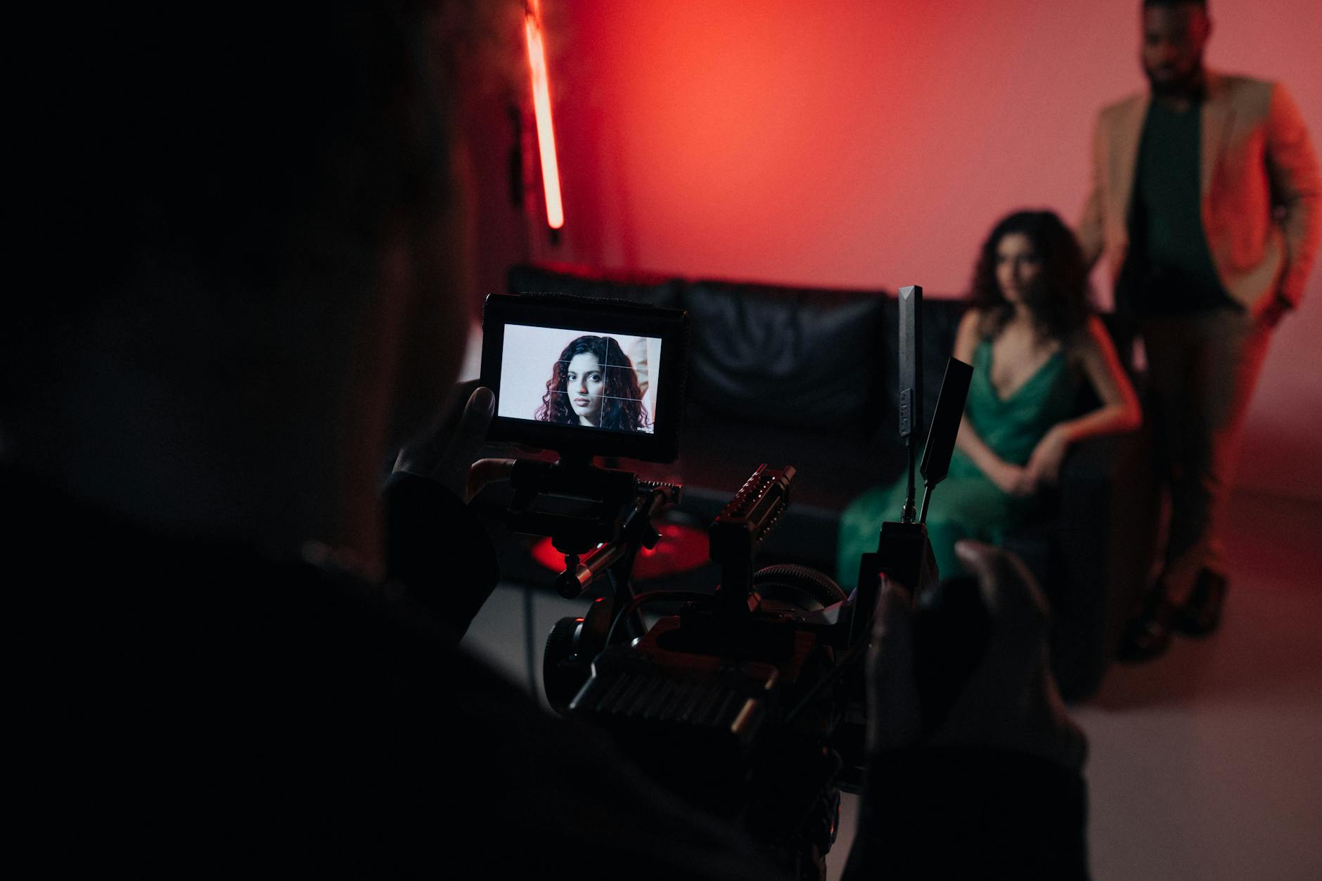
The development of compelling 3D property visuals involves a systematic process that begins with meticulous planning. A professional photographer or technician assesses the property, preparing key areas for shooting to optimize lighting conditions and minimize reflections or shadows that could distort the virtual experience. Scheduling is arranged to coincide with natural lighting whenever possible, ensuring vivid and true-to-life images.
During the shoot, the technician strategically places panoramic cameras and laser scanners at various points within each room, capturing comprehensive images and spatial data. Multiple overlapping shots are taken from different angles, creating a dense dataset that software later stitches together into a seamless model. When exterior shots are necessary, drones or elevated camera mounts can be used to secure high-angle views that showcase landscaping, frontage, and surrounding neighborhood features.
Post-production is crucial in refining the 3D visuals. Specialized software integrates all the data, aligning images, correcting distortions, and adding interactive elements. The result is an accurate, immersive virtual tour that can be navigated by potential buyers or tenants with simple mouse clicks or touch gestures. Delivery formats are optimized to ensure smooth loading times without sacrificing image quality, making virtual tours accessible on a variety of devices from desktop computers to smartphones.
Technologies and Equipment Used in 3D Photography
To produce exceptional 3D property visuals, professionals leverage a sophisticated array of tools, software, and hardware designed specifically for high-resolution, accurate imaging. Central to this process are specialized panoramic cameras equipped with multiple lenses that allow the capturing of comprehensive, 360-degree images within a single shot. These cameras enable rapid data collection, minimizing the need for extensive post-processing and ensuring consistency across various shots.
Alongside high-end cameras, laser scanning devices, also known as LiDAR sensors, play a pivotal role in capturing precise spatial measurements of interior and exterior environments. These devices emit laser beams that reflect off surfaces, recording intricate details of the property’s dimensions with exceptional accuracy. The result is a detailed 3D point cloud that serves as the foundation for constructing virtual models.
Software tools are integral to stitching, editing, and optimizing the captured data. Applications specialized in 3D modeling and virtual tour creation facilitate the alignment of panoramic images with the spatial data collected via laser scans. These platforms also allow for the integration of annotations, interactive hotspots, and multimedia elements, enriching the virtual experience for potential buyers.
In addition, drones equipped with high-resolution cameras are increasingly used to achieve aerial shots and external views of properties, providing comprehensive contextual understanding and showcasing the property's surroundings effectively. These are often synchronized with ground-based imaging systems to ensure consistency and accuracy in the final virtual tour.
All these tools combined facilitate a seamless workflow, from initial image and data capture to the final, immersive virtual presentation. The integration of cutting-edge technology allows for the creation of engaging and highly detailed 3D property visuals that meet the high standards demanded in the competitive Miami real estate market.
Technologies and Equipment Used in 3D Property Photography
Producing high-quality 3D property visuals relies on a sophisticated blend of cutting-edge technology and professional-grade equipment. Laser scanning devices are fundamental, capturing the precise dimensions of a property through laser beams that reflect off surfaces to generate detailed point clouds. These point clouds form the backbone of accurate 3D models, allowing viewers to explore the property’s layout dynamically. Complementing laser scanners, panoramic cameras with high resolution capture the interior spaces, providing crisp, immersive images that enhance virtual tour quality.
In addition, unmanned aerial vehicles (UAVs), commonly known as drones, equipped with ultra-high-definition cameras, play a vital role in capturing exterior shots and aerial views. Drones facilitate the visualization of a property’s surroundings, offering prospective buyers a comprehensive understanding of the local context and neighborhood dynamics.
Specialized software applications are integral to transforming raw data into interactive virtual tours. These tools assist in aligning panoramic images with the spatial data acquired through laser scans, ensuring accuracy and consistency throughout the virtual environment. They also enable the integration of interactive elements such as hotspots, annotations, and multimedia content, enriching the overall virtual experience.
Such technology facilitates a seamless workflow, beginning with data capture and culminating in the creation of immersive virtual tours that serve as powerful marketing tools in the competitive Miami real estate market. The continuous evolution of these devices and software solutions promises even greater realism, interactivity, and user engagement in future property visualizations.
The Process of Creating 3D Property Images
Developing high-quality 3D property images involves a systematic approach that combines precision hardware with advanced software to generate immersive digital representations of real estate spaces. The process begins with meticulous planning, where the photographer assesses the property layout, lighting conditions, and unique features to determine the optimal equipment setup and shooting angles. This preparation ensures that each shot captures the property's dimensions and intricacies with clarity.
During the actual capture phase, specialized 3D cameras and laser scanning devices are used to gather comprehensive spatial data. Panoramic cameras with high-resolution sensors are often employed to document interior spaces, providing seamless 360-degree views that serve as the foundation for virtual tours. Concurrently, laser scanners meticulously record the room dimensions, structural details, and spatial relationships within the property, ensuring precision in the digital model.
Once data collection is complete, specialized software takes over to process and convert the raw data into an interactive digital environment. This software aligns panoramic images with laser scan data, creating a cohesive virtual model that accurately reflects the property's real-world dimensions. During this stage, virtual hotspots, annotations, and multimedia elements such as videos or audio clips can be integrated to enhance user engagement.
The final step involves rendering the virtual tour, ensuring all elements work harmoniously to deliver a realistic and immersive experience. This stage requires careful quality assurance to address any discrepancies, such as misaligned images or inaccuracies in spatial representation. The culmination of these efforts results in a digital product that not only showcases the property in a compelling manner but also provides potential buyers and investors with an invaluable visual understanding of the space.
Technologies and Equipment Used in 3D Photography
Implementing high-quality 3D property photography relies on advanced technology and specialized equipment. Modern 3D imaging techniques utilize a combination of cutting-edge tools to ensure accurate, detailed, and immersive virtual representations of real estate properties. Among the most prominent devices are high-resolution panoramic cameras, laser scanners, and sophisticated software platforms designed for processing the captured data.
High-resolution panoramic cameras are integral in capturing 360-degree views of interior spaces, providing seamless visualizations that allow viewers to virtually explore every corner of a property. These cameras are capable of capturing multiple images in a single shot, which are later stitched together to create comprehensive virtual environments. Employing such technology ensures fine details and textures are preserved, enhancing the realism of the virtual tour.
Laser scanners, often used in conjunction with panoramic cameras, play a crucial role in capturing precise measurements and structural details. These devices emit laser beams that scan the space, collecting data points to create a detailed point cloud model. This model accurately reflects the spatial dimensions and layout of the property, which is essential for producing realistic virtual walkthroughs. The integration of laser scanning technology mitigates potential discrepancies between the digital model and the physical space, boosting confidence in the visual representation.
Software platforms used in 3D property photography are sophisticated tools that analyze, process, and render the data collected by cameras and scanners. These programs align the panoramic images with laser scan data, enabling the creation of cohesive virtual models. They also provide options for adding multimedia elements like hotspots, text annotations, and multimedia content, thereby enhancing the interactivity of the virtual tour. During the rendering phase, these software solutions ensure a smooth, immersive experience by fine-tuning lighting, textures, and spatial coherence.
In addition to hardware, powerful computing systems facilitate rapid processing and model generation, crucial for meeting client deadlines and maintaining high standards. The combination of these technologies forms a comprehensive arsenal capable of delivering highly detailed and engaging virtual representations tailored to the needs of Miami's dynamic real estate market.
Advanced Techniques in 3D Property Imaging
Creating precise and captivating 3D property images in Miami involves sophisticated techniques that leverage cutting-edge technology. High-resolution panoramic cameras capture every angle of a property, ensuring no detail is overlooked. These cameras often come equipped with fisheye lenses that capture a 360-degree view, which is then seamlessly stitched together through specialized software to produce a cohesive, immersive image. Additionally, drone photography is increasingly integrated into 3D property visualization, offering aerial perspectives that highlight property exteriors, landscaping, and surrounding areas—especially beneficial for luxury estates or properties with expansive lands.
The accuracy of 3D models is further enhanced through the use of laser scanning devices, which produce precise spatial data points. These devices emit laser beams that measure distances to surfaces within a property, creating detailed point cloud models. This data forms the backbone of realistic virtual tours, allowing potential buyers to virtually walk through a space as if physically present. When combined with the visual fidelity of high-quality images, these technologies ensure a rich, accurate representation of the property, crucial for Miami's competitive real estate market.
Enhancing Virtual Experiences with Interactive Elements
Modern 3D property photography incorporates an array of interactive features designed to engage potential buyers more effectively. Elements such as hotspots enable viewers to access additional information about specific areas or features within a property, like appliances, finishes, or unique architectural details. Text annotations provide context and descriptions directly within the virtual tour, enhancing user understanding without overwhelming the viewer. Video and audio clips can also be integrated to deliver personalized messages or detailed explanations, making virtual tours not only visually appealing but also highly informative.
Furthermore, users can customize their virtual experience by choosing different viewing modes, such as floor plan overlays or sectional views. These options help in understanding spatial relationships and measurements, aiding buyers in visualizing the property’s scale and layout comprehensively. The seamless integration of these interactive elements ensures that the virtual tour serves as a powerful marketing tool that captures attention and accelerates the decision-making process.
Latest Developments in 3D Imaging Technologies
The field of 3D property photography is continuously evolving with innovations that improve both quality and efficiency. Real-time rendering capabilities allow photographers to generate complex virtual models on-site or shortly after a shoot, reducing turnaround times and enabling faster client reviews. Artificial intelligence and machine learning algorithms are increasingly used to automate image stitching, data analysis, and even the detection of architectural elements, resulting in more accurate models with less manual intervention.
Additionally, augmented reality (AR) tools are now being incorporated into 3D property presentations. These enable prospective buyers and investors to overlay digital furniture, decor, or renovation options onto the virtual space, providing a preview of potential modifications. Such advancements not only elevate the visual impact but also facilitate more informed decisions for Miami’s diverse and discerning real estate clientele.
Choosing a Local 3D Photography Service in Miami
Selecting a reputable and experienced provider for 3D property photography is essential to maximize the visual impact of your Miami real estate listings. An effective service should specialize in high-quality imaging, possess a nuanced understanding of the local market dynamics, and demonstrate proficiency in the latest technological advancements. When evaluating potential vendors, consider their portfolio of completed projects, especially those showcasing properties similar in style and scale to your own. This provides insight into their capability to capture the unique features and architectural details that resonate with prospective buyers in Miami’s diverse market.
Another critical factor is the provider’s familiarity with Miami’s specific property types, whether luxury waterfront condos, historic homes, or modern apartments. Local photographers often have better knowledge of lighting conditions, neighborhood aesthetics, and market preferences, which translates into more compelling visuals. Additionally, inquire about their workflow, from initial consultation and planning to post-production and delivery, to ensure a seamless experience that respects your timeline and marketing schedule.
It’s also advantageous to select a service with experience in integrating 3D property visuals into multiple marketing channels, including online listings, virtual tours, and social media platforms. A provider with a comprehensive understanding of digital marketing strategies can help leverage these images for greater reach and engagement. Lastly, reviewing customer testimonials and obtaining references can offer valuable insights into the provider’s professionalism, responsiveness, and overall quality of work.
In Miami’s competitive real estate environment, partnering with the right local 3D photography expert ensures your property stands out. The investment in high-quality visuals not only attracts more prospective buyers but also accelerates the sales process by providing a transparent, immersive experience that transcends traditional photography. Carefully considering these aspects will help secure a service that elevates your property’s market presentation and delivers measurable results.