Overview of Drone Services in Real Estate
Drone technology has revolutionized the landscape of real estate marketing by providing innovative ways to showcase properties. The integration of aerial drone footage into property listings offers a dynamic perspective that traditional photography cannot replicate. This technological advancement allows real estate professionals to present homes and commercial spaces with engaging visuals that highlight the property’s best features, surrounding landscape, and community amenities.
Using drones in real estate significantly enhances the visual appeal of listings, making them stand out in a competitive market. High-quality aerial images and videos provide a comprehensive view of the property's exterior, including the roof, yard, landscape, and outdoor amenities. This broad perspective is particularly valuable for large estates, waterfront properties, or commercial developments where showcasing the entire property layout is essential.
Moreover, drone footage can be seamlessly integrated into virtual tours, offering potential buyers an immersive experience from anywhere in the world. This not only increases engagement but also accelerates the decision-making process by providing a clear understanding of the property's spatial relationships and surrounding environment.
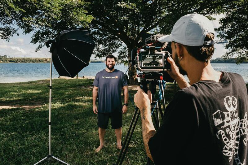
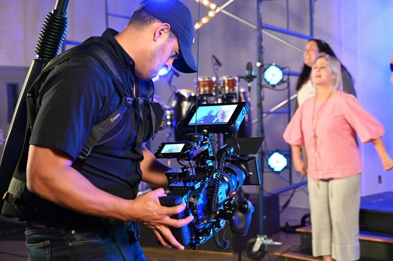
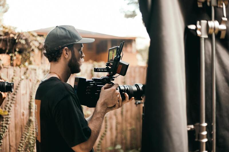
Employing professional drone services ensures top-quality visuals that meet industry standards, which is essential for establishing trust and credibility in real estate marketing. Professional operators use advanced equipment and techniques to capture stunning imagery, delivering results that elevate the perceived value of listed properties.
In addition to visual appeal, the strategic use of drone footage can facilitate better marketing outreach. By integrating aerial videos into online platforms, social media campaigns, and virtual presentations, real estate agents can reach broader audiences and generate more interest.
Types of Drone Footage Used in Real Estate
Employing various styles of drone footage enhances the visual storytelling of a property, making listings more engaging and comprehensive. Aerial photographs serve as striking cover images, providing instant context about the property's size, shape, and surrounding environment. These images often highlight unique features such as landscaped gardens, water views, or distinctive architectural details from angles that are difficult to capture with traditional ground photography.
3D video tours, generated through drone footage, offer a dynamic walkthrough experience. They allow potential buyers to explore the layout and spatial relationships of a property remotely, creating an immersive viewing experience that can replicate onsite visits. These virtual tours often include fly-through sequences that showcase property interiors and exteriors seamlessly, capturing the flow of the space while accentuating key features such as open floor plans or outdoor living areas.
Hyper-lapse videos, which involve rapid, time-lapse-style sequences captured from drones, provide an innovative way to reveal expansive property grounds or scenic surroundings over a specific period. They effectively demonstrate the scale of outdoor spaces, landscaping, and natural features like bodies of water or hills, creating visually compelling content that can hold viewers' attention longer.
Advantages of Using Drones for Real Estate Agents
For real estate professionals, integrating drone footage into marketing strategies offers several compelling benefits. First, aerial visuals significantly enhance property listings by providing a comprehensive view that ground-level photography cannot achieve. Listings with high-quality drone imagery tend to attract more attention online, increasing the likelihood of generating inquiries and showing interest from prospective buyers.
Furthermore, drone footage helps to emphasize the property's unique selling points—such as panoramic views, sprawling acreage, or proximity to local amenities—by showcasing these features from captivating perspectives. This visual impact often translates into faster sales cycles, as buyers gain a clearer understanding and emotional connection to the property.
In addition, aerial imagery integrates well into various marketing channels, including social media platforms, virtual tours, and print advertisements. The versatility of drone content ensures that marketing campaigns reach broader audiences, boosting visibility and engagement. This strategic use of technology also positions real estate agents as innovative and committed to high-quality marketing practices, helping to build trust with clients.
Enhancing Client Confidence with Professional Drone Services
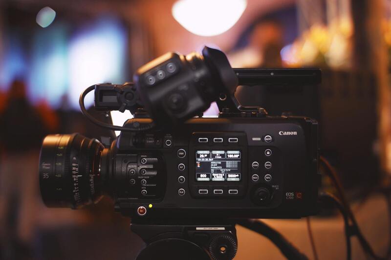
Using professional drone services guarantees that the footage captured meets the highest industry standards. Experienced operators utilize state-of-the-art equipment and proven techniques to avoid common issues such as image distortion, shaky footage, or poor lighting. This professionalism not only results in stunning visuals but also ensures safety protocols are rigorously followed, minimizing risks during flight operations.
High-quality drone imagery can elevate a property’s perceived value, significantly impacting buyer perception. Well-produced videos and photos can turn an average listing into a flagship property that stands out in a competitive market. As a result, clients benefit from a more effective presentation, which can translate into quicker sales and better market positioning.
Best Practices for Incorporating Drone Footage into Real Estate Marketing
To maximize the impact of drone footage in real estate marketing, it is essential to adopt best practices that ensure high-quality presentation and effective audience engagement. This involves a strategic approach to the timing, content, and integration of aerial visuals into overall marketing campaigns, thereby enhancing property appeal and attracting prospective buyers.
Firstly, pre-planning the shoot is crucial. Clear communication with the drone service provider allows the agent to specify key aspects such as the preferred angles, highlight features of the property, and optimize lighting conditions. Early coordination ensures that the imagery and videos align with the property’s unique selling points and marketing objectives.
During the filming process, attention to detail is paramount. Maintaining steady flight paths, utilizing smooth camera movements, and capturing various angles provide a comprehensive view of the property. The inclusion of both wide shots showcasing the property's surroundings and close-up shots emphasizing architectural details creates a compelling visual narrative that resonates with potential buyers.

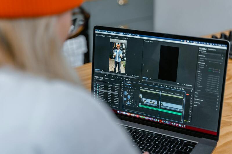
Following the shoot, professional editing plays a vital role in refining footage. Enhancing lighting, color correction, and incorporating branded elements or key property information results in visually captivating content. In addition, creating virtual tours or short video snippets tailored for social media platforms helps reach wider audiences effectively.
Integrating drone footage into broader marketing channels amplifies exposure. For instance, embedding aerial videos in online listings offers a dynamic overview of the property, enticing viewers to explore further. Utilizing drone images in brochures, email campaigns, and virtual reality experiences creates a cohesive marketing ecosystem, ensuring properties stand out in competitive markets.
To preserve professionalism and consistency, establishing a workflow that includes timelines for content delivery, approval processes, and performance tracking enhances the effectiveness of drone-based marketing strategies. Regularly updating visuals with seasonal or market changes keeps listings fresh and engaging, maintaining a competitive edge in the dynamic real estate landscape.
Maintaining Quality and Consistency in Drone Footage for Real Estate
Ensuring a high standard of drone footage is crucial for real estate professionals seeking to maximize the visual appeal of their property listings. Consistency in quality, image framing, and shooting techniques helps create a professional portfolio that enhances brand trust and attracts serious buyers. Working with experienced drone service providers who adhere to established industry standards guarantees that each shoot captures the property's most compelling features with clarity and precision.
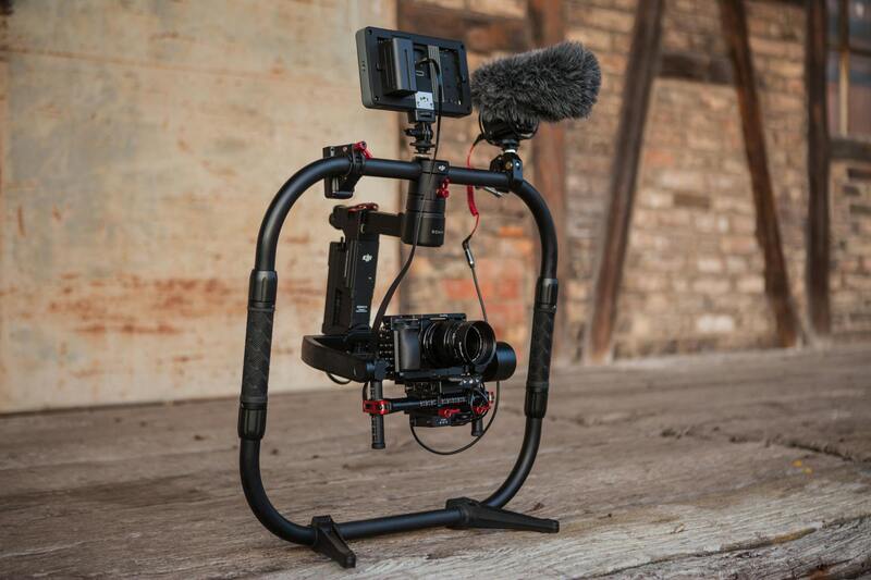
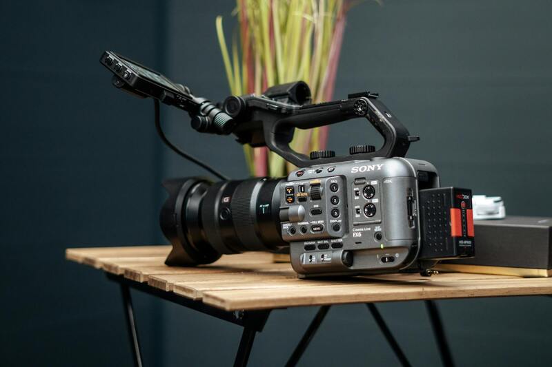
Effective drone photography involves selecting the right equipment and settings tailored to real estate needs. High-resolution cameras, stabilized gimbals, and drones capable of smooth, stable flight contribute to capturing sharp, visually appealing images. Proper planning of flight paths and shooting angles eliminates distortions and ensures comprehensive coverage of the property and its surroundings.
Post-production editing is equally vital to maintain a polished, professional look. Adjustments in lighting, contrast, and color grading help bring out the property's best features. Incorporating branding elements, text overlays, and virtual tours creates an engaging viewing experience that appeals to a targeted audience.
For real estate agents, establishing a workflow that includes clear timelines for content creation, review, and approval ensures deadlines are met and the content remains current. Regular updates to drone visuals, especially during market fluctuations or different seasons, keep listings fresh and relevant, ultimately aiding in faster sales.
Leveraging Drone Content Across Multiple Platforms
Integrated marketing strategies benefit greatly from versatile drone footage. Embedding aerial videos into online property listings provides buyers with a dynamic perspective not achievable through static images alone. Additionally, short video snippets optimized for social media channels broaden outreach and engagement, speaking directly to the digital-first behavior of modern homebuyers.
Utilizing drone images and videos in printed materials such as brochures, postcards, and virtual reality experiences adds layers of immersive storytelling. These elements create a cohesive marketing ecosystem, ensuring properties are showcased consistently across various touchpoints, thereby increasing their visibility in competitive markets.

By prioritizing quality and consistency, real estate professionals can significantly elevate their marketing efforts through drone imagery, reaching wider audiences and fostering faster sales cycles. Developing a reliable workflow and committing to ongoing visual updates maintain a competitive edge in the evolving real estate landscape.
Legal and Safety Considerations for Drone Use in Miami
Implementing drone services for real estate in Miami requires adherence to established operational standards designed to ensure safety and effectiveness. These standards encompass a range of practices, including authorized flight procedures, aircraft maintenance protocols, and responsible operational habits, such as respecting privacy boundaries and avoiding interference with manned aircraft. Conducting thorough pre-flight assessments of the environment can prevent potential hazards, including obstacles, adverse weather conditions, or crowded airspaces.
Professional drone operators utilize certified equipment that is regularly inspected and calibrated to guarantee optimal performance. They also maintain comprehensive flight logs and adhere to defined altitude restrictions, ensuring smooth integration with the local airspace management systems. Operators are typically trained in advanced navigation and emergency response techniques to swiftly address any unexpected situations during flights, thereby safeguarding both property and individuals.
Moreover, employing standardized communication protocols when planning and executing drone flights minimizes disruptions and promotes coordination among team members. Utilizing designated flight zones, securing necessary permissions, and respecting neighborhood privacy are integral components of responsible drone operation. Compliance with local regulations, including those related to flight restrictions over private properties and sensitive sites, helps maintain smooth operational workflows.
Engaging a drone service provider with documented experience and a track record of compliant operations fosters confidence. Such providers are well-versed in implementing safety checks and safety management systems that align with recognized industry practices. This structured approach not only enhances the quality of drone footage but also mitigates risks associated with aerial photography, ultimately producing professional results that elevate real estate listings.
Technological Enhancements and Data Integration in Drone Services
As drone technology continues to evolve, service providers are increasingly integrating advanced data analysis tools to maximize the value of aerial imagery in real estate marketing. High-resolution imaging coupled with Geographic Information System (GIS) integration allows agents to create highly detailed and interactive property maps, providing prospective buyers with comprehensive spatial understanding. This technological synergy enables the generation of 3D models and virtual tours, offering immersive experiences that can be accessed remotely, thus broadening the reach of property marketing campaigns.
Furthermore, the employment of multispectral sensors enables the collection of environmental data, such as vegetation health and thermal imaging, which can be instrumental in showcasing landscaped properties or highlighting technical aspects of the property’s infrastructure. Such detailed insights not only enhance the visual appeal of listings but also support transparent and informative communication with potential buyers.
Customization and Unique Offerings in Drone Service Packages
Recognizing the diverse needs of the real estate market, many drone service providers offer tailored packages designed to suit specific property types and market objectives. Custom options may include specialized camera setups for interior or detailed architectural shots, aerial videos with cinematic effects, or property fly-throughs with narration overlays. This customization allows real estate agents to craft compelling narratives around each property, making listings stand out in a competitive market.
Beyond standard services, some providers incorporate supplementary elements such as aerial staging, where drones assist in arranging or highlighting key features of a property to maximize visual impact. Additionally, integrating drone footage with existing marketing channels, such as social media, virtual walkthroughs, and online listings, creates cohesive and engaging campaigns that attract higher interest and accelerate sales cycles.
Quality Assurance and Performance Standards in Drone Campaigns
Ensuring consistency in quality is a critical element for drone service providers working within the real estate sector. This involves rigorous pre-flight planning, including detailed property assessments, weather analysis, and clearance checks, to guarantee safe and reliable flight operations. Post-flight, providers employ meticulous editing and color correction processes to produce visually appealing content that accurately reflects the property’s features.
Adherence to industry best practices emphasizes transparency and professionalism, with providers often offering samples, client testimonials, and performance metrics to demonstrate their commitment to excellence. Certifications and ongoing pilot training reinforce a high standard of service delivery, ultimately building confidence among real estate professionals who rely on drone footage to showcase their listings effectively.
Choosing a Drone Service Provider in Miami
Selecting the right drone service provider for real estate purposes in Miami involves a detailed evaluation of several key factors to ensure the outcomes align with your marketing objectives. Professionals operating within this niche must demonstrate a comprehensive understanding of the local real estate market, possess advanced technical skills, and adhere to strict operational standards. An ideal provider invests in cutting-edge drone technology, ensuring high-resolution footage, stable flight performance, and a variety of imaging options to capture every angle of a property.
Experience is vital when choosing a drone operator. Providers with a solid track record in real estate marketing can tailor their services to highlight unique property features, from spacious landscapes to intricate architectural details. Before engaging with a provider, it’s advisable to review their portfolio and request sample footage relevant to similar property types or locations. This preview helps evaluate their ability to deliver crisp, engaging visuals that resonate with target audiences.
Another important aspect is the provider’s compliance with industry standards for safety and operation. Effective communication and transparency about the flight process, equipment, and post-production procedures foster trust. High-quality providers typically offer consultations to understand your specific needs, ensuring that the delivered content aligns with your branding and marketing strategies. Moreover, they often support flexible package options, catering to different project budgets and scope complexities.
Cost transparency is another essential element when selecting a drone service provider. While pricing structures vary, reputable companies clearly outline their fee models, which may include flat rates, hourly rates, or customized packages based on property size and the number of desired footage types. Generally, larger or more complex properties requiring extensive coverage, specialized shots, or post-production editing will incur higher costs. Nevertheless, providers should be willing to discuss options and offer scalable solutions that suit different marketing campaigns.
It's also advantageous to inquire about ongoing support and consultation services. A committed provider will guide clients through the entire content creation process — from initial site assessments and flight planning to post-flight editing and integration into marketing channels. Such collaborations minimize project risks and ensure the final product effectively enhances the property's market appeal.
Future Trends in Drone Usage for Real Estate
As the landscape of real estate marketing continues to evolve, emerging drone technologies are poised to significantly enhance how properties are presented to potential buyers. The integration of advanced features such as 4K resolution filming allows for ultra-high-definition visuals, providing sharply detailed imagery that captures the property’s best features with crystal clarity. This level of detail not only improves visual appeal but also fosters greater transparency, helping prospective clients get a true sense of the property's scale and condition.
Thermal imaging capabilities are increasingly being incorporated into drone services, presenting new opportunities for property analysis. These tools enable real estate professionals to identify issues related to insulation, moisture intrusion, or energy efficiency—facts that might otherwise require invasive or costly inspections. By providing thermal data alongside traditional aerial footage, agents can offer comprehensive property insights, setting their listings apart in competitive markets.
Artificial Intelligence (AI) integration is another frontier gaining momentum in drone applications. AI can automate flight paths, optimize shot angles, and even assist in object recognition, which helps in creating more dynamic and personalized visual content. For instance, AI-driven editing software can quickly generate engaging virtual tours or highlight key property features, reducing turnaround times and improving campaign responsiveness.
Furthermore, the advent of autonomous drones equipped with smarter obstacle avoidance systems allows for safer and more efficient flights around complex or hard-to-access properties. This not only minimizes operational risks but also broadens the scope of environments where drone footage can be safely captured.
Looking ahead, the continuous advancement of drone accessories and onboard sensors will facilitate more diverse applications. These can include detailed topographical surveys, 3D mapping of large estates, and real-time property monitoring—tools that empower real estate professionals to deliver richer, more informative content to clients.