Overview of Drone Realty Photography
Drone realty photography has revolutionized the way real estate properties are showcased, particularly within vibrant markets such as Miami. This innovative approach employs unmanned aerial vehicles (UAVs) equipped with high-resolution cameras to capture stunning aerial images and videos of properties. By providing a comprehensive, bird's-eye perspective, drone photography allows prospective buyers to experience a property’s scale, layout, and surrounding environment more vividly than traditional ground-level images. In Miami’s competitive real estate landscape, the integration of aerial imagery has become a vital component of effective marketing strategies, helping listings stand out among numerous options.
The strategic use of drone realty photography extends beyond simply capturing attractive images. It enables real estate professionals to showcase the property’s proximity to local amenities, waterfronts, parks, and other significant features of the Miami area. Furthermore, aerial footage provides viewers with a sense of scale and context that traditional photos often cannot convey. This enhanced visual presentation frequently leads to quicker sales, higher engagement from potential buyers, and a boost in listing visibility.
As Miami continues to thrive as a hub for luxury, beachfront properties, and unique architectural developments, the demand for professional drone realty photography services has surged. Buyers increasingly rely on high-quality aerial imagery to make informed decisions without the need for immediate onsite visits. For agents and property developers, investing in professional drone photography elevates their marketing efforts, positioning their properties at the forefront of digital real estate platforms.
When executed by experienced operators, drone realty photography adheres to strict safety standards, ensuring that images are captured efficiently and ethically. These professionals utilize advanced equipment and techniques to deliver pristine visuals that highlight each property’s unique features. As a result, drone photography has become an indispensable part of the modern real estate marketing toolkit in Miami, helping listings achieve maximum exposure and appeal through visually compelling content.
Legal and Regulatory Considerations in Miami
Successfully executing drone realty photography in Miami necessitates adherence to specific operational standards and guidelines that ensure responsible flight practices. Professional drone operators maintain rigorous workflows aligned with local regulations, which include obtaining necessary authorizations for aerial filming, especially in densely populated or sensitive areas. These standards emphasize safety, privacy, and airspace management, preserving public trust while enabling high-quality visual content creation.
Operators utilize certified drone systems that are regularly inspected and maintained to meet performance and safety benchmarks. They conduct thorough pre-flight assessments to identify potential risks, such as nearby structures, wildlife, or crowded environments. During flights, real-time monitoring helps prevent accidental incursions into restricted zones or flight paths that could disrupt the safety of others.
Moreover, professional drone photographers are well-versed in local airspace restrictions, which often include designated no-fly zones, altitude limits, and specific time windows for aerial activities. This knowledge helps ensure operations occur within prescribed parameters, safeguarding both the operators and the community.
Before any aerial shoot, detailed planning involves evaluating weather conditions, wind patterns, and lighting scenarios—all critical factors for capturing sharp, visually appealing imagery. This preparatory phase guarantees that each shot aligns with marketing objectives and meets quality standards.
Technical Aspects of Drone Photography for Real Estate
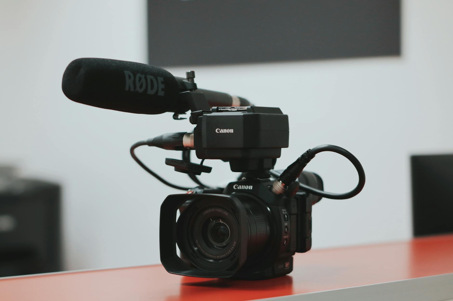
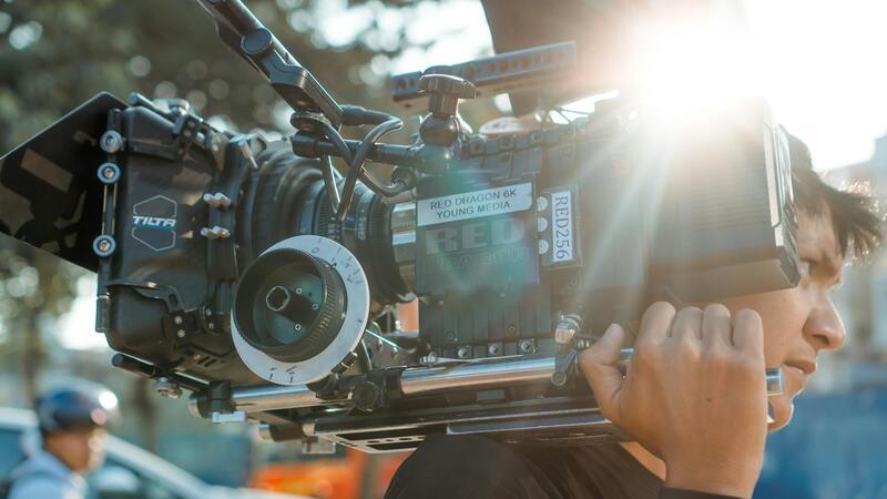
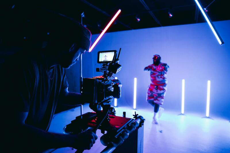
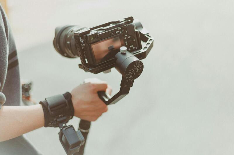
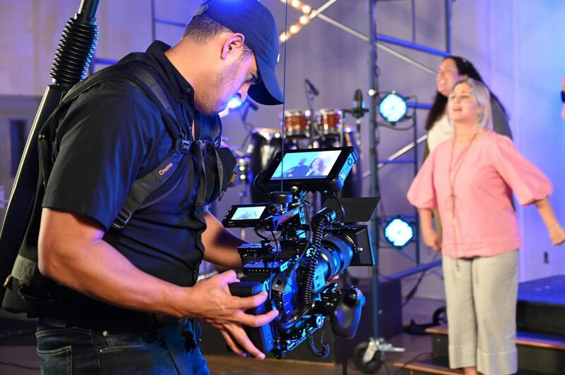
Effectively capturing compelling real estate imagery with drones requires a combination of advanced technology and expert operation. High-quality drone units are equipped with high-resolution cameras capable of capturing detailed images and videos, even in challenging lighting conditions. Multi-axis gimbal stabilization ensures smooth footage, reducing vibrations and motion blur that can detract from the visual appeal of property shots.
To achieve optimal results, drone operators utilize flight planning software that maps out precise routes, altitude, and angles. This planning is essential for covering the entire property and surrounding landscape comprehensively. Automated flight modes, such as orbit or waypoint navigation, enable consistent framing and repetition, which is invaluable during property staging or promotional campaigns.
Post-flight processing plays a key role in delivering striking visuals. Professional editing software enhances color grading, corrects distortions, and stitches images into high-resolution panoramas. For video content, stabilization, color correction, and aerial stabilization techniques are employed to produce cinematic sequences that captivate viewers.
Understanding the technical specifications of drone hardware and software is vital. Flight time varies depending on drone model and environmental conditions, typically ranging from 20 to 30 minutes per battery cycle. Advanced drones feature obstacle avoidance sensors, which mitigate collision risks during complex flight paths, particularly around densely built properties.
Color calibration and imaging presets ensure consistency across multiple shots, which is crucial when showcasing a portfolio of listings or creating virtual tours. Furthermore, integrated GPS systems provide geo-tagging capability, allowing real estate agents to precisely document every location and angle, facilitating accurate property mapping and virtual visualization.
By harnessing these technological advancements, drone realty photography offers a level of detail and perspective that enhances property marketing strategies and appeals directly to prospective buyers, making it an indispensable tool in Miami’s competitive real estate market.
Different Methods to Legally Capture Drone Realty Photography in Miami
Obtaining high-quality aerial footage for real estate purposes in Miami involves adhering to a range of official procedures designed to respect established guidelines and operational standards. The process begins with selecting accredited drone operators who have demonstrated expertise and compliance with local aviation policies. These professionals possess the necessary certifications and licenses to operate UAVs in compliance with regulations, ensuring the safety of both the operator and the surrounding community.
One of the primary approaches involves securing the appropriate permissions or permits issued by relevant authorities, such as the Federal Aviation Administration (FAA) and local Miami agencies. These permits typically specify the permitted flight zones, times, and altitude limits to prevent interference with other airspace users or restricted areas. For real estate photography, these approvals enable drone operators to conduct flights over private properties while maintaining safety standards.
In addition to permits, there are robust operational procedures that drone pilots follow to align with official protocols. These include pre-flight risk assessments, detailed flight planning, and environmental considerations, such as weather conditions and flight path restrictions. Using geo-fencing technology and obstacle avoidance systems further enhances safety during aerial captures, especially in densely populated or high-rise areas typical of Miami.
Another important method involves utilizing drone services from companies that specialize in real estate aerial photography. These firms often have established relationships with regulatory bodies and are familiar with the necessary steps to ensure compliance. Their expertise extends to planning compliant flights, obtaining authorizations, and conducting post-flight audits, which collectively help property marketers achieve stunning visuals without infringing on established guidelines.
Furthermore, drone operators often coordinate with property owners and local authorities to schedule flights that minimize disruption and follow local ordinances. Clear communication and thorough planning are essential to execute professional drone realty photography that aligns with all regulatory requirements, fostering trust and professionalism in Miami’s vibrant real estate market.
Maintaining a thorough documentation process is equally vital. This includes recording flight plans, permits, and compliance checks, which serve as official records in the event of audits or further regulatory inquiries. By following these official procedures meticulously, real estate professionals can utilize drone photography effectively and ethically, capturing the full scope of Miami’s diverse properties from impressive aerial perspectives.
Technical Aspects of Drone Photography for Real Estate
Effective drone realty photography hinges on a combination of advanced technical skills and sophisticated equipment. High-resolution imaging sensors are essential for capturing sharp, detailed visuals that showcase the unique attributes of Miami’s diverse properties. Modern drones equipped with 4K or higher video capabilities allow for stunning cinematic footage, while high-megapixel cameras ensure crisp still images that highlight architectural details and landscape features.
Fly stability and GPS precision play a critical role in acquiring professional footage. Drones outfitted with state-of-the-art stabilization systems minimize camera shake, resulting in smooth, professional-grade visuals. GPS technology facilitates precise navigation, enabling operators to execute complex flight paths with accuracy—important for capturing comprehensive views of large properties or intricate outdoor spaces unique to Miami's upscale neighborhoods.
Lighting conditions significantly influence the quality of drone visuals. Planning flights during golden hours—shortly after sunrise or before sunset—maximizes natural lighting and creates warm, inviting images. Additionally, understanding local weather patterns, such as high humidity or tropical storms, helps drone operators schedule flights for optimal conditions, ensuring safety and image clarity.
Image stabilization and gimbal technology are vital for capturing smooth videos and sharp photos simultaneously. When selecting equipment, professional-grade gimbals that allow for 3-axis stabilization can dramatically improve the quality of aerial footage, providing clear, jitter-free visuals that emphasize a property’s best features from various angles.
Operationally, pre-flight planning involves mapping out flight paths and defining specific angles for capturing expansive views of Miami’s waterfronts, high-rise developments, and lush landscapes. This meticulous approach ensures comprehensive coverage while adhering to safe flight practices. Also, utilizing software tools for flight planning enhances route accuracy, helps avoid obstacles, and enables effective management of multiple takes rapidly.
Post-flight processing is another important phase. Raw footage and images require precise editing to enhance colors, correct distortions, and produce a portfolio of visual content that aligns with branding strategies. Utilizing editing software that allows for color grading and image enhancement ensures the final visuals capture the vibrancy and appeal of Miami’s properties accurately.
Furthermore, establishing consistent shooting protocols—such as standardized angles, height levels, and shot sequences—helps maintain visual coherence across property listings. This consistency reinforces brand identity and provides potential buyers with a seamless viewing experience, whether they are exploring a luxury condo overlooking downtown Miami or a sprawling estate in Coral Gables.
Technical Aspects of Drone Photography for Real Estate
Executing drone realty photography in a manner that elevates a property’s visual narrative requires attention to several technical details. Equipment choice is paramount, with professional-grade drones equipped with high-resolution cameras, stabilized gimbals, and advanced sensor technology. These components contribute to sharp, clear imagery that captures intricate architectural features and expansive property landscapes from various altitudes and angles.
Flight planning is a critical phase where precise route mapping ensures comprehensive coverage of the property’s exterior. Flight paths should be strategically designed to highlight unique features such as waterfront access, landscaped gardens, and multi-level structures. Employing flight planning software allows operators to create efficient, obstacle-aware routes that maximize coverage without compromising safety or image quality.
Image capturing techniques involve selecting the right angles and heights to present properties in their best light. Overhead shots from varying heights can illustrate the scale and layout of a property, while angled shots can accentuate architectural design and landscaping. Consistency in shot framing and camera settings is essential to maintain visual coherence across listings, creating a seamless portfolio for prospective buyers.
Advanced Imaging and Stabilization
Modern drones come equipped with stabilization technologies that eliminate jitters and vibrations, resulting in smooth, professional-grade footage. High dynamic range (HDR) imaging allows for rich color depth and detail, especially in challenging lighting conditions where shadows or bright highlights could compromise the shot quality.
Post-flight editing plays a vital role in enhancing raw footage. Color correcting, distortion removal, and image sharpening help achieve a polished look that accurately reflects the property’s ambiance. Incorporating branded annotations or overlay graphics can also provide useful information for potential buyers without detracting from the overall image quality.
For real estate professionals aiming at a competitive edge, adherence to these technical standards ensures that every visual element contributes positively to a property’s marketing narrative, delivering compelling, high-quality imagery that resonates with prospective buyers in Miami’s dynamic market.
Strategic Approaches to Drone Realty Photography in Miami
Effective drone realty photography in Miami hinges on employing meticulous techniques that highlight the unique features of each property while adhering to official standards. Utilizing the latest drone technology equipped with high-resolution cameras, adjustable gimbals, and automated flight paths allows professionals to capture consistent, high-quality images and videos that reflect the true essence of the property. Experts emphasize the importance of pre-planning flight routes to optimize angles and elevations, ensuring comprehensive coverage of interior and exterior features. Careful consideration of lighting conditions, time of day, and weather variables maximizes visual appeal and avoids undesirable shadows or glare.
Advanced techniques such as panoramic stitching, HDR imaging, and controlled ascent and descent enhance the detail and richness of aerial visuals. These methods ensure sharp, vibrant images that serve as compelling visual assets for property listings. Additionally, employing multiple shot formats—vertical, horizontal, and oblique angles—provides diverse perspectives that can be used to craft engaging virtual tours, promotional videos, and interactive content. Consistent camera settings and flight parameters across shoots establish visual coherence, making property portfolios more appealing to prospective buyers.
Furthermore, the integration of precise GPS and sensor data facilitates accurate geotagging and spatial referencing, contributing to detailed floor plans and site analyses. This holistic approach not only elevates the quality of real estate marketing materials but also reinforces credibility through reliable, fact-based representations of properties.

Enhancing Visual Impact with Post-Processing and Consistency
Post-flight editing plays a crucial role in refining drone imagery. Skilled operators employ professional editing software to adjust color balance, unify tonal ranges, and remove distortions, resulting in polished visuals that accurately convey the property’s ambiance. Incorporating branding elements, such as logos or contact details, into images helps personalize marketing materials without compromising aesthetic quality.
Maintaining a standardized style across visual assets creates a cohesive narrative, which is key to building a recognizable brand presence. For Miami’s competitive real estate environment, these polished, professional visuals distinguish standout properties, attract targeted buyer segments, and foster trust through consistent quality.
Implementing Industry-Standard Protocols for Drone Operations
While capturing exceptional imagery is critical, adherence to industry-accepted operational protocols ensures safety, efficiency, and compliance. Standard procedures include conducting pre-flight site assessments, establishing clear communication channels, and adhering to prescribed flight altitudes and distances. Investing in FAA-compliant equipment and up-to-date training underscores a commitment to responsible operation and safety.
Choosing a Drone Production Agency in Miami
When selecting a drone production agency for real estate needs in Miami, it is essential to evaluate their expertise, equipment quality, and adherence to industry best practices. A professional firm should possess a fleet of advanced drones equipped with high-resolution cameras and stability systems to capture detailed imagery and smooth footage, beneficial for showcasing luxurious properties and distinctive Miami homes.
It is also beneficial to assess the company’s portfolio and experience specifically within the Miami real estate market. A seasoned agency understands local property highlights, neighborhoods, and what appeals to prospective buyers in the region. Their capability to incorporate aerial perspectives that accentuate property features, surrounding landscape, and nearby amenities can significantly enhance listing appeal.
Miami-based drone agencies with specialized real estate portfolios can tailor imagery to meet unique property requirements, ensuring visually compelling marketing assets.
Evaluating Safety Protocols and Compliance
Reliable drone providers adhere to strict safety protocols and technical standards to guarantee seamless operation. This includes comprehensive pre-flight assessments, risk analysis, and adherence to prescribed flight paths and altitude limits. They utilize high-quality, FAA-compliant equipment and invest in ongoing training to keep pilots current with industry advancements and regulatory updates.
Customer Support and Customization Options
Outstanding agencies offer personalized services, understanding that each property has unique features requiring specific shot compositions. They should provide consultation services to discuss marketing goals and recommend visual strategies that best highlight the property’s value. Clear communication throughout the project ensures that the final output aligns precisely with the client’s expectations.
Post-Production Excellence
Beyond capturing stunning footage, a professional agency offers robust editing capabilities. This includes color correction, image stabilization, and composite work when necessary, to produce polished, impactful visuals. They frequently incorporate branding elements subtly within images to enhance marketing cohesion and recognition.
Industry Credentials and Certifications
Looking into an agency’s certifications, memberships in professional organizations, and environmental or safety standards adherence provides insights into their commitment to excellence. Certified operators familiar with local regulation nuances tend to deliver higher-quality results and greater project confidence.
Technical expertise and compliance in drone operations are critical components for successful real estate marketing campaigns in Miami.