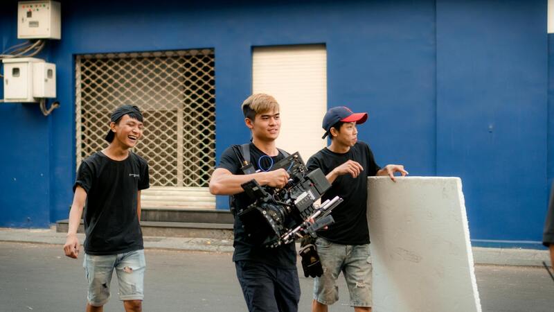
Role of a Drone Real Estate Photographer
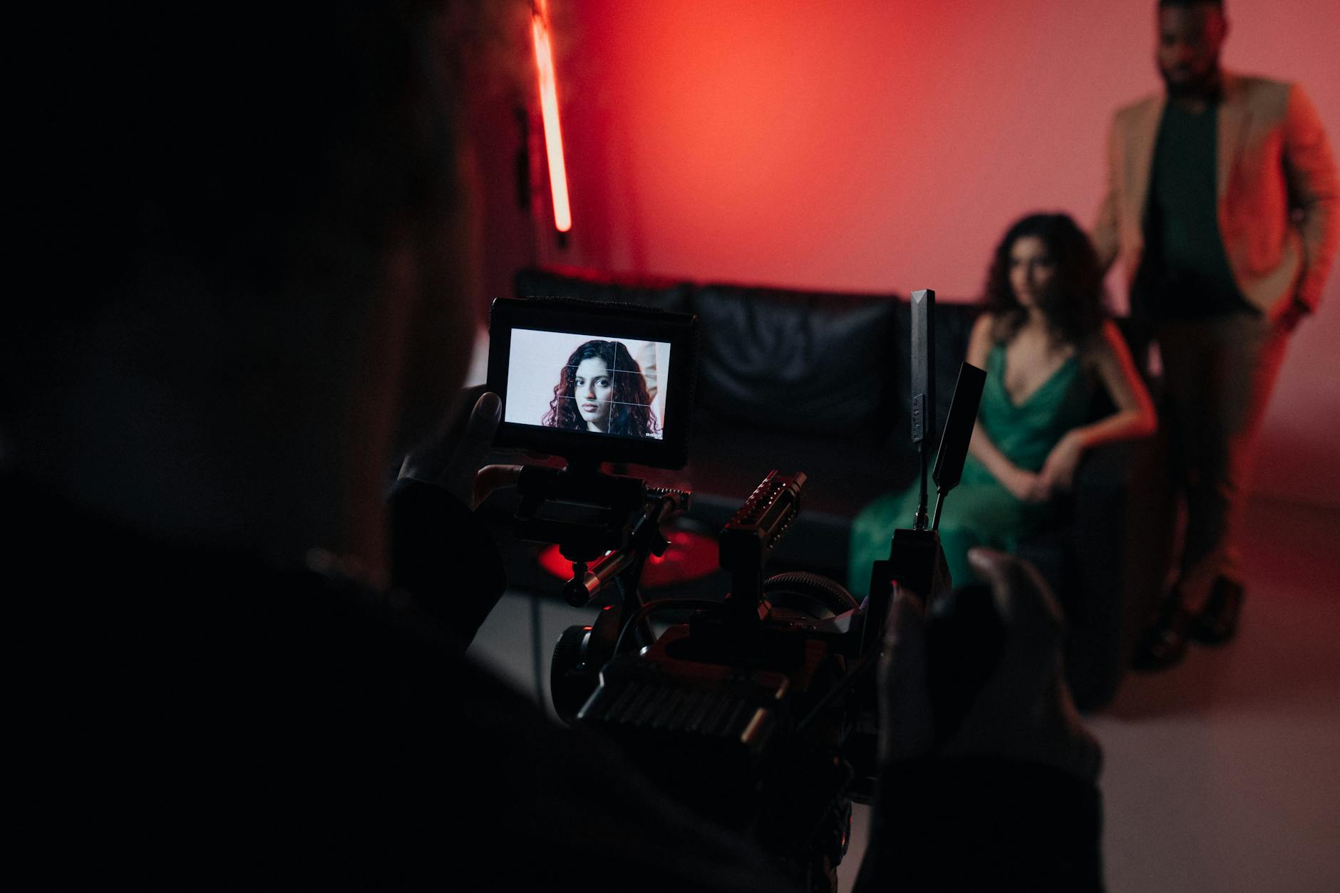
In the dynamic and competitive Miami real estate market, the importance of high-quality imagery cannot be overstated. A drone real estate photographer plays a crucial role in capturing aerial views that showcase property listings in their best light. Their primary responsibility is to utilize advanced drone technology to produce compelling visual content that attracts potential buyers and investors.
These professionals are skilled in framing breathtaking shots that highlight the unique features and surrounding amenities of each property. From sprawling beachfront estates to urban condos, drone photographers provide a perspective that traditional ground-level photography often cannot achieve. This aerial perspective not only enhances visual appeal but also provides a comprehensive understanding of the property’s layout, size, and proximity to key points of interest in Miami's vibrant neighborhoods.
Moreover, a drone real estate photographer serves as an essential component of a comprehensive marketing strategy. The footage and images created are used across multiple platforms — including listings, social media campaigns, and virtual tours — to increase engagement and drive interest. The ability to effectively convey a property’s ambiance and spatial dynamics through aerial imagery can significantly influence buyer decisions and facilitate quicker sales.
By providing high-quality, visually stunning content, drone real estate photographers help realtors and property owners stand out in a crowded marketplace. Their work not only highlights the property itself but also emphasizes the lifestyle and convenience associated with the location, which is especially vital in a city like Miami, known for its diverse neighborhoods, scenic coastlines, and thriving real estate sector.
Ultimately, the role of a drone real estate photographer encompasses technical expertise, artistic sensibility, and a strategic understanding of real estate marketing. Their contributions are pivotal in elevating property listings, capturing the attention of prospective buyers, and shaping the overall perception of Miami’s real estate offerings.
Tools and Technologies Essential for High-Quality Drone Imagery
In the field of drone real estate photography, utilizing the right equipment is crucial for capturing stunning, professional-grade aerial images and videos. Advanced drone models equipped with high-resolution cameras enable photographers to produce detailed visuals that highlight a property’s unique features. These UAVs should ideally have stable flight capabilities, GPS-assisted navigation, and the ability to operate in various lighting conditions to ensure consistent results.
Camera specifications are equally vital. Drones fitted with 20-megapixel or higher sensors, capable of capturing 4K or even 8K video, are preferred for their clarity and color accuracy. Additionally, gimbal stabilization technology ensures smooth footage even in windy conditions, providing viewers with fluid, professional visuals that significantly enhance listing appeal.
Modern drone software also plays a fundamental role in executing complex flight paths and automated shots. These programs facilitate precise coverage of property layouts, ensuring comprehensive coverage from various angles and altitudes. Seamless integration of aerial imagery into marketing platforms is achievable through software that supports quick editing, watermarking, and format compatibility, streamlining the post-production workflow.
Techniques to Maximize the Impact of Drone Photography
Effective drone photography hinges on strategic flight planning and compositional techniques. Utilizing predetermined flight paths allows for consistent framing of properties, especially when capturing multiple listings or creating virtual tours. Elevational shots, panoramic captures, and dynamic fly-throughs help showcase the property's physical size, landscape features, and surrounding neighborhood context.
Time of day significantly influences image quality. Golden hour lighting—shortly after sunrise or before sunset—offers soft, warm light that minimizes shadows and enhances colors, making properties appear more inviting. High vantage points and aerial angles can reveal sightlines, outdoor amenities, and land boundaries, providing prospective buyers with a comprehensive visual understanding of the property.
Post-Production Enhancements for Visual Impact
The editing process allows for refinement and enhancement of raw drone footage. Adjustments to brightness, contrast, and saturation heighten visual appeal, while techniques like color grading can create a consistent aesthetic across a property’s visual content. Corrections for lens distortion and stabilization issues ensure that imagery accurately represents the physical space without distractions.
Incorporating motion effects, such as smooth transitions and cinematic fades, can elevate virtual tours beyond static images. Proper watermarking and branding during post-processing also serve to protect the content and promote the agency’s branding efforts, making the visuals not only more attractive but also more effective for marketing campaigns.
Advantages of Employing Advanced Drone Photography in Real Estate Listings
- Enhanced Visual Appeal: High-quality aerial images attract more attention and generate increased online engagement.
- Comprehensive Property Showcase: Aerial shots provide a full perspective of land sizes, outdoor features, and proximity to amenities.
- Distinctive Marketing Edge: Unique angles and dynamic footage help listings stand out in competitive markets like Miami.
- Increased Buyer Engagement: Immersive visuals foster emotional connections, encouraging prospective buyers to explore further.
- Faster Sale Timelines: Better visuals facilitate quicker decision-making and reduce time on the market.
Investing in the latest drone technology and proven techniques ensures real estate professionals can maximize the benefits of aerial photography, creating captivating content that resonates with modern buyers and elevates property marketing efforts.
Techniques for Effective Drone Photography
Achieving compelling aerial imagery for real estate purposes requires mastering specific drone photography techniques. One fundamental approach involves optimal flight planning, which includes selecting the best time of day to capture natural lighting conditions. Early mornings and late afternoons often provide softer light and reduce harsh shadows, enhancing the visual appeal of property images.
Maintaining a consistent altitude during shots ensures uniformity across a property’s visuals, making it easier to create cohesive virtual tours or promotional materials. Proper positioning of the drone also plays a crucial role, with strategic angles highlighting unique architectural features or expansive outdoor spaces.
Incorporating smooth and controlled movements during drone operation results in visually engaging footage. Techniques such as gradual upward or outward shots can emphasize a property's size and surroundings, while orbit shots circumnavigate the property to reveal comprehensive perspectives. Utilizing automatic flight modes or programmable routes can help achieve precision and repeatable sequences, especially for multiple property shoots.
Additionally, understanding how to handle dynamic environments—such as windy conditions—ensures stability and crisp image capture. Operators should adjust their drone's settings to optimize shutter speed, ISO, and aperture, which collectively contribute to clearer and more vibrant visuals. Employing these techniques consistently improves the overall quality and marketability of real estate listings.
Editing and Post-Processing of Drone Footage
Post-processing is essential to maximize the impact of aerial imagery in real estate marketing. Software tools enable professionals to refine footage, correct color imbalances, and enhance details that may appear less vivid straight from the drone. Adjustments to brightness, contrast, and saturation ensure the images accurately represent the property's true appeal.
Stabilization is often necessary to smooth out any jittery movements, providing a cinematic feel that captivates prospective buyers. Additionally, cropping and framing adjustments help highlight key property features, ensuring the most striking visuals are front and center.
Incorporating motion effects like fades, transitions, or slow pans during editing can add a professional touch, turning raw footage into compelling marketing content. Watermarking and branding are also strategically applied during post-processing to protect content and reinforce brand recognition. With meticulous editing, drone footage becomes a powerful tool to inspire confidence and foster emotional connections with potential buyers.
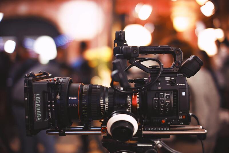
Equipment and Technology Used
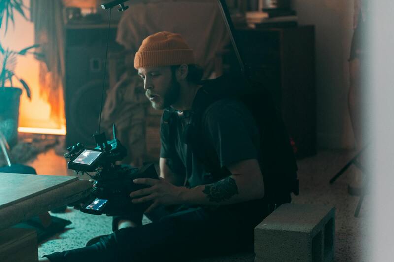
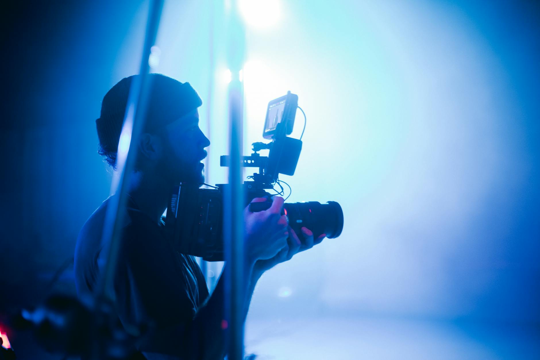
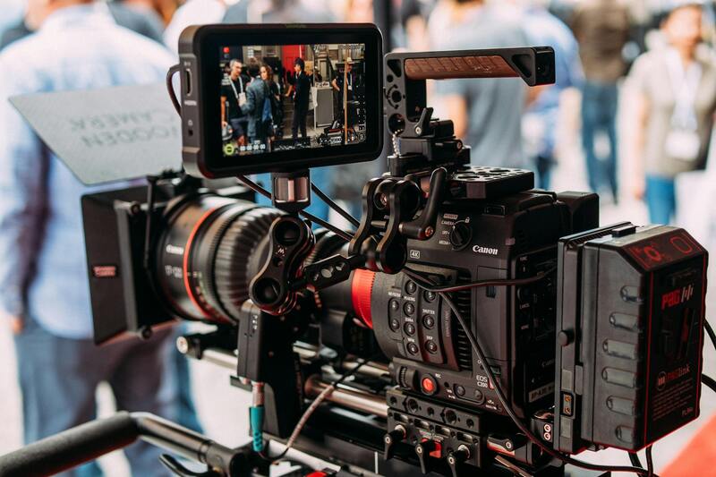
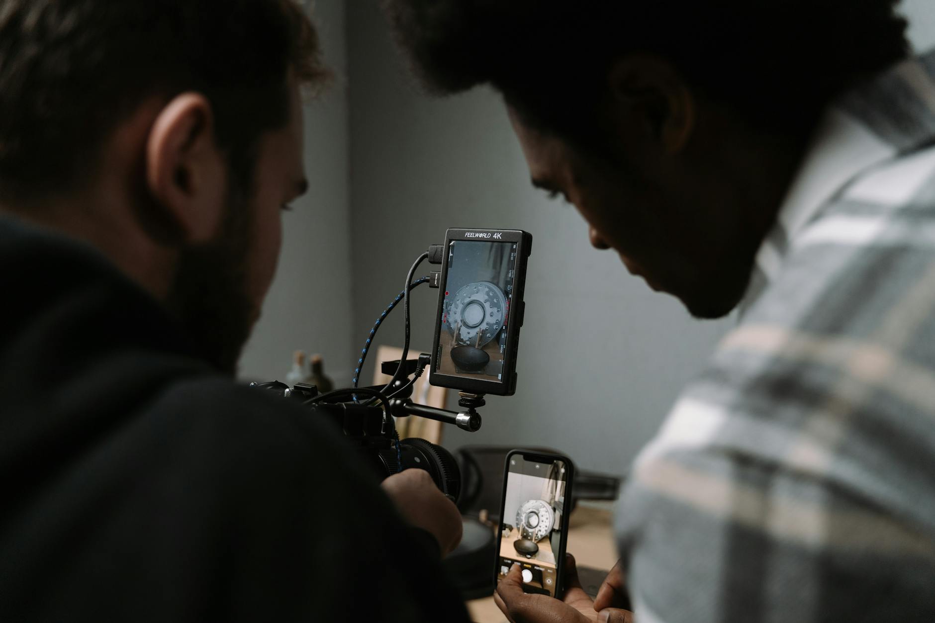
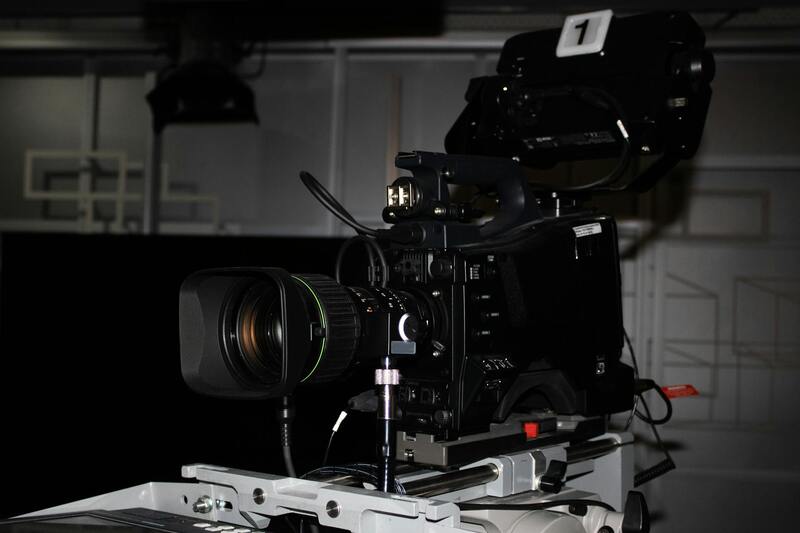
The foundation of high-quality drone real estate photography hinges on the utilization of cutting-edge equipment. Professional drone operators rely on advanced unmanned aerial vehicles equipped with high-resolution cameras capable of capturing detailed, vibrant images from various altitudes. These drones often feature stabilized gimbal systems, which ensure smooth footage even in challenging weather conditions or complex flight paths. The quality of sensors used in these devices directly impacts the clarity, color accuracy, and overall visual appeal of the images, making them crucial tools for real estate marketing.
In addition to drones, professionals equip themselves with supplementary gear that enhances photography outcomes. These include adjustable ND filters that control exposure in bright conditions, portable lighting solutions for fill lighting during low-light scenarios, and high-precision GPS systems that facilitate precise flight path planning. The integration of thermal imaging or multispectral sensors can also provide added value by showcasing property features that are otherwise hidden, such as energy efficiency or landscaping details.
In terms of software, professional operators employ sophisticated flight planning applications that allow meticulous route design, optimizing angles and altitudes for ideal shots. Post-flight data is processed using high-end editing tools capable of 4K or higher resolution image manipulation, enabling the fine-tuning necessary to produce polished, market-ready visuals. These technological advancements collectively empower drone real estate photographers to deliver images that highlight property details and vantage points unavailable through traditional photography methods.
Moreover, battery technology and flight time are critical considerations. Extended flight durations enabled by high-capacity batteries ensure comprehensive coverage of property boundaries, aerial landscapes, and surrounding features. This ability to capture diverse perspectives in a single session enhances the overall impact of the visual presentation.
Leveraging these official tools and technologies ensures that drone real estate photography maintains its reputation as a premier visual marketing approach, delivering crisp, dynamic images that attract potential buyers and elevate property listings.
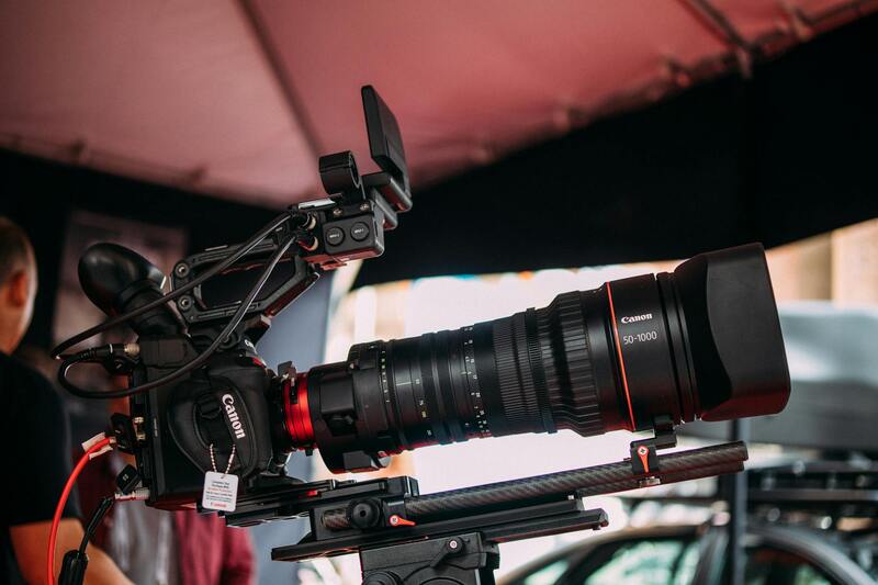
Equipment and Technology Used
In the realm of drone real estate photography, utilizing advanced equipment is essential to achieving high-quality, professional results. The core components include high-resolution cameras mounted on stabilized gimbals, which ensure sharp imagery even in challenging flight conditions. These cameras often feature sensors capable of capturing 4K or higher resolution videos and images, providing detailed visuals that highlight the property's finest features.
Flight controllers and autonomous navigation systems are integral to precise flight path management, allowing operators to execute complex routes with minimal manual input. This technology ensures consistent coverage of the property’s exterior and surrounding environment, including hard-to-reach areas such as rooftops, wooded lots, or expansive landscapes.
Battery technology also plays a significant role, with high-capacity batteries enabling longer flight times. Extended battery life allows photographers to capture comprehensive aerial imagery without frequent recharging, facilitating thorough coverage of large properties and their immediate surroundings. Additionally, drones equipped with obstacle avoidance sensors contribute to safer flight operations, especially in complex environments, thereby protecting both the equipment and the property.
Modern drones are also outfitted with features such as rapid GPS positioning, live video feeds, and programmable flight plans, augmenting the efficiency and precision of missions. These technological innovations combine to produce crisp, detailed visuals that effectively showcase a property’s layout, landscape, and unique features.
Role of a Drone Real Estate Photographer
A drone real estate photographer plays a crucial role in capturing high-quality aerial images and videos that provide a comprehensive perspective of a property. These professionals utilize advanced drone technology to highlight a property's exterior, surrounding landscape, and unique features that may not be visible through traditional photography. Their expertise ensures that every shot maximizes visual appeal, offering potential buyers a detailed sense of space, layout, and context within the neighborhood.
Beyond just capturing images, these photographers understand the significance of composition, lighting, and timing. They select optimal angles and weather conditions to emphasize property appeal, whether it’s showcasing sprawling outdoor areas, waterfront access, or architectural details from above. With the ability to produce dynamic, high-resolution visuals, drone real estate photographers significantly enhance property listings, making them stand out in competitive markets.
Technical Skills and Industry Knowledge
Successful drone photographers also possess a solid grasp of aviation practices specific to real estate. They ensure safe and efficient flight operations while adhering to established guidelines. An in-depth understanding of real estate trends allows them to tailor their imagery to current market demands, capturing shots that resonate with prospective buyers and brokers alike.
Client Collaboration and Customization
Effective communication with real estate agents and property owners is essential. Drone photographers often collaborate to plan flight routes, identify key features to highlight, and decide on the best times for shoots, such as during daylight with optimal weather conditions. This tailored approach guarantees that the visual content aligns with marketing strategies and enhances the property's appeal.
Legal and Regulatory Considerations
Executing drone photography within the real estate sector involves adhering to strict operational guidelines. Professionals ensure that all flights are conducted in accordance with applicable regulations, which includes registering drones when necessary, securing permits, and respecting privacy boundaries. Proper planning and adherence to these protocols help prevent disruptions and maintain safety during shoots.
Operating a drone for real estate purposes also requires comprehensive knowledge of airspace restrictions, especially around airports, city centers, or sensitive areas. Skilled photographers plan their flights meticulously to comply with no-fly zones and local airspace rules, thereby avoiding potential legal complications.
Risk Management and Insurance
Part of responsible drone operation involves risk management practices that include acquiring appropriate insurance coverage. This coverage protects against potential damages to property or equipment, safeguarding the interests of both the client and the photographer.
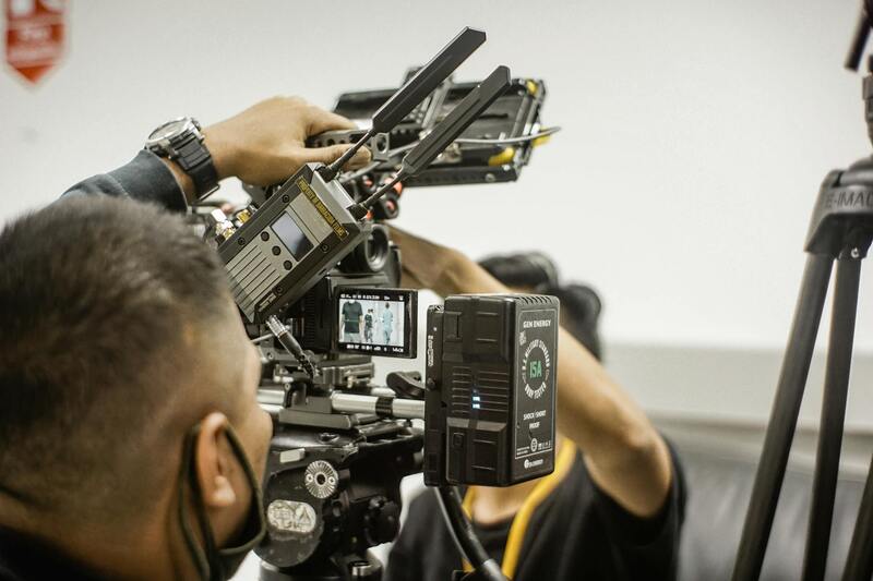
Equipment and Technology Used
The backbone of effective drone real estate photography is the selection of the right equipment. Modern drones equipped with high-definition cameras, stabilizers, and autonomous flight capabilities are standard. These features enable stable, crisp images and allow for complex flight paths to cover large or difficult-to-access areas.

High-capacity batteries extend flight duration, providing ample time to capture extensive aerial coverage. Obstacle avoidance sensors ensure safety during complex maneuvers, especially in tight or obstacle-rich environments. Additionally, GPS stabilization enables precise positioning, contributing to smooth, accurate footage that aligns with the client’s specifications.
Additional Tools and Accessories
- Zoom and high-resolution cameras for detailed imaging
- Gimbals for stabilization during flight
- Lighting attachments for night or low-light conditions
- Software for mission planning and autonomous flight
Techniques for Effective Drone Photography
Optimizing drone imagery involves strategic planning of flight paths, shot selection, and timing. Effective techniques include executing multiple angles to showcase different property aspects, such as facades, gardens, and surrounding amenities. Utilizing panoramic and 3D mapping capabilities can deliver immersive visuals that help buyers get a virtual sense of the property.
Lighting conditions, especially during golden hour, can significantly impact image quality. Maintaining a steady flight and controlling camera settings allows for sharper visuals and vibrant colors. Combining still images with synchronized video tours provides a comprehensive view that captures the property's full potential.
Specialized Shooting Styles
- Vertical and oblique aerial shots to accentuate depth and dimensions
- Fly-over sequences illustrating property scale and layout
- Close-up shots of architectural details from above
Editing and Post-Processing of Drone Footage
High-quality editing enhances raw drone footage, ensuring images are clear, color-balanced, and properly exposed. Post-processing software allows for adjustments in contrast, saturation, and sharpness, as well as stabilization tweaks to eliminate any jitter. Advanced editing can also include creating virtual tours, adding overlays, or stitching images into panoramic views, enriching the property's presentation.
Utilizing professional editing practices not only improves visual appeal but also ensures consistency across marketing materials. The end result is engaging, high-impact visuals that elevate property listings, attract more inquiries, and facilitate quicker sales, especially within competitive Miami real estate markets.
Role of a Drone Real Estate Photographer
A drone real estate photographer plays an integral part in modern property marketing, utilizing cutting-edge aerial technology to capture stunning visuals that highlight a property's unique features. Their expertise extends beyond basic photography; they skillfully compose shots that emphasize property scale, architecture, landscape elements, and surrounding amenities. This elevated perspective provides potential buyers with a comprehensive view of the property’s layout, position, and relationship to nearby features such as parks, roads, or body of water, which are often inaccessible through traditional ground-level photography.
Professional drone photographers possess a keen eye for composition, understanding how to frame shots that optimize aesthetic appeal and informational value. They carefully plan flight paths to ensure coverage of critical areas, capturing both the broad scope of the property and the detailed architectural features. Their work involves selecting ideal flight altitudes, angles, and camera settings to produce vivid, crisp imagery that stands out in listings and promotional materials.
Effective drone photographers also have a comprehensive understanding of property storytelling, utilizing various dynamic shots—such as wide-angle landscapes, close-ups of distinctive architectural elements, and sweeping fly-over sequences—to craft a compelling visual narrative. This multi-faceted approach attracts targeted audiences, enabling real estate agents and property owners to showcase their listings with a level of clarity and professionalism that traditional photography cannot match.
The role also involves maintaining high standards of safety and regulatory compliance to ensure flights are conducted responsibly. Alongside photographic skills, a drone photographer must be proficient in operating various drone models and associated imaging equipment, often using high-resolution cameras capable of capturing detailed images even in challenging lighting conditions. Their proficiency enables the production of consistently high-quality visuals that elevate a property’s market visibility and appeal.
Equipment and Technology Used
Drone real estate photographers rely on advanced unmanned aerial vehicles equipped with professional-grade cameras. Popular models tend to feature stabilizing gimbals, high-resolution sensors, and wide-angle lenses to produce clear, sharp images and smooth video sequences. High-end drones also incorporate obstacle avoidance and intelligent flight modes, facilitating safe and precise maneuvers around complex property sites.
Camera features such as adjustable aperture, ISO settings, and various shooting modes allow photographers to adapt to different lighting conditions, ensuring optimal image quality. Additionally, the integration of GPS and autopilot technology facilitates pre-programmed flight paths, enabling consistent coverage and efficient image capture. Drone operators often utilize specialized accessories, such as polarizing filters or ND filters, to manage reflections and enhance color saturation.
Techniques for Effective Drone Photography
Achieving professional-grade aerial imagery requires deliberate technique and planning. Photographers employ a range of methods, including strategic flight planning to maximize shot variety and coverage, ensuring all key areas are captured from optimal angles. Using altitude variation helps emphasize depth, while tilting the camera for oblique shots can reveal architectural details and landscape features.
Stability is crucial; utilizing gimbals and stabilizers minimizes vibrations, resulting in smooth footage that maintains focus and sharpness. Golden hour lighting, typically during sunrise or sunset, produces warm, naturally diffused illumination that enhances the visual appeal of images. Practicing consistent camera settings across shots ensures uniformity, making editing and post-processing more efficient.
Furthermore, integrating video tours with still-image galleries creates engaging marketing content, providing viewers with immersive property overviews. Advanced techniques, such as panorama stitching and HDR imaging, can also add a refined touch, highlighting propertyexteriors with rich detail and realistic colors.
Editing and Post-Processing of Drone Footage
Post-processing transforms raw drone footage into compelling visual assets for real estate marketing. Skilled editors utilize software such as Adobe Lightroom, Photoshop, or specialized video editing tools to enhance clarity, balance colors, and correct exposure issues. Slight adjustments in contrast and saturation help create vibrant, eye-catching visuals that resonate with potential buyers.
Stability corrections and cropping refine the composition, while panoramic stitching can create wide, seamless views that showcase entire properties or landscapes. Virtual tour creation often involves stitching together aerial clips, adding motion effects, and overlaying property information or branding to produce a polished presentation.
Consistent use of professional editing standards ensures that all visuals maintain a high level of quality and brand uniformity, which is crucial in competitive markets like Miami. These efforts lead to listings that are not only visually appealing but also accurately represent the property's true features, ultimately facilitating faster and more effective sales.
Role of a Drone Real Estate Photographer
A drone real estate photographer plays a pivotal role in elevating property marketing strategies through high-quality aerial imagery and videography. These professionals are adept at capturing innovative perspectives that traditional ground-based photography cannot achieve, providing a comprehensive visual narrative of each property. Their expertise includes understanding optimal flight paths, framing, and angles to highlight key features such as expansive yards, architectural details, and surrounding landscapes. By utilizing advanced drone platforms equipped with high-resolution cameras, they ensure that every shot enhances the property's appeal and stands out in a competitive Miami real estate market.
Additionally, drone operators work closely with realtors and property owners to tailor imagery that aligns with marketing objectives. This collaborative approach helps craft compelling narratives that attract potential buyers and facilitate quicker transactions. In essence, a drone real estate photographer is not just capturing images but creating an immersive visual experience that resonates with viewers and enhances listing visibility.
Legal and Regulatory Considerations
When deploying drone technology for real estate, it is critical to adhere to established operational standards and guidelines. This ensures that aerial photography is conducted responsibly, respecting privacy and safety concerns. Certified pilots often hold specialized licenses or certifications that affirm their knowledge of airspace regulations, flight restrictions, and safety procedures. These credentials are vital in maintaining professionalism and ensuring that drone activities align with regional guidelines.
Practitioners also meticulously plan flight missions to avoid restricted zones and minimize potential disruptions. They utilize advanced flight planning tools to create detailed flight paths that optimize coverage while adhering to altitude and distance limitations. Compliance with these practices guarantees that aerial images are obtained smoothly and with the confidence that the operation is conducted within lawful parameters.
Equipment and Technology Used
The backbone of effective drone real estate photography lies in the selection of sophisticated equipment. Professional-grade drones are equipped with stabilized gimbals that ensure smooth footage, even in windy conditions. High-resolution cameras, often capable of 4K or higher, capture detailed images suitable for both digital and print marketing materials. Features like HDR imaging, panoramic capture, and automated flight modes enhance the versatility and quality of aerial visuals.
Furthermore, operators employ remote controls integ-rated with real-time image transmission, allowing for immediate assessment and adjustments during flights. Advanced flight planning software enables precise pre-mission mapping, ensuring comprehensive coverage of property sites. The integration of GPS technology supports accurate positioning, making it easier to revisit specific viewpoints for consistent content production.
Techniques for Effective Drone Photography
To maximize the impact of aerial visuals, drone photographers utilize a range of techniques tailored to real estate marketing. Dynamic framing, such as incorporating the property within the landscape and emphasizing unique architectural elements, attracts attention. Variations in altitude and angles help showcase different aspects of a property, from sweeping driveway shots to intimate backyard views.
Utilizing circular or sweeping panoramas provides potential buyers with a broader sense of space and context. Time-of-day considerations, including golden hour lighting, add warmth and depth to images. Smooth flight paths combined with high frame rate captures afford the ability to produce cinematic footage that can be integrated into virtual tours or promotional videos.
Editing and Post-Processing of Drone Footage
Post-production enhances raw drone footage, transforming it into polished assets that command investor and buyer attention. Skilled editors employ editing software such as Adobe Lightroom, Photoshop, and Premiere Pro to refine visual quality. They correct color imbalances, adjust contrast, and subtly increase saturation to produce vibrant, true-to-life images.
In addition, stabilization corrections and cropping focus the viewer’s attention on the most compelling aspects of the property. Techniques like HDR imaging can be used to equally expose shadow and highlight areas, resulting in a balanced and detailed image. Stitching multiple shots into panoramic views offers expansive visuals of large estates or vistas.
Benefits of Drone Photography for Real Estate Listings
The integration of drone photography into property marketing yields numerous advantages. Aerial imagery provides prospective buyers with a comprehensive understanding of property size, layout, and environmental features. It highlights aspects such as waterfront access, spacious outdoor living areas, and neighborhood context, which are often difficult to convey through ground photography alone.
Enhanced visual materials also increase online engagement, attracting more views and inquiries. Listings featuring eye-catching aerial visuals tend to stand out in competitive markets, facilitating faster sales cycles and broader reach across digital platforms. The ability to deliver immersive, high-impact content strengthens brand positioning for real estate professionals.
Choosing a Drone Real Estate Photographer in Miami
Selecting an experienced drone real estate photographer in Miami involves evaluating their portfolio to ensure they possess a diverse collection of high-quality aerial images. Familiarity with local regulations and the ability to navigate Miami’s unique airspace is essential for smooth operation. Contractors should demonstrate proficiency in advanced photography techniques and provide clear insights into their process, from pre-flight planning to post-production editing.
Moreover, attention to detail, professionalism, and timely delivery are key benchmarks for assessing potential collaborators. A seasoned drone photographer will understand the nuances of Miami's diverse property landscape, helping showcase homes—from beachfront villas to urban condominiums—with visuals that maximize property appeal and marketability.