Overview of Drone Photography for Residential Properties
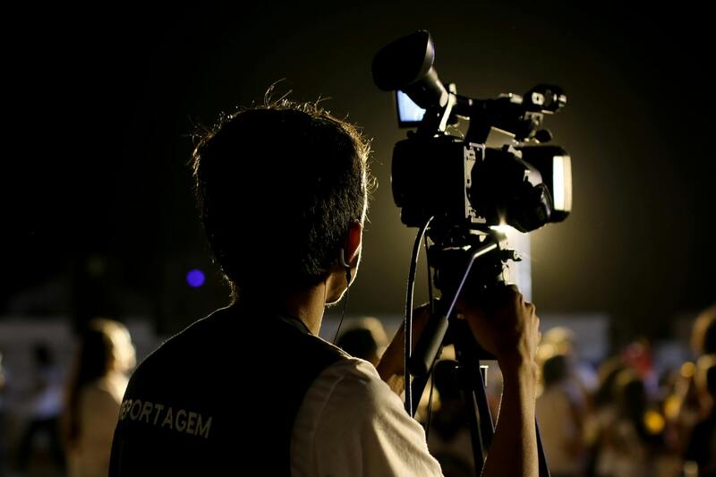
Drone photography has revolutionized the way residential properties are showcased, offering a new perspective that traditional ground-level photography cannot provide. In recent years, this innovative approach has gained substantial traction among real estate professionals in Miami, a city renowned for its luxurious homes and dynamic real estate market. Using unmanned aerial vehicles (UAVs), real estate agents and photographers capture stunning aerial images and videos that highlight the property's extensive features, proximity to key amenities, and the neighborhood's appeal.
The rising popularity of drone pictures of houses is driven by their ability to provide potential buyers with a comprehensive view of the property’s exterior, layout, and surrounding environment. These high-quality images serve as powerful marketing tools that enhance listing presentations, attract more inquiries, and accelerate the selling process. Whether it's capturing the grandeur of waterfront estates, lush backyard landscapes, or impressive architectural details, drones offer a versatile method to present a property in its best light.
Moreover, drone technology contributes to a more immersive experience for prospective buyers, making online listings more engaging and informative. Real estate firms in Miami leverage these advanced imaging techniques to stand out in a competitive market, ultimately helping clients realize the full potential of their properties through compelling visual storytelling. As the industry continues to evolve, the integration of drone photography into real estate marketing strategies becomes an increasingly vital component for success.
Advantages of Using Drones for House Photography
Utilizing drone technology in residential real estate photography offers numerous strategic benefits that elevate property marketing efforts. One of the primary advantages is the ability to capture unique aerial perspectives that traditional ground-based photography cannot achieve. This viewpoint allows potential buyers to see the entire property layout, including expansive yards, driveways, pools, gardens, and neighboring amenities, delivering a comprehensive visual narrative.
High-quality drone images significantly enhance the visual appeal of property listings, making them stand out in online portfolios and print advertisements. When prospective buyers scan through listings, striking aerial shots can quickly draw attention and generate interest. The elevated perspective also showcases architectural details and landscaping features that could be overlooked in standard photos.
Another notable benefit is the capacity to depict the property within its broader context, such as proximity to parks, schools, commercial districts, or waterfronts. This contextualization helps buyers understand both the specific features of the house and its integration into the surrounding community, fostering an emotional connection.
Moreover, drone imagery can shorten the decision-making process for buyers by providing comprehensive views early in the search stage. When online listings include compelling aerial images, they communicate professionalism and attention to detail, which can translate into increased inquiries, faster negotiations, and quicker sales.
Overall, the strategic application of drone photography amplifies a property's visual storytelling, attracting a broader audience and maximizing the property's market potential.
Legal Regulations and Compliance in Miami
Operators aiming to capture drone pictures of houses in Miami must adhere to established guidelines that govern drone use in residential environments. These rules are designed to ensure safety, privacy, and responsible operation, aligning with local protocols and federal standards. Obtaining the necessary authorizations involves registering the drone with the appropriate authorities, familiarizing oneself with altitude restrictions, and understanding no-fly zones within the area. Miami’s city ordinances may also specify specific height limits and operational hours to minimize disruptions to residents.
Furthermore, drone pilots should conduct thorough site assessments before flight to identify any potential hazards, such as power lines, tall structures, or aerial obstructions. Maintaining a clear line of sight and avoiding flight over private property without consent are crucial steps to ensure smooth operation. Prior planning and awareness of airspace restrictions contribute significantly to conducting effective and respectful drone flights.
Knowledge of local and federal procedures, including adherence to FAA Part 107 rules, is essential for commercial drone usage in property photography. This includes maintaining proper documentation, adhering to radiotelephony protocols, and respecting privacy boundaries to prevent misunderstandings or disruptions. By following these official and responsible practices, professionals can consistently produce high-quality drone imagery that aligns with the standards for effective real estate marketing.
Legal Regulations and Compliance in Miami
To ensure safe and professional drone photography of residential properties in Miami, adhering to established operational protocols is essential. This involves a thorough understanding of the procedures for obtaining the necessary permissions and maintaining compliance with both local ordinances and federal regulations. Operators should familiarize themselves with designated no-fly zones, especially those around sensitive infrastructure and private properties, to avoid unintentional infringements.
Prior to each drone flight, conducting a comprehensive site assessment helps identify potential obstacles such as power lines, tall trees, or other aerial obstructions that could interfere with safe operation. Maintaining a direct line of sight with the drone during flight is crucial to maintain control and awareness of surroundings. If flying over private property, securing the appropriate permissions or agreements is advisable to ensure respectful engagement with property owners.

In terms of operational standards, familiarity with the FAA Part 107 regulations provides a framework for schedule management, altitude limits, and safe operation procedures. Documenting flight plans, maintaining records of each mission, and using verification tools for airspace authorization contribute to a seamless workflow. Moreover, understanding the protocols for radiotelephony communication and respecting privacy boundaries minimizes potential misunderstandings.
Engaging with local authorities or licensed drone service providers often streamlines the process, offering guidance on necessary permits and best practices for commercial applications. This collaborative approach facilitates consistent production of high-quality imagery that aligns with official standards and protocols, reinforcing professionalism in the realm of residential drone photography.
Essential Equipment and Technical Considerations for Drone House Photography
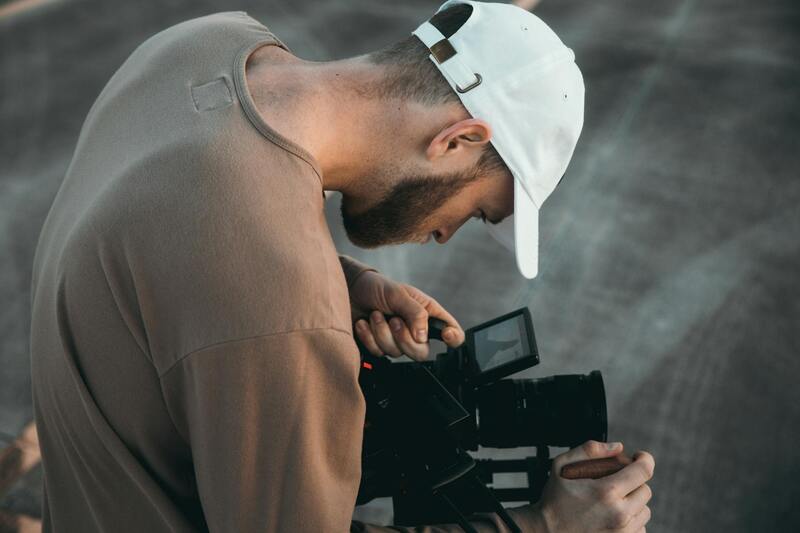
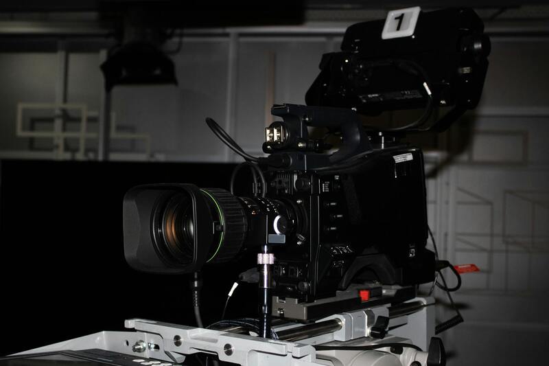
Executing high-quality drone pictures of houses in Miami requires more than just a drone with a camera. The choice of equipment plays a vital role in capturing crisp, detailed images that showcase the property’s best features. Operators should select drones equipped with high-resolution cameras, ideally capable of at least 20-megapixel imagery, to ensure marketable quality. Gimbals with advanced stabilization technology help produce steady shots, reducing motion blur during aerial captures.
Beyond the drone itself, supplementary equipment enhances the quality and safety of drone flights:
- Extra Batteries: Extended shoot sessions demand multiple batteries to avoid downtime and ensure comprehensive coverage of the property.
- Memory Storage: High-capacity, fast-speed SD cards facilitate the storage of large image files and rapid data transfer post-flight.
- Filters: ND filters and polarizers can optimize image clarity and color accuracy, especially under Miami’s bright sunlight conditions.
- Remote Controllers with Advanced Features: These controllers allow precise flight control and camera adjustments, enabling operators to capture unique angles and compositions.
The professionalism of drone house photography hinges on mastering flight stability, optimal camera settings, and real-time adjustments. Operators often use GPS-enabled drones that provide reliable stabilization, precise hovering, and accurate positioning, which are crucial for framing the property and surrounding landscape effectively.
Utilizing Advanced Flight Planning and Navigation Tools
Advanced flight planning software enables precise waypoint setting, route optimization, and altitude management. Pre-programming flight paths ensures comprehensive coverage of the property, minimizing the risk of missed details. These tools also facilitate adherence to Miami’s airspace guidelines, scheduling flights during optimal times of daylight and favorable weather conditions.
Utilizing real-time telemetry, operators can monitor the drone’s position, battery life, and camera parameters, allowing for quick adjustments mid-flight. This proactive management ensures safety and quality control throughout the aerial shoot process.
Investing in Drone Training and Certification
Proficiency in drone operation and photography techniques significantly impacts the quality of images captured. Formal training programs focus on safe flying practices, camera control, aerial cinematography, and adherence to law-encompassing standards. Certification courses validate skills, often required when offering drone photography services professionally or commercially in Miami. Such credentials demonstrate a commitment to operational excellence, resulting in better results and customer trust.
Continued education, workshops, and industry conferences contribute to staying updated on the latest drone technologies and best practices, ensuring consistently high standards in drone house photography.
Ensuring Proper Image Quality Through Controlled Flight Operations
When capturing drone pictures of houses, maintaining high image quality is paramount. This begins with meticulous flight planning, which involves selecting the appropriate altitude, flight speed, and camera settings. Utilizing high-resolution cameras coupled with stable flight paths minimizes motion blur and ensures sharp, detailed imagery. Operators should calibrate cameras before each flight, adjusting focus, white balance, and exposure to match lighting conditions.
Pre-flight checks are essential for operational safety and image quality. These include verifying battery levels, inspecting propellers, and confirming GPS signal strength. Initiating flights during optimal weather conditions—preferably clear, windless days—reduces the likelihood of turbulence that can disturb camera stability. Additionally, ensuring the drone’s stabilization systems are properly calibrated helps achieve crisp, well-composed shots.
Post-flight, the raw images should be carefully reviewed for clarity and composition. Immediate review allows for identifying areas that may require retakes, especially in capturing important architectural details or landscape features. Taking multiple shots from varied angles and altitudes provides a comprehensive dataset that can be later combined for enhanced visual storytelling.
Leveraging Advanced Imaging Techniques for Better Results
To maximize image impact, drone operators should utilize HDR (High Dynamic Range) photography when possible. HDR suppresses shadows and highlights, resulting in balanced images that reveal both interior and exterior details without overexposure or underexposure. Incorporating panoramic stitching or 3D mapping can also offer clients immersive views of the property, supporting virtual tours and marketing campaigns.
Utilizing gimbals—vestibular stabilizers attached to the drone’s camera—also plays a crucial role in achieving smooth, professional-quality footage. These technological tools compensate for drone movement, particularly during windy conditions, ensuring that each shot remains stable and aesthetically pleasing.
Legal Compliance and Best Practices in Miami
Capturing drone pictures of houses in Miami involves adherence to established standards for flight safety and image capture. Operators should be familiar with Miami’s airspace regulations, including restrictions around certain zones and altitude limits. It is advisable to plan flights during daylight hours and in favorable weather, avoiding periods of low visibility or high wind conditions. Prior notification of property owners or residents is also recommended, ensuring transparency and cooperation during photo shoots.
Engaging with local drone associations or certification programs can help maintain a professional standard while navigating the operational landscape. These affiliations often provide updated information on Miami-specific guidelines, ensuring each flight adheres to community standards and promotes responsible drone photography.
Best Practices for Quality Drone House Photography
- Plan each flight meticulously, setting waypoints and camera angles beforehand.
- Always check weather conditions to ensure safe and stable flights.
- Use high-resolution cameras and stabilization gear to enhance image quality.
- Capture multiple angles to provide comprehensive property views.
- Review images immediately post-flight for clarity and completeness.
- Maintain open communication with property owners and local authorities for a smooth operation.
Best Practices for Capturing Drone Pictures of Houses
Achieving high-quality drone images of residential properties requires a strategic approach that combines technical skill with careful planning. Ensuring optimal image outcomes involves selecting the appropriate equipment, planning flight paths meticulously, and understanding the property's unique features to highlight its best attributes. Proper preparation not only enhances the visual appeal of the images but also ensures safety and efficiency during the shoot.
Pre-Flight Planning
- Assess the Property: Conduct a thorough review of the property to identify angles that emphasize its architectural features, landscaping, and overall layout. Recognize lighting conditions and the best times of day when the property appears most attractive, typically during golden hour for warm, soft light.
- Weather Conditions: Monitor weather forecasts closely. Ideal conditions involve minimal wind, clear skies, and moderate temperatures. Avoid flying during rain, fog, or high winds that can compromise safety and image quality.
- Flight Path and Camera Angles: Plan your flight paths to encompass comprehensive coverage of the property, including aerial shots of the entire lot, close-ups of architectural details, and creative angles to showcase the property's unique features. Pre-visualizing shots helps streamline the process during execution.
- Legal and Safety Checks: Confirm adherence to local airspace restrictions, flight altitude limits, and no-fly zones. Always inform property owners and obtain necessary permissions, particularly when capturing images over private areas or near structures.
Equipment Preparation
- High-Resolution Camera: Use drones equipped with high-quality cameras capable of capturing detailed images at various resolutions. This ensures flexibility in post-processing and marketing use.
- Stabilization and Gimbals: Utilize drones with stabilized gimbals to avoid blurriness caused by vibrations or sudden movements, resulting in sharp, professional images.
- Batteries and Storage: Carry sufficient batteries and storage devices to avoid interruptions during extended shoots. Fully charged batteries and ample memory cards are essential for maximizing drone flight time and image capture capacity.
Execution and Technique
- Optimal Flight Speed: Maintain smooth, steady flight speeds to avoid motion blur and capture crisp images. Use automated flight modes with predefined waypoints when available for consistency.
- Altitude Control: Vary altitudes strategically to provide diverse perspectives. Lower altitudes are ideal for detailed shots, while higher flights offer dramatic, panoramic views.
- Lighting and Time of Day: Schedule flights during times when natural lighting enhances the property’s appearance. Mid-morning or late afternoon often provide the most flattering natural light.
- Multiple Angles and Perspectives: Capture multiple shots from different angles and heights to create a comprehensive visual portfolio. Incorporate both straight-down and oblique angles to showcase rooflines, landscaping, and property boundaries.
Post-Flight Review and Optimization
- Immediate Image Review: Review images promptly to ensure they meet quality standards. Reshoot if necessary, especially in case of motion blur or suboptimal lighting.
- Color Correction and Enhancement: Employ post-processing techniques to adjust exposure, contrast, and color balance, bringing out the property's best features while maintaining natural aesthetics.
- Image Stitching: For panoramic or 360-degree views, use stitching software to blend multiple images seamlessly, creating immersive visual experiences.
Advanced Techniques for Capturing Drone Pictures of Houses
To elevate drone photography of residential properties, leveraging advanced flight and photography techniques is critical. These methods ensure high-quality, compelling images that enhance property listings and marketing materials. Precision in flight planning combined with technological tools allows photographers to capture dynamic visuals that showcase the property’s best features from multiple perspectives.
Utilizing Automated Flight Modes
Automated flight modes, such as waypoint navigation, enable precise control over drone paths. By pre-programming waypoints around the property, photographers can ensure consistency across shoots, capturing images from predetermined angles and altitudes. This approach minimizes human error and facilitates the creation of comprehensive visual portfolios that include front, side, backyard, and roof views.
Adjusting Flight Altitude Strategically
Effective altitude management involves varying drone heights to offer diverse perspectives. Lower altitudes are ideal for highlighting architectural details, landscaping features, and entrance points. Higher altitudes provide sweeping, panoramic views that position the property within its surrounding environment, emphasizing neighborhood appeal and spatial relationships.
Optimizing Lighting Conditions
Natural lighting significantly influences image quality. Scheduling drone flights during the golden hours—shortly after sunrise or before sunset—ensures warm, soft light that enhances textures and colors. Overcast days also provide even lighting, reducing harsh shadows. Utilizing filters or adjusting camera settings can further deepen the impact of lighting conditions.
Capturing a Range of Angles and Perspectives
Incorporate multiple viewpoints to create a comprehensive visual story. Straight-down shots effectively display landscaping, garden layouts, and rooflines, while oblique angles emphasize architectural features and outdoor amenities. Vertical and horizontal compositions should be balanced to lead viewers through the property's key attractions.
Implementing Post-Flight Quality Checks
After each flight, immediate review of images allows for quick identification of issues such as motion blur, misalignment, or inadequate lighting. Reshooting those specific areas optimizes the overall quality of the portfolio.Employing advanced editing software enhances images further, correcting exposure imbalances, refining colors, and ensuring a natural yet striking appearance.
Enhancing Images through Post-Processing
Post-processing is integral to drone photography, with tools available for exposure adjustment, contrast enhancement, and color grading. Stitching software can be used to create panoramic views or immersive 360-degree images. These techniques allow real estate professionals to present properties in a visually captivating manner, helping potential buyers visualize the space more effectively.
Final Tips for Superior Drone House Photography
- Conduct site reconnaissance to identify the best maneuvering paths and potential obstacles before each flight.
- Maintain consistent camera settings to ensure uniformity across a series of shots, facilitating easier editing and comparison.
- Communicate clearly with all participants, including residents and neighbors, regarding flight operations, especially in densely populated areas like Miami.
- Keep abreast of technological updates and software improvements that can enhance image quality and flight safety.