Understanding Drone House Photography
Drone house photography has emerged as a pivotal tool in the modern real estate industry, particularly within vibrant markets like Miami. This innovative approach leverages unmanned aerial vehicles (UAVs) equipped with high-resolution cameras to capture striking, aerial perspectives of residential properties. By offering a bird’s-eye view, drone photography uncovers features and aspects of homes that traditional ground-level shots often cannot showcase effectively.
The distinctive advantage of drone house photography lies in its ability to provide comprehensive visual narratives of a property’s exterior, surrounding landscape, and neighborhood context. Prospective buyers gain a clearer understanding of the property's layout, proximity to amenities, nearby recreational areas, and overall neighborhood ambience. Such detailed imagery is invaluable for highlighting premium features like expansive yards, swimming pools, scenic views, or unique architectural elements that can significantly influence purchasing decisions.
Integrating drone house photography into real estate listings enhances visual appeal and marketing reach. High-quality aerial images make listings stand out on digital platforms, attracting more potential buyers and investors. Additionally, they facilitate virtual walkthroughs for clients who may not be able to visit in person, supporting remote decision-making processes.
Beyond residential sales, drone footage can serve various purposes, including promotional videos, construction site monitoring, and landscape planning. As technology advances, the clarity, stability, and creative possibilities of drone photography continue to expand, making it an essential component of Miami’s dynamic real estate marketing landscape.
Ultimately, drone house photography transforms the way properties are presented and perceived. It offers a compelling combination of detailed, authoritative imagery and captivating visuals that can significantly accelerate sale cycles and elevate the reputation of real estate professionals committed to high-standard marketing practices.
Legal and Safety Considerations
Executing drone house photography in Miami involves adhering to a set of official protocols designed to ensure safe and responsible operation. It is essential for pilots and professionals to obtain the appropriate authorizations before conducting any aerial imaging. This includes registering the drone with the Federal Aviation Administration (FAA), which maintains a registry for unmanned aircraft weighing above a specified threshold. Registration involves providing operator details and the drone’s specifications, ensuring accountability and compliance with operational standards.
In addition to registration, drone operators should secure any necessary operational permits specific to Miami's regulations. These permits typically involve submitting details about flight locations, intended use, and times of operation to local authorities or relevant agencies. Such documentation helps coordinate airspace usage and minimizes disruptions to other aerial activities.
Operational safety protocols must also be strictly followed. These include conducting pre-flight checks on equipment, ensuring the drone is in optimal condition to prevent malfunctions. Flight planning should take into account environmental conditions such as weather, wind speeds, and potential obstructions like tall trees or power lines. Maintaining a safe altitude and distance from structures and residents is crucial to avoid accidents or disruptions.
Operators should always be familiar with Miami’s specific airspace restrictions, including no-fly zones around airports, military installations, or urban areas with high-density housing. Many regions also enforce restrictions during particular times or events, requiring operators to plan accordingly. Using official monitoring tools to stay informed about temporary flight restrictions adds another layer of operational diligence.
Safety measures extend to the personnel involved. Training and certification programs are available for drone pilots, emphasizing techniques for stable flying, precise maneuvering, and emergency procedures. Insurance coverage is also recommended to mitigate risks associated with drone accidents, especially when capturing high-value properties or during complex shoots.
Standards for Professional Drone Operation
- Secure necessary registrations and permits from authorities and local agencies.
- Conduct thorough pre-flight inspections and environmental assessments.
- Maintain communication protocols with other aerial and ground-based operators when operating in shared airspace.
- Respect privacy and property boundaries during shoots to foster community trust and uphold professional standards.
- Adjust flying altitude and angles to optimize imagery while ensuring safety for residents and infrastructure.
- Employ certified pilots trained in safe drone operation and emergency response procedures.
- Carry adequate insurance coverage to address potential liabilities or damages.
By following these official methods, drone house photography projects in Miami can be conducted smoothly, safely, and with full compliance to governing protocols, ultimately contributing to high-quality, professionally responsible visual marketing.
Understanding Drone House Photography
Drone house photography involves utilizing unmanned aerial vehicles equipped with high-resolution cameras to capture comprehensive images of residential properties from various angles and perspectives. This method provides a unique vantage point that traditional ground-based photography cannot achieve, showcasing property layouts, surrounding landscapes, and architectural details with exceptional clarity and depth. Precision in drone maneuvering allows for dynamic footage that highlights interior courtyards, rooftop features, and landscaped gardens, creating compelling visual narratives for real estate marketing and development projects.
Employing drone technology in real estate photography elevates the presentation of residential listings by offering potential buyers an immersive view of the property’s spatial relationships and environment. This approach enhances marketing strategies by generating engaging visual content suitable for online listings, social media promotions, and virtual tours. The ability to capture consistent, high-quality footage efficiently makes drone house photography a preferred tool for real estate professionals seeking a competitive edge in Miami’s thriving property market.
In practice, drone house photography involves meticulous planning of flight paths to ensure optimal angles and lighting conditions. Skilled pilots prepare comprehensive shot lists and use stabilization equipment to minimize vibrations and blurriness. The resulting imagery offers comprehensive visual documentation, supporting property listings with high-quality visuals that drive engagement and attract prospective buyers. Moreover, pre-programmed autonomous flight paths enable consistent results across multiple shoots, saving time and ensuring standardized coverage of each property.
Besides aesthetic advantages, drone footage can assist during the negotiation process by providing clear, detailed visuals that accurately represent the property's features. This transparent presentation facilitates informed decision-making for clients and enhances trust in the seller’s marketing materials. As drone technology continues evolving, incorporating innovative features such as thermal imaging, multispectral sensors, and 3D mapping enhances the depth and utility of drone house photography in Miami's diverse real estate landscape.
Choosing the Correct Drone Equipment for House Photography
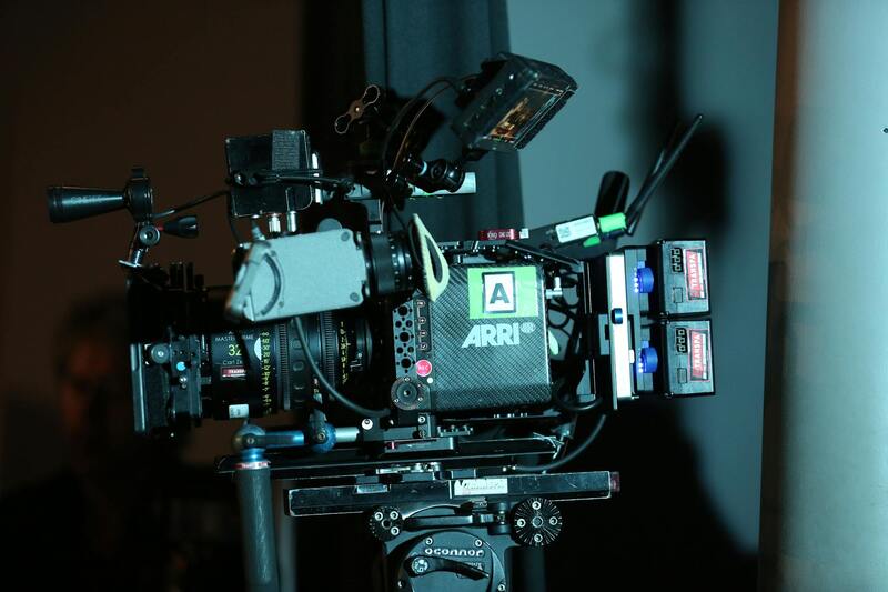
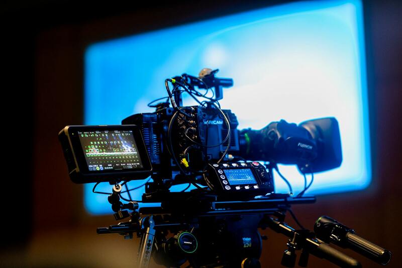
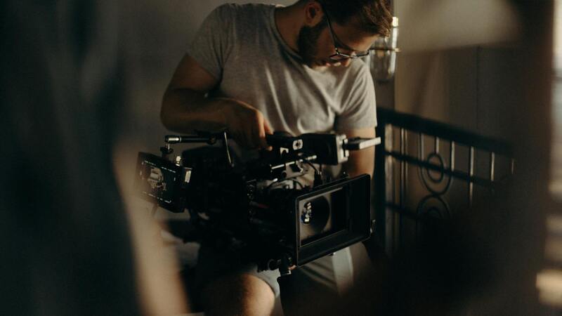
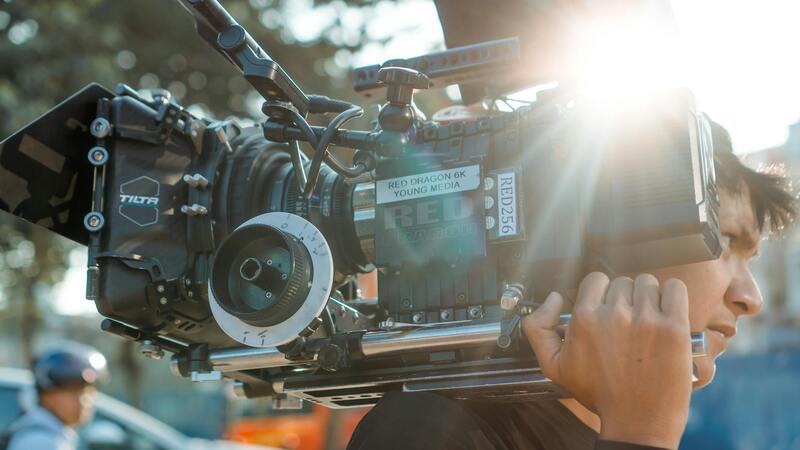
To achieve professional-grade drone house photography, selecting the appropriate equipment is crucial. The drone itself should be equipped with high-resolution cameras capable of capturing sharp, detailed images and videos. Cameras that support 4K or higher resolution are preferred, as they provide clarity that can highlight architectural textures and landscape features effectively. Additionally, imaging systems with a wide dynamic range ensure balanced exposure across different lighting conditions, preventing overexposed skies or shadowed areas that could diminish image quality.
Gimbal stabilization is another essential feature. It keeps the camera steady during flight, resulting in smooth, blur-free images and videos. When choosing a drone, opt for models with 3-axis gimbals, which provide enhanced stabilization and allow for complex maneuvers to capture various angles without compromising image sharpness.
Battery life also plays a significant role in ensuring enough flight time to complete comprehensive shoots. Drones with longer flight durations enable covering larger properties and capturing multiple shots from varied perspectives without frequent interruptions for battery changes.
Beyond hardware, accessories such as polarized filters can be valuable. These filters minimize glare from reflective surfaces like windows or water bodies, delivering more accurate colors and contrast in your images. Additionally, carrying spare batteries, ND filters, and remote controllers with reliable transmission ranges ensures that your drone operations are seamless and efficient throughout the shooting session.
Utilizing Autonomous Flight Paths for Consistent Results
Pre-programmed autonomous flight paths are a transformative feature in drone house photography. Using specialized software, pilots can set precise routes, angles, and flight altitudes in advance, which improves consistency across different shoots. This ensures that every property receives a uniform coverage, making it easier to compare listings or create comprehensive marketing packages.
These autonomous capabilities also optimize workflow efficiency. Multiple properties can be scheduled for automated flights, minimizing manual control and reducing the chances of human error. Furthermore, programmed paths allow drones to execute complex maneuvers, such as orbit shots, panoramic sweeps, or vertical roof inspections, with precision and repeatability.
Integrating mission planning tools can also help schedule optimal times of day for shooting, such as early morning or late afternoon, when lighting conditions are ideal for revealing architectural details and landscape features. By leveraging these technologies, professionals can deliver high-quality, consistent visual content that enhances overall marketing strategies.
Understanding Drone House Photography
Drone house photography utilizes unmanned aerial vehicles equipped with high-resolution cameras to capture comprehensive and stunning visuals of residential properties. This technique provides a unique perspective, showcasing the entire estate including landscaping, architectural design, and surrounding amenities that are often hard to capture from ground level. Such images significantly enhance property listings by providing prospective buyers with a vivid sense of space, scale, and property features. Furthermore, drone imagery can highlight features like expansive yards, swimming pools, outdoor entertainment areas, and the overall property layout, creating engaging visual narratives that draw attention and facilitate faster sales.
Leveraging Professional Techniques for Effective Results
Professional drone house photography involves more than just flying a drone and capturing images. It requires careful planning, technical skill, and an understanding of optimal angles and lighting conditions that accentuate a property's best features. Effective use of high vantage points, sweeping panoramic shots, and strategic framing emphasizes the property's grandeur and promotes a positive impression. Adjustments such as proper drone altitude, camera settings, and flight paths are essential to produce clear, sharp images with vibrant colors and balanced exposure. Skilled operators also consider the timing of shoots, opting for early mornings or late afternoons to utilize natural lighting, which can dramatically enhance image quality and visual appeal.
The integration of emerging drone camera technologies, including stabilized gimbals and adaptive imaging sensors, allows for capturing images with minimal distortion and maximum clarity. This results in professional-grade visuals that stand out in competitive real estate markets. When capturing detailed shots of architectural features or landscape assets, employing techniques like HDR imaging or multiple exposure stacking can further improve image quality, ensuring every detail is preserved and showcased effectively to attract potential buyers or renters.
Utilizing Advanced Equipment and Software
To maximize the potential of drone house photography, professionals often incorporate sophisticated equipment, such as drones with obstacle avoidance systems, extended flight times, and adjustable camera gimbals. Additionally, using specialized software for flight planning allows for precise control over flight paths, angles, and altitudes, ensuring coverage consistency across multiple properties. As part of the workflow, editing software is employed to enhance captured footage—correcting color, improving contrast, and cropping for optimal composition. These enhancements serve to produce visually compelling content that accurately reflects the property’s attributes and appeals to viewers.

Post-Processing and Image Enhancement
After capturing aerial shots of a house using a drone, the next critical phase involves post-processing to ensure the images accurately showcase the property’s best features. High-quality editing not only elevates visual appeal but also highlights architectural details, landscaping, and surrounding amenities, which are vital for engaging potential buyers or renters. Software tools such as Adobe Lightroom and Photoshop are commonly employed to refine images through adjustments in brightness, contrast, and color saturation. These modifications help produce vibrant, true-to-life visuals that stand out in listings and marketing materials.
One of the most effective techniques in drone house photography is High Dynamic Range (HDR) imaging. This method combines multiple exposures to balance the lighting across a scene, especially when there are stark contrasts between shaded and sunlit areas. HDR processing ensures the exterior of a property appears evenly lit and detailed, making it more attractive to viewers. Another advanced approach involves multiple exposure stacking, where several images are layered to create sharper details and deeper depth, particularly useful when capturing intricate architectural features or landscape elements.
Color correction is essential to maintain consistency across all photographs, ensuring that the hues reflect the true appearance of the property. Correcting distortions caused by lens optics or perspective can also be achieved in post-processing, leading to more professional compositions. Cropping and framing adjustments are made to draw attention to key elements, such as the entrance, backyard, or swimming pool.
In addition, adding subtle enhancements, such as clarity boosts or softening specific areas, can help create a polished final image that appeals to a broad audience. When preparing images for various platforms, resizing and optimizing file formats ensure fast load times and high-resolution display across desktop and mobile devices. Proper post-processing not only improves aesthetics but also enhances the overall credibility of the listing, fostering trust and interest among prospective clients.
Understanding Drone House Photography
Drone house photography involves capturing aerial images of residential properties using unmanned aerial vehicles equipped with high-resolution cameras. This advanced technique provides a unique perspective that showcases the property's overall layout, exterior features, surrounding landscape, and proximity to key points of interest. The elevated vantage point enables real estate professionals, homeowners, or developers to highlight architectural details, outdoor amenities, and the property's relationship to nearby features such as parks, waterfronts, or commercial districts.
Compared to traditional ground-level photography, drone house photography offers a comprehensive view that is engaging and informative. This approach not only attracts potential buyers by providing a clear understanding of the property’s size and layout but also enhances marketing campaigns across digital platforms. The strategic use of aerial imagery allows home sellers and agents to stand out in a competitive market, emphasizing property attributes that might be less visible from the ground.
Legal and Safety Considerations
When conducting drone house photography, adherence to official operational protocols ensures the process remains seamless and professional. Prior to flying, it is essential to secure appropriate permissions, understand airspace restrictions, and respect privacy boundaries. Maintaining safe drone operation involves conducting pre-flight risk assessments, ensuring that the drone is properly maintained, and adhering to established altitude limits to avoid interference with manned aircraft or other aerial activities.
- Perform thorough site assessments to identify potential hazards.
- Set clear operational boundaries to prevent intrusion into private spaces.
- Maintain visual line of sight with the drone at all times during flight.
- Avoid flying over crowds, private backyards, or sensitive areas without authorization.
- Utilize flight planning tools that incorporate local airspace regulations for accurate route mapping.
Additionally, drone operators should stay updated with any official guidelines or mandates issued by aviation authorities to ensure all aerial photography activities remain compliant with current standards. Employing licensed personnel with experience in aerial imaging further assures that each session is executed safely and professionally, minimizing risks and maximizing image quality.
Best Drone Equipment for House Photography
Selecting the right drone and camera system is critical to achieving high-quality residential imagery. Look for drones capable of capturing 4K resolution video and high-resolution still images, with stabilizing gimbals to ensure smooth footage. Features such as GPS hold, intelligent flight modes, and obstacle avoidance improve operational accuracy and safety during shoots.
- High-resolution camera with adjustable aperture to control depth of field.
- Gimbal stabilization for sharp and steady aerial images.
- Obstruction sensors to prevent collisions during complex maneuvers.
- Long battery life for extended flight sessions targeting large properties.
- Remote control with intuitive user interface for precise navigation.
Investing in quality drone hardware paired with professional-grade lenses ensures that every shot captures intricate architectural details and expansive outdoor spaces. Choosing equipment that is compatible with advanced editing software can also streamline the post-processing phase, resulting in polished, market-ready images.
Optimal Shooting Techniques and Angles
Effective drone house photography hinges on adopting strategic shooting techniques that maximize visual impact. Elevation, angle selection, and timing all play crucial roles in producing engaging images.
- Elevation Control: Ascend to vantage points that reveal property breadth without distorting proportions, typically between 20 to 100 feet elevation depending on property size.
- Perspective Angles: Capture front-facing shots for curb appeal, side views to highlight the architectural length, and aerial shots of outdoor amenities like pools, patios, or gardens.
- Lighting Timing: Schedule flights during golden hour—shortly after sunrise or before sunset—to utilize soft, warm light that enhances textures and colors.
- Composition Skills: Apply the rule of thirds, leading lines, and framing to create balanced and compelling images that direct viewer focus to key property features.
- Overlap and Panorama Shots: Combine overlapping images for high-resolution panoramas, providing a wide-angle overview ideal for marketing brochures or online listings.
Mastering these techniques ensures the final images are not only visually striking but also communicate essential property attributes clearly, aiding prospective buyers or investors in their decision-making process.
Maximizing the Impact of Drone House Photography in Modern Real Estate Marketing
To achieve truly compelling drone house photography, employing the most effective techniques for capturing and presenting a property is essential. This process begins with choosing the appropriate drone equipment, which should balance camera quality, stabilization features, and flight capabilities. High-resolution cameras equipped with gimbal stabilization allow for sharp, distortion-free images that showcase a property’s best features from a bird’s-eye view. Furthermore, drones with advanced GPS and autonomous flight modes facilitate consistent altitude and smooth maneuvers, resulting in professional-quality footage that enhances the property's appeal.
Successful drone house photography hinges on mastery of specific flight techniques designed to accentuate key property features. For example, elevating the drone to a height that captures both the entire property and its surroundings creates a comprehensive visual context that appeals to potential buyers. Angles should be carefully selected to highlight architectural details, outdoor living spaces, and landscape design. Shooting during the golden hour provides warm, inviting lighting conditions that render the property in the best light, emphasizing textures and colors appealingly.
Utilizing a combination of front, side, and aerial shots allows for a rich visual narrative, giving viewers multiple perspectives of the property. Overlap shots are particularly effective for creating detailed panoramas, which can be used in high-end marketing materials or online listings to present an expansive view of the estate and its environs. Employing these techniques consistently results in images that are not only visually captivating but also strategically structured to highlight the property’s most marketable features.
A keen eye for composition is vital during image capture. Applying principles such as the rule of thirds and leading lines helps direct the viewer’s attention toward focal points like the entrance, pool, or garden features. Framing techniques can further isolate key elements while providing depth and dimension to the images. The integration of high-resolution panoramas enhances the overall visual impact, allowing potential buyers to virtually tour the property in a comprehensive manner, which boosts engagement and interest overall.
In addition, post-processing plays a significant role in refining drone images. Adjustments to brightness, contrast, and color saturation can bring out the natural beauty of the property, ensuring the images meet professional standards. Removing minor distortions or artifacts enhances clarity, while cropping can improve overall composition. Such enhancements are vital for creating marketing content that stands out in competitive real estate environments.
Beyond static images, incorporating drone footage into virtual tours or promotional videos offers dynamic perspectives that can significantly increase viewer interest. Moving along smooth flight paths, highlighting outdoor amenities, or providing immersive walkthroughs with aerial views create an engaging experience for prospective buyers. When combined with compelling storytelling and strategic editing, these visual assets transform the property presentation into a highly effective marketing tool.
As drone technology continues to evolve, new features such as obstacle avoidance, longer flight times, and higher camera resolutions expand the potential for more creative and detailed house photography. Future developments may also introduce AI-driven flight planning and automated editing tools, streamlining the process from capture to presentation. Staying current with these advancements ensures that real estate professionals and property owners leverage the latest techniques to showcase their listings most effectively and attract discerning buyers more efficiently in the vibrant Miami market.