Introduction to Drone Footage in Miami Real Estate
Miami’s real estate market is renowned for its luxurious properties, vibrant neighborhoods, and stunning coastal views. To effectively showcase these features, real estate professionals are increasingly turning to drone footage as a strategic marketing tool. Drone technology allows for dynamic, high-resolution aerial visuals that provide potential buyers with a comprehensive perspective of a property’s location, surrounding amenities, and unique architectural details.
The growing adoption of drone footage in the Miami real estate industry is driven by its ability to highlight property scale and context in ways traditional photography cannot achieve. High-quality aerial videos create an immersive experience, capturing the property's footprint from above, which is especially compelling in a city defined by its scenic landscapes and waterfront properties. These visuals not only enhance online listings but also elevate the overall marketing campaign, making properties stand out in a competitive market.
Real estate agents and marketers utilizing drone footage report increased engagement, longer viewing times, and a higher rate of inquiries. The ability to integrate smooth, cinematic drone shots into virtual tours and promotional videos has set a new standard in property marketing. As technology advances, the use of drone footage is expected to become an integral part of the Miami real estate landscape, transforming how properties are presented to prospective buyers and investors alike.
Legal and Regulatory Considerations
Professionals seeking to incorporate drone footage into their Miami real estate marketing strategies must adhere to specific operational standards that ensure safe and responsible usage. These standards encompass a variety of official protocols designed to facilitate smooth integration into the vibrant Miami market while maintaining safety and efficiency.
Operators of drones must undergo comprehensive registration processes, which involve providing detailed personal identification and operational information to relevant authorities. This registration helps establish accountability and facilitates communication regarding operational guidelines.
Flight restrictions are in place to prevent interference with public safety and privacy, particularly around sensitive areas such as airports, government buildings, and densely populated zones. Accurate flight planning involves verifying no-fly zones and obtaining necessary clearances if flight paths encroach upon restricted airspace.
Operational limitations, such as maximum allowable altitude and minimum distance from structures and individuals, are strictly enforced to minimize risk. Maintaining a direct line of sight with the drone at all times is also essential to ensure precise control and situational awareness.
To align with all endorsed practices, operators should use updated equipment that adheres to technical specifications outlined by governing bodies. Regular maintenance, detailed flight logs, and thorough pre-flight risk assessments contribute to consistent safety standards.
By respecting these official procedures, real estate professionals can confidently utilize drone technology to enhance property marketing efforts, knowing they operate within the proper framework that prioritizes safety, transparency, and respect for community guidelines.
Optimal Methods for Capturing Drone Footage for Real Estate
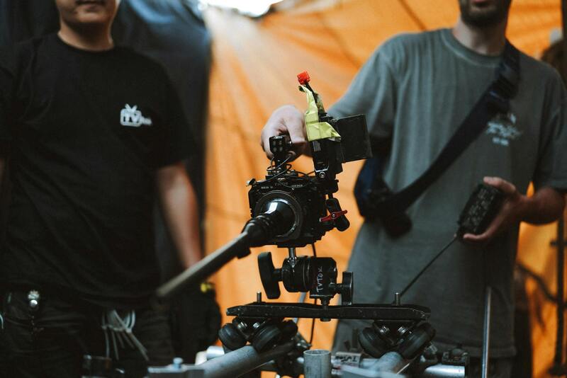
To achieve high-quality drone footage that effectively showcases Miami real estate, operators must utilize official and standardized techniques that adhere to industry best practices. This involves meticulous planning and execution to ensure footage is both captivating and compliant with operational guidelines.
Pre-flight planning is crucial. This includes studying property layouts, understanding surrounding environments, and identifying the best times of day to capture optimal lighting conditions. Early morning or late afternoon, when sunlight provides softer illumination, often yields the most appealing visuals. Detailed flight plans should map out specific angles and paths to highlight the property’s unique features and its relationship with the neighborhood.
When flying the drone, maintaining a steady altitude that captures the full scope of the property landscape is essential. Typically, maintaining a height between 50 to 150 feet provides an expansive view without compromising detail. Additionally, framing the shots to include nearby amenities, access points, and natural surroundings helps create a comprehensive visual story for potential buyers.
Shot composition should emphasize balance and symmetry, focusing on the property's standout features such as pools, gardens, or architectural details. Using a combination of wide-angle shots to establish context and slow, smooth panning shots to emphasize specific elements enhances viewer engagement. It’s vital to keep the drone movements fluid, avoiding abrupt shifts that might detract from the visual appeal.
During the shoot, operators should verify that they maintain a consistent line of sight with the drone at all times, while adhering to altitude and distance guidelines to ensure safety and image quality. External factors such as wind, lighting conditions, and obstacles like trees or power lines must be cautiously monitored to prevent accidents and ensure clean, professional footage.
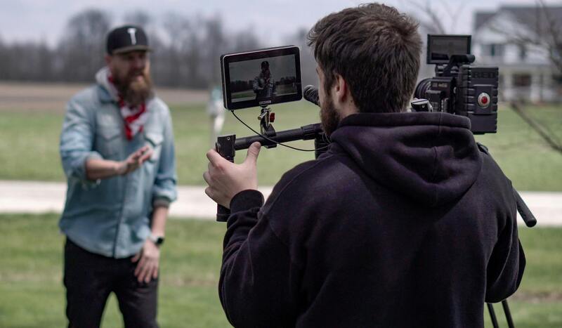
Post-flight, reviewing footage for clarity, stability, and framing ensures only the best clips are integrated into the final marketing materials. Additionally, capturing multiple angles and perspectives provides flexibility during editing, allowing real estate professionals to select the most engaging visuals.
Executing drone footage with precision and adherence to established operational standards directly contributes to an engaging property presentation. Properly captured footage elevates online listings, attracting more prospective buyers by offering immersive, detailed visuals that attract attention and foster emotional connections with the property.
Legal and Regulatory Considerations in Drone Footage for Miami Real Estate
Successfully capturing compelling drone footage for real estate listings in Miami involves adhering to a structured framework that ensures safety, quality, and compliance. Operators must be well-versed in the operational standards set forth by relevant authorities and industry best practices. These guidelines emphasize the importance of maintaining a clear line of sight during flight, managing altitude restrictions, and respecting privacy boundaries within residential and commercial zones.
Prior to each shoot, a comprehensive planning process is essential. This includes scouting the property location to identify potential obstacles such as high-rise buildings, power lines, or dense foliage that could interfere with the drone’s flight path. Accurate weather assessments are also critical—avoiding windy conditions, rain, or extreme temperatures ensures stable footage and safeguards equipment integrity. The selection of appropriate flight times, typically during daylight hours with good natural lighting, contributes significantly to video quality and aesthetic appeal.
Operational procedures should be meticulously followed to prevent inadvertent disturbances. This includes setting predefined flight corridors and minimum distances from bystanders or neighboring structures. Drone pilots should verify that their aircraft are well-maintained, with regularly updated software and calibration checks to optimize performance. Conducting pre-flight inspections helps to identify potential issues and reduces the risk of in-flight failures.
During the shoot, consistent communication among team members, where applicable, enhances coordination and safety. Post-flight, editors analyze the raw footage for stability, clarity, and composition, selecting the best shots for inclusion in marketing materials. Ensuring footage meets high standards of quality further elevates the property's presentation, making it more appealing to potential buyers.
It is crucial for operators to stay informed about any updates to local regulations or guidelines that may influence drone operations. Participating in ongoing training and certification programs can also help maintain proficiency and awareness of evolving best practices within the industry.
Optimal Techniques for Capturing Drone Footage in Miami Real Estate
To maximize the impact of drone footage in real estate marketing, it is crucial to employ the best practices during the shooting process. Achieving high-quality visuals requires meticulous attention to drone operation, camera settings, and overall scene composition. Proper planning and execution of drone shots can significantly enhance the property’s appeal, capturing its unique features and surroundings effectively.
Optimal Flight Planning
Effective drone filming begins well before the aircraft takes to the sky. Detailed pre-flight planning involves selecting shooting angles that highlight the property's most attractive features, such as landscape views, architectural design, and surrounding amenities. Flight paths should be predetermined to ensure smooth, steady footage, avoiding abrupt maneuvers that could impair video quality.
Lighting Conditions
The time of day plays a vital role in delivering visually stunning footage. The golden hours—shortly after sunrise and before sunset—offer soft, warm light that enhances textures, colors, and the overall ambiance of the scene. Overcast days can provide diffuse lighting, reducing harsh shadows and glare. Weather conditions must be carefully monitored to prevent wind, rain, or fog from compromising flight safety and footage clarity.
Camera Settings and Stabilization
Using appropriate camera settings tailored to lighting and environmental conditions is essential. A higher shutter speed helps eliminate motion blur during movement, while adjusting ISO and aperture levels ensures proper exposure. Employing gimbals or stabilization systems maintains smooth footage, especially during complex maneuvers or windy conditions.
Scene Composition and Angles
Dynamic shots—such as high-altitude panoramas, sweeping flyovers, or close-ups of key features—provide comprehensive perspectives that captivate potential buyers. Incorporating varied angles and altitudes introduces visual interest, emphasizing property scale and surrounding environment. Care should be taken to avoid obstructive elements like power lines, trees, or neighboring structures that may distract from the property view.
Safety and Privacy Considerations
During the shoot, maintaining a respectful distance from neighboring properties and public spaces ensures smooth operations and avoids unnecessary disturbances. Operators should also be vigilant about privacy, avoiding flyovers over private areas unless explicitly authorized. Consistent communication within the team helps coordinate movements and ensures safety protocols are adhered to throughout the shoot.
Post-Flight Review and Adjustments
After recording, reviewing footage for stability, focus, and composition enables editing choices that highlight the property's best features. When necessary, additional flights can be scheduled to capture missed angles or enhance specific details, ensuring comprehensive and compelling visual content for marketing efforts.
Efficient Strategies for Capturing Drone Footage in Miami Real Estate
Utilizing Advanced Equipment and Techniques
To maximize the visual appeal of drone footage for real estate, professionals rely on cutting-edge drone technology equipped with high-resolution cameras and sophisticated stabilization systems. These tools enable the capture of crisp, clear images and smooth videos even in challenging weather conditions or complex environments. Employing adjustable gimbals ensures stable shots during dynamic maneuvers, while autonomous flight modes facilitate precise control over camera angles and flight paths. For comprehensive property showcases, drone operators often plan multi-point shots that encompass different viewpoints, including aerial panoramas, close-up exterior details, and seamless flyovers that narrate the property's story effectively.
Optimizing Flight Planning and Execution
Effective drone videography begins with meticulous planning. Pre-flight surveys are essential to identify optimal flight paths, camera angles, and shot sequences. Flight plans should consider the unique topography of Miami’s vibrant neighborhoods, ensuring coverage of all key selling points while avoiding obstacles such as power lines, tall trees, or neighboring structures. Advanced software tools can assist in creating detailed flight routes, enabling pilots to execute complex maneuvers with precision. During shoots, maintaining steady altitude levels and smooth camera movements guarantees professional-quality footage. Operators should also account for optimal lighting conditions, typically during golden hours—shortly after sunrise or before sunset—to enhance the visual warmth and depth of the footage.
Prioritizing Safety and Respect for Privacy
Operational safety is a fundamental aspect of effective drone videography. Maintaining a respectful distance from neighboring properties and public spaces prevents disruptions while ensuring the safety of both personnel and bystanders. Adhering to coordinated flight protocols minimizes the risk of accidents and data loss. Respecting privacy involves avoiding flyovers of private areas without explicit authorization, especially when shooting in densely populated or coveted neighborhoods. Clear communication with homeowners and neighbors, along with thorough site assessments, help prevent misunderstandings and foster cooperation. Additionally, conducting pre-shoot surveys to identify potential hazards such as tall trees, wires, or restricted airspaces allows pilots to plan safe, obstacle-free routes, ensuring seamless and professional footage acquisition.
Handling Post-Flight Review and Footage Refinement
Once the drone footage is captured, a thorough post-flight review process allows for assessment of shot stability, focus accuracy, and overall composition quality. This review enables editors to select the best segments for marketing materials, removing any unstable or distracting footage. Color correction and stabilization techniques further enhance the visual clarity, making the content more appealing to prospective buyers. If certain angles or features are overlooked or require accentuation, additional flight sessions can be scheduled to capture these critical details, ensuring a comprehensive visual presentation. The goal is to produce polished, cinematic-quality videos that highlight every desirable aspect of the property and its surroundings, providing viewers with a compelling virtual experience that motivates action.
Advanced Techniques in Drone Photography for Enhanced Property Presentation
Implementing advanced drone photography techniques can significantly elevate the visual impact of real estate marketing. Using high dynamic range (HDR) imaging allows capturing a broader spectrum of light and shadow, ensuring that both the bright exteriors and shaded areas of a property are rendered with accurate detail. This results in more vibrant and lifelike visuals that attract potential buyers.
Another technique involves dynamic shooting modes such as hyper-lapse and timelapse photography, which can demonstrate the property in its environment over different times of the day or stages of landscaping development. For instance, showcasing a sunny afternoon, a sunset view, or even night scenes with well-placed lighting can provide a comprehensive understanding of the property's ambiance and aesthetic appeal.
Utilizing 3D mapping technologies and photogrammetry enables the creation of detailed, interactive property models. These models allow viewers to virtually explore the property’s layout and surroundings from multiple perspectives, enhancing engagement and aiding in decision-making. Integrating such technology into your drone footage offers a modern approach to real estate marketing that stands out in Miami's competitive market.
To maximize the effectiveness of these advanced techniques, it is essential to partner with experienced drone operators who understand the specific visual and technical requirements of high-quality real estate footage. They should utilize the latest drone models equipped with high-resolution cameras, gimbal stabilization, and intelligent flight modes to ensure smooth, detailed captures with minimal post-production correction.
Strategic Usage of Drone Footage for Targeted Marketing Campaigns
Effective incorporation of drone footage goes beyond property listings; it also plays a crucial role in targeted marketing efforts. Professionally produced aerial videos can be used to craft compelling social media advertisements, virtual tours, and email campaigns tailored to specific buyer demographics. When tailored to the interests of prospective clients, such content can generate greater engagement and lead to faster property turnover.
For example, an aerial drone video highlighting proximity to Miami’s vibrant neighborhoods, beaches, or key transit hubs can appeal directly to buyers seeking convenience and lifestyle advantages. Moreover, drone footage showcasing the property's surrounding amenities and landscape features emphasizes its unique selling points, making listings more attractive and memorable.
Continuous analysis of viewer engagement with these campaigns allows real estate professionals to refine their messaging and select the most impactful visuals. This strategic approach spearheads a more personalized marketing experience that aligns with current digital trends and buyer preferences, ultimately increasing the likelihood of sale success.
Advanced Techniques and Industry Standards for Drone Footage in Miami Real Estate
To maximize the impact of drone footage in the Miami real estate market, professionals are adopting advanced filming techniques and adhering to established industry standards that ensure quality, consistency, and visual appeal. These practices not only enhance the attractiveness of property listings but also safeguard the integrity and professionalism associated with high-end real estate marketing.
Utilization of Golden Hour and Optimal Lighting Conditions
One of the key techniques employed by skilled drone operators is capturing footage during the so-called "golden hour," typically during early morning or late afternoon when natural light casts a warm, soft glow. This timing accentuates architectural features, landscaping details, and surrounding scenery, creating visually compelling content that resonates with potential buyers. Proper lighting conditions reduce shadows and highlight the property's best features, making the footage more engaging and realistic.
High-Resolution Imaging and Stabilization Technologies
Employing high-resolution cameras, such as 4K or higher, guarantees crisp, detailed images that can be zoomed in on without losing clarity. Modern drones often feature sophisticated gimbal stabilization systems, which eliminate jitter and vibrations during flight, resulting in smooth, professional-quality footage. Such enhancements allow real estate professionals to present properties in a polished manner, reflecting the quality and attention to detail that clients seek.
Comprehensive Flight Planning and Automated Missions
Effective drone work involves meticulous flight planning. This includes pre-programming flight paths to ensure consistent coverage of property exteriors and surrounding landscapes. Automated flight modes enable the drone to capture complex angles and dynamic shots with precision, reducing the likelihood of errors such as shaky footage or missed key viewpoints. Proper planning also ensures safety and compliance within regulated airspace, maintaining operational standards.
Combining Aerial and Ground-Level Shots
To provide a comprehensive visual narrative, drone footage is often integrated with ground-level videography. This multi-angle approach offers viewers a well-rounded perspective, emphasizing both the scale of the property and its immediate environment. Transitioning smoothly between aerial and ground shots can be achieved through professional editing, creating engaging virtual tours that highlight interior spaces, exterior features, and neighborhood amenities seamlessly.
Adherence to Industry Protocols and Certification Standards
Professional drone operators often hold certifications and undergo specific training to ensure operational competence and adherence to industry protocols. These standards encompass flight safety, equipment maintenance, and data management. Employing certified operators guarantees that the footage produced meets high-quality benchmarks, aligning with the expectations of discerning clients and high-end real estate markets in Miami.
As technology continues to advance, industry stakeholders are embracing innovative techniques to elevate the standards and effectiveness of drone footage in property marketing. From HDR imaging and panoramic captures to 3D mapping and virtual reality integrations, staying at the forefront of these innovations ensures listings remain competitive and visually compelling in Miami’s vibrant real estate landscape.