Overview of Commercial Real Estate Drone Photography
In the competitive realm of commercial real estate, high-quality visual representations are critical for attracting investors, tenants, and buyers. Drone photography has revolutionized property showcasing by providing comprehensive aerial perspectives that traditional ground-level photography cannot achieve. This innovative approach captures expansive views of commercial properties, highlighting their size, strategic location, and surrounding infrastructure. Such imagery not only demonstrates the physical attributes of a property but also enhances its perceived value by offering prospective clients a detailed, immersive experience. Miami's dynamic real estate market benefits greatly from commercial real estate drone photography. The city’s unique blend of urban landscapes, waterfront properties, and expansive commercial developments calls for aerial imaging solutions that deliver clarity and impact. Using drone technology enables real estate professionals to present their properties in a compelling manner, fostering faster transactions and broader reach. The significance of drone photography extends beyond mere aesthetics. It allows for the detailed visualization of hard-to-access areas, such as rooftops, building exteriors, and large-scale properties. Additionally, aerial shots can effectively showcase the property's proximity to transportation hubs, commercial centers, and natural attractions—key factors in influencing investment decisions. As Miami continues to grow as a commercial hub, the utilization of drone photography has become an essential component of strategic marketing and property management. This method offers a competitive edge by providing engaging, high-resolution images that can be integrated into online listings, promotional videos, and virtual tours. The dynamic perspective helps differentiate properties in a crowded market space, attracting more interest and facilitating quicker sales or lease agreements. The use of commercial real estate drone photography has become a hallmark of professional marketing strategies in Miami, ensuring properties are presented in the most appealing and comprehensive manner possible.
Integrating detailed aerial imagery into marketing efforts elevates the overall appeal of commercial properties. As technology advances, the capabilities of drones continue to improve, offering higher resolutions, longer flight durations, and enhanced stability. These improvements enable real estate professionals to capture stunning visuals that highlight a property's unique features and potential. The strategic application of commercial real estate drone photography not only creates visually compelling content but also supports data-driven marketing campaigns, helping both sellers and buyers make informed decisions.
Equipment and Technology for Commercial Drone Photography
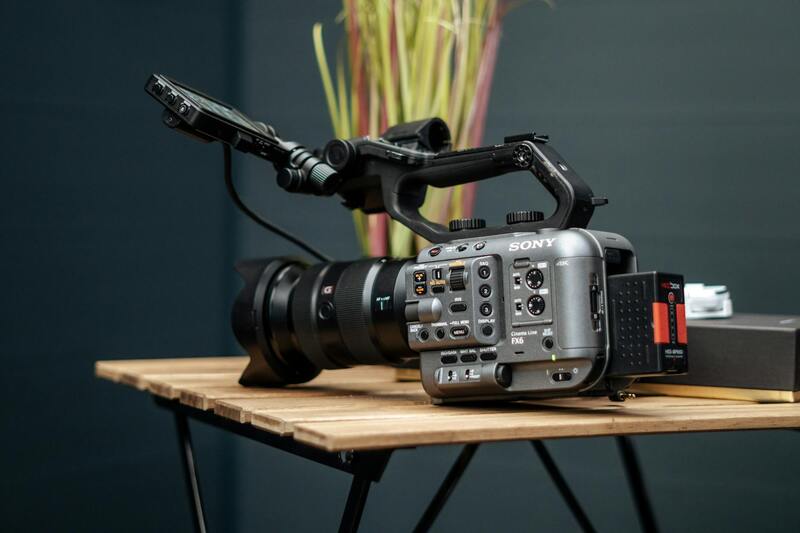
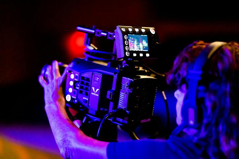
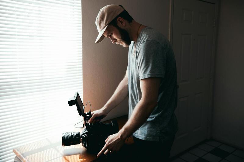
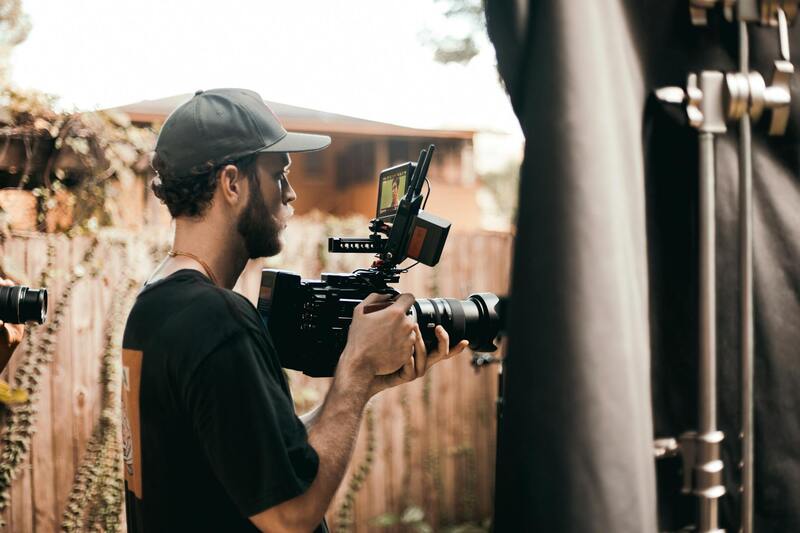
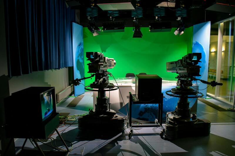
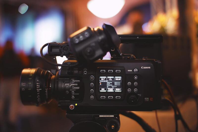
The foundation of high-quality commercial real estate drone photography relies heavily on the selection of advanced equipment and cutting-edge technology. Modern drones designed for professional photography are equipped with high-resolution cameras that capture crisp, detailed images and videos suitable for marketing and analysis. These drones typically feature gimbals, which stabilize the camera to eliminate shake and ensure smooth footage, thus enhancing the visual quality of aerial shots. Additionally, multi-directional stabilization systems allow for sharp images even when operating in variable wind conditions common in Miami's coastal environment.
Beyond camera quality, the capabilities of drone hardware significantly influence the scope of aerial imaging. Long-range flight systems with extended battery life enable comprehensive coverage of large properties, ensuring no vital detail is missed. Some professional drones are equipped with multi-spectral sensors that can provide insights into property conditions, such as land use and vegetation health, supporting holistic property assessments.
Advanced software integration is also a critical component. Drones equipped with GPS navigation and autonomous flight paths allow for precise, repeatable shot framing, which is especially beneficial for creating consistent virtual tours or aerial maps. Real-time data transmission systems facilitate immediate review and adjustments during shoots, ensuring optimal captures.
Given the demanding nature of commercial real estate projects, the choice of equipment also extends to durability and weather resistance. Miami's climate—with frequent sun, humidity, and occasional storms—necessitates resilient hardware capable of operating safely and reliably under various environmental conditions. High-quality, weather-rated drones prevent disruptions and safeguard investments.
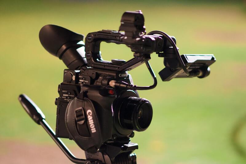
Investing in suitable equipment is complemented by auxiliary accessories, such as supplementary lighting, additional batteries, and payload options like high-zoom lenses or thermal imaging devices. These tools unlock new dimensions of visual storytelling, enabling real estate professionals to showcase properties in the most compelling manner.
Legal Regulations and Permits in Miami
Conducting commercial real estate drone photography in Miami requires adherence to specific procedures that ensure operational compliance within the city’s regulatory framework. These requirements are designed to promote safe and responsible drone usage, safeguarding the interests of property owners, the public, and the environment.
Prior to scheduling any drone shoot, practitioners must obtain proper authorization from relevant authorities. This involves submitting detailed flight plans, including the intended flight altitudes, areas of operation, and safety measures to manage potential risks. Approval is often contingent upon demonstrating technical proficiency and adherence to operational guidelines that mitigate interference with manned aircraft, comply with local airspace restrictions, and respect privacy boundaries.
Furthermore, specific zones within Miami, such as near airports, government buildings, or densely populated areas, necessitate additional permissions. These designated zones may restrict drone flights altogether or impose height and time constraints to minimize disruptions. An experienced drone operator closely monitors these regulations and ensures all necessary clearances are obtained beforehand, avoiding delays and potential violations.
Enlisting the expertise of licensed drone service providers proficient in Miami’s regulatory landscape is crucial. These providers rigorously stay informed about updates to airspace rules, temporary flight restrictions for special events, or new ordinance implementations. Employing such professionals guarantees that commercial drone photography projects proceed smoothly and in full accordance with city policies.
In addition to securing permits, operators often use pre-flight checklists to confirm equipment readiness and escape routes for emergency situations. Clear communication with property owners and neighboring entities is also an integral part of the operational plan, fostering a cooperative environment and reducing any misunderstandings during the shoot.
Staying current on Miami’s evolving rules helps maintain uninterrupted workflow and legal peace of mind. By respecting all procedural mandates, drone operators contribute to a professional standard that benefits the overall quality, reputation, and success of commercial real estate marketing initiatives within the city.
Techniques for Effective Drone Photography
Capturing high-quality images of commercial properties with drone technology involves more than just flying the device and snapping pictures. It requires a strategic approach to optimize visual impact and convey the unique features of each property. Proper technique begins with selecting the right angles; aerial shots from elevated vantage points provide expansive views of the property’s layout, surroundings, and proximity to key infrastructure. These perspectives are invaluable for showcasing large-scale developments, parking facilities, and landscape design, which are often critical selling points in commercial real estate.
Lighting conditions play a pivotal role in drone photography. Shooting during the golden hour—shortly after sunrise or before sunset—can yield images with warm, soft lighting that enhances textures and colors. Overcast days, while less ideal in some cases, can also provide evenly diffused light that minimizes shadows and glare, resulting in well-balanced images. Operating at optimal times ensures that the property is portrayed in its best light, attracting more interest from prospective buyers or tenants.
Another critical element is property staging. Though primarily associated with traditional photography, staging techniques can be adapted for drone shots by ensuring that the property’s exterior and landscaping are well-maintained. Clear, uncluttered surroundings allow the drone’s camera to focus on the property's most appealing features without visual distractions. Additionally, incorporating elements such as surrounding greenery or nearby amenities can contextualize the property's location, emphasizing its convenience and appeal within the commercial district.
Effective drone photography also involves hands-on skills, including controlling flight stability and camera settings. Maintaining smooth camera movements and consistent exposure levels avoids distracting artifacts like motion blur or overexposure. Using high-resolution cameras with adjustable settings enables capturing detailed images that can be used across various marketing platforms. Skilled operators understand how to adjust shutter speeds, aperture, and ISO to accommodate varying light conditions, ensuring clarity and vibrancy in every shot.
Post-flight planning is equally vital. Reviewing footage, selecting the best shots, and capturing multiple angles provides flexibility in post-production. Real estate professionals benefit from access to a comprehensive set of visuals, including panoramic shots and detailed close-ups, which can be tailored to different marketing channels like online listings, brochures, or presentations. Mastery of drone photography techniques directly translates into compelling visual narratives that elevate a commercial property's market presence, drawing attention and producing results.
Equipment and Technology for Commercial Drone Photography
Utilizing the right equipment is essential for capturing high-quality commercial real estate images that stand out in competitive markets. Modern drone technology offers a range of capabilities that allow photographers to produce detailed, vibrant, and wide-reaching visuals, essential for effective marketing strategies. Professional-grade drones equipped with high-resolution cameras ensure sharp, crisp images that highlight both the property's architectural features and its surrounding environment.
Key components of effective equipment include stabilized gimbals, which maintain camera orientation during flight to eliminate motion blur and deliver smooth footage. Advanced sensors and lenses, such as wide-angle or zoom capabilities, give flexibility in capturing expansive shots or close-up details, crucial for showcasing large commercial properties or intricate architectural features.
Battery life and flight range are also significant factors in equipment choices. Longer battery durations allow for more comprehensive coverage of extensive properties or multiple locations in a single session. Moreover, selecting models with GPS and obstacle avoidance technology enhances safety, precision, and ease of navigation, especially in complex urban or landscaped environments.
Additional Accessories and Supporting Gear
- Extra batteries: Facilitate extended shooting sessions without interruption.
- Lighting equipment: Enhances visibility under low-light conditions or during dawn and dusk shoots.
- Transmission systems: Ensure real-time high-definition streaming from the drone to the operator, crucial for adjusting angles on the fly.
- Protective cases and maintenance kits: Guard equipment during transport and ensure operational reliability.
Investing in quality hardware not only improves the visual output but also streamlines the workflow, enabling quick adjustments and reducing post-production time. The integration of cutting-edge technology in commercial drone photography translates directly into more compelling visuals that can drive engagement and attract prospective tenants or buyers.
Choosing appropriate technology tailored to specific project needs ensures high flexibility and precision. This technological foundation allows professional photographers to deliver consistent, high-quality results that meet the demanding standards of the commercial real estate market, ultimately providing clients with visually impactful assets that support robust property marketing campaigns.
Equipment and Technology for Commercial Drone Photography
Achieving precision and exceptional quality in commercial real estate drone photography relies heavily on the selection and utilization of advanced equipment and cutting-edge technology. Professional-grade drones equipped with high-resolution cameras are fundamental tools, capable of capturing detailed imagery that highlights the unique features of large-scale properties, commercial complexes, and expansive land parcels. These devices often incorporate stabilizing systems, such as gimbals, to ensure steady footage, even in challenging wind conditions prevalent in urban environments like Miami.
Furthermore, the integration of high-efficiency sensors enables the collection of radiometric and multispectral data, supporting more in-depth analysis and presentation of property conditions. Advanced drones also come with features such as obstacle avoidance systems, GPS accuracy, and automated flight modes, allowing operators to focus on capturing optimal visuals while maintaining safety and precise navigation.
State-of-the-art equipment isn't limited to the drone itself. Ground control stations equipped with monitors for real-time image transmission help operators make immediate adjustments. Additional accessories, including extra batteries, lighting enhancements, and transmission systems, support extended shooting sessions and ensure high-quality output under various lighting conditions—whether during early mornings, late evenings, or overcast days, which are common in Miami's subtropical climate.
Investing in reliable hardware paired with sophisticated software for flight planning and image processing translates directly into improved productivity and higher-quality visuals. These technological tools enable precise flight paths, comprehensive coverage of large property sites, and swift post-flight processing. When consistently applied, they ensure deadlines are met, assets are captured comprehensively, and imagery consistently meets the high expectations of the commercial real estate market in Miami.
Commercial drone photography projects often demand tailored configurations. For example, multi-spectral cameras can be used to assess landscaping health or environmental concerns, while thermal imaging can help identify heating or cooling inefficiencies in large structures. This versatility allows professionals to provide clients with more insightful visual data, supporting better decision-making and marketing strategies.
Advanced Techniques for Capturing Impactful Commercial Drone Imagery
Achieving superior results in commercial real estate drone photography hinges on employing sophisticated techniques that maximize the visual appeal and informational content of aerial images. These methods involve meticulous flight planning, optimal shooting angles, and strategic staging of property features to highlight their best attributes.
Meticulous Flight Path Planning
To ensure comprehensive coverage of expansive commercial properties, precise pre-flight planning is essential. Utilizing advanced flight planning software, operators can designate specific waypoints, determine optimal flight altitudes, and set camera angles, guaranteeing that every critical aspect of the property is captured systematically. This approach minimizes flight time while maximizing coverage, and reduces the risk of missing vital details, particularly in complex sites such as large industrial parks or multi-building commercial complexes.
Utilizing Dynamic Shooting Angles
Shooting from diverse angles conveys a richer narrative about the property's scale, layout, and surroundings. High-altitude shots offer a broad overview, demonstrating the property's size and its relation to neighboring infrastructure. Low-angle shots or oblique perspectives highlight architectural features and landscaping details, which are crucial for attracting prospective tenants or buyers. Employing camera tilt adjustments and variable focal lengths during flight allows photographers to create visually compelling compositions that stand out in marketing materials.
Leveraging Natural Lighting Conditions
Optimal lighting enhances image clarity and color vibrancy. Conducting shoots during the golden hour—shortly after sunrise or before sunset—provides soft, warm light that minimizes shadows and highlights architectural textures. Overcast days, prevalent in Miami's subtropical climate, reduce harsh shadows and glare, facilitating consistent exposure across images. Operators should monitor weather forecasts closely and plan flights during periods of stable weather to avoid disruptions caused by sudden rain or high winds.
Implementing Strategic Staging
Placement of movable assets or temporary signage can accentuate specific property features or convey intended branding messages. For example, positioning construction materials or equipment strategically in shots can demonstrate ongoing development, while clean landscaping and well-maintained facades underscore property value. These details add depth to visuals and can influence perception positively, supporting more effective marketing campaigns.
Optimizing Post-Flight Image Composition and Processing
Post-processing plays a pivotal role in elevating raw drone footage into compelling marketing visuals. Advanced editing software enables operators to adjust contrast, correct color imbalances, and sharpen details, ensuring images meet the high standards of Miami's competitive real estate market. Techniques such as HDR (High Dynamic Range) imaging can be employed to balance exposure across scenes with varying light intensities, resulting in balanced images that accurately depict the property's true appearance.
Orthomosaic mapping—stitching together multiple overlapping images—produces high-resolution, detailed maps ideal for site analysis or showcasing extensive properties. Such detailed visuals facilitate strategic planning, asset valuation, and promotional efforts. Additionally, incorporating 3D modeling from captured imagery can provide immersive virtual tours, offering potential clients a comprehensive understanding of the property’s layout and spatial relationships.
Maintaining Data Security and Quality Assurance
Ensuring that all captured data is stored securely and processed with precision safeguards the integrity of the project. Regular calibration of cameras and drones mitigates inconsistencies, while employing reliable data management protocols prevents loss or corruption of valuable imagery. These practices uphold a high standard of quality control, reinforcing credibility and trustworthiness in professional services offered within Miami’s commercial real estate sector.
Implementing Ethical and Safe Drone Operations in Miami's Commercial Real Estate Market
To maximize the benefits of commercial real estate drone photography while maintaining responsible operation standards, professionals must adhere to established practices that prioritize safety, efficacy, and respect for privacy. This includes rigorous pre-flight planning, such as assessing weather conditions, selecting optimal flight paths, and ensuring all equipment functions properly to prevent mishaps during shoots. Clear communication with property owners and stakeholders is essential, outlining the scope of the shoot, flight times, and potential noise or disruption, thereby fostering transparency and trust.
Employing advanced flight planning tools allows operators to design precise flight paths that maximize coverage and image quality while avoiding obstacles such as power lines, tall structures, and restricted zones. These tools often incorporate real-time mapping and obstacle detection, enhancing safety protocols and reducing the risk of accidents. During flight, continuous monitoring and immediate response to any unforeseen issues are critical for maintaining control and safeguarding equipment and personnel.
Post-flight procedures should include comprehensive data review, secure storage, and systematic maintenance checks of equipment used. These steps ensure that the collected imagery is of high quality, accurate, and ready for further processing or dissemination. Furthermore, documenting flight logs and operational details supports accountability and can aid in compliance reviews or audits.
Training and Certification for Drone Operators
Competent drone operation hinges on professional training and certification programs that not only enhance technical skills but also deepen understanding of the regulatory environment. Miami-based operators often pursue courses accredited by relevant authorities, which cover safety protocols, navigation guidelines, and best practices for commercial imaging. Continuous education and experience are key to adapting to evolving technology and industry standards.
Maintaining Up-to-Date Knowledge of Miami's Airspace Regulations
Given Miami’s bustling urban airspace, staying informed about current airspace restrictions and temporary flight restrictions is fundamental. This includes regularly consulting official notices, participating in local aviation community updates, and collaborating with drone authorities to ensure compliance during all operations. Being proactive in understanding regional rules prevents disruptions and demonstrates professionalism.
Furthermore, establishing a culture of safety within the operational team—through routine safety briefings and adherence to best practices—strengthens overall execution quality. Integrating these protocols seamless into daily workflows helps to produce consistently reliable, high-quality imagery that highlights the unique features of Miami’s commercial properties.