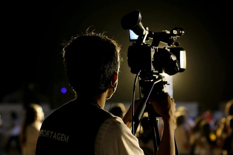
Importance of Drones in Real Estate Marketing
In the competitive landscape of property sales, visual appeal plays a crucial role in attracting potential buyers. The advent of drone technology has significantly elevated the quality and scope of real estate marketing by enabling agents and owners to showcase properties from a compelling aerial perspective. High-resolution aerial images and dynamic videos captured by drones offer an immersive view of properties, highlighting architecture, landscaping, and surrounding amenities with remarkable clarity. This innovative approach helps listings stand out in crowded online platforms, leading to increased viewer engagement and faster sales turnover.
Using drones in real estate marketing provides a comprehensive overview of a property’s location and its proximity to key features such as parks, schools, and commercial hubs. Such visual storytelling boosts interest by giving potential buyers a sense of space and context that static photographs simply cannot deliver. Moreover, aerial footage can effectively demonstrate unique property attributes, including expansive gardens, swimming pools, or scenic views, adding emotional appeal that resonates with viewers. As a result, real estate professionals increasingly prioritize drone photography as an essential tool for creating captivating property listings and marketing campaigns.
Furthermore, the integration of drone footage into virtual tours enhances online listing interactivity, allowing prospective buyers to explore properties remotely with a realistic sense of scale and environment. For agents operating in vibrant markets like Miami, employing high-quality drone imagery can differentiate their listings from competitors, ultimately attracting more qualified leads. Given these advantages, incorporating drone technology into real estate marketing strategies has become indispensable for maximizing property visibility and facilitating quicker transactions.

Key Features to Consider in a Real Estate Photography Drone
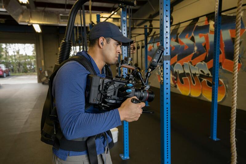
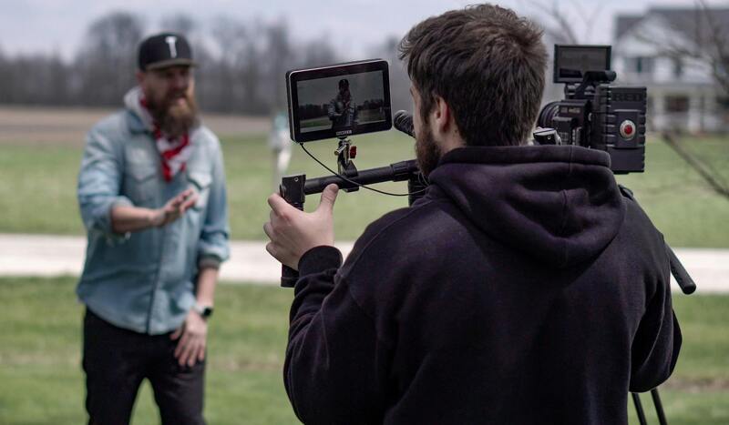
When selecting a drone specifically for real estate photography, it is essential to focus on features that optimize image quality, flight reliability, and ease of use. These attributes ensure that every shot captured contributes to compelling property presentations and maintains professional standards. High-resolution cameras are paramount, as they deliver crisp, detailed images that highlight the property's best aspects. Look for drones equipped with 4K or higher video capabilities, which allow for stunning promotional videos and impactful aerial shots.
Flight stability is another critical factor, particularly in windy conditions often encountered in coastal cities like Miami. Drones with advanced stabilization systems or gimbal mechanisms ensure smooth footage and prevent shaky images that can diminish the listing's appeal. Battery life also plays a significant role; longer flights enable coverage of larger properties or multiple angles without frequent recharging interruptions. Many professional-grade drones offer batteries that support flights lasting 20-30 minutes, maximizing productivity.
GPS capabilities contribute to precise positioning and intelligent flight modes, making it easier to capture consistent, well-framed images. Features such as waypoint navigation and return-to-home functions are advantageous for ensuring safety and reducing operational risks. Additionally, user-friendly interfaces and intuitive controls are crucial for efficiency, particularly when capturing multiple shots or managing complex flight paths.
Other considerations include obstacle avoidance systems to safeguard against collisions, especially important in densely populated or obstacle-rich environments. Optical zoom capabilities can also be beneficial, allowing tight shots of specific features without manual repositioning. Finally, compatibility with editing software and ease of transportation are additional factors that facilitate a streamlined workflow from aerial shot to listing publication.
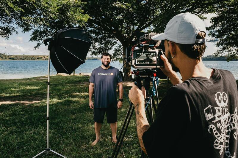
Effective Techniques for Capturing High-Quality Aerial Real Estate Footage
To maximize the visual impact of real estate listings, employing strategic shooting techniques with a drone is essential. First, plan your shot angles carefully to highlight the property's most attractive features, such as expansive facades, lush landscaping, or nearby amenities. Utilizing a drone's ability to fly at various altitudes and angles can reveal the property's scale and context within its surroundings, creating compelling visuals that attract prospective buyers.
Optimal lighting conditions are crucial for capturing crisp, vibrant images. Early mornings or late afternoons often provide the best natural light, reducing harsh shadows and providing a warm, inviting ambiance to the property. Avoid flying during overcast or rainy conditions, which can dull the imagery and complicate flight stability.
Stability and motion control are vital. Using a drone equipped with a gimbal ensures smooth footage, especially when moving the camera across different viewpoints. It prevents jitteriness that can distract viewers and diminishes the overall professional quality of the images.
Advanced flight techniques include executing orbit shots, where the drone circles the property to showcase its layout and exterior design dynamically. Elevation changes can also be utilized to produce a vertical perspective, emphasizing rooftop views or landscaping details from above.
In addition, adhering to proper framing and composition principles enhances the visual appeal. Apply the rule of thirds to position key elements, ensuring the property remains the focal point. Horizontal and vertical lines should be aligned to avoid distorted perspectives that can detract from the overall aesthetic.
Finally, consider the sequence of shots, capturing a variety of angles and perspectives to provide a comprehensive view of the property. This approach not only appeals to prospective buyers but also allows for creative editing and storytelling during the post-processing phase.
Choosing the Best Real Estate Photography Drone for Miami Properties
When selecting a drone for real estate photography in Miami, it's essential to prioritize high-quality image capture capabilities, stability, and user-friendly features that align with professional standards. The ideal drone should be equipped with a high-resolution camera, preferably 4K or higher, to ensure crisp, detailed footage that highlights every aspect of a property, from expansive lawns to architectural intricacies.
Stability is a critical factor, and models with advanced gimbal stabilization systems provide smooth, jitter-free footage even in windy Miami conditions. An integrated gimbal helps maintain a level horizon and reduces vibrations, resulting in polished visuals suitable for marketing materials and listings.
Battery life is equally important for capturing comprehensive shots without frequent interruptions. Drones offering extended flight durations, typically 20-30 minutes per charge, enable operators to scout entire properties efficiently and gather varied footage from multiple angles and elevations.
Additionally, intelligent flight modes such as orbit, waypoint navigation, and automated height adjustments help streamline the shooting process, ensuring consistent quality and reducing the need for complex manual controls. These features are invaluable for producing captivating aerial views that emphasize the spaciousness and appeal of Miami real estate.
Real estate professionals should also consider the drone’s portability and ease of setup, which simplifies on-site operations and enables quick deployment across multiple properties. Compatibility with remote controls and mobile apps allows for precise camera adjustments, live viewing, and real-time adjustments, making the operation more intuitive and professional.
Finally, for those seeking the best of the best, some models incorporate advanced obstacle avoidance systems and GPS-assisted flight planning. These capabilities enhance safety and ensure consistent results, even in complex environments with surrounding structures or trees.
By carefully evaluating these features, Miami-based real estate professionals can select a drone that maximizes the visual impact of their property listings, attracts potential buyers, and elevates their marketing efforts to new heights. Investing in a reliable, high-performance drone tailored to real estate photography ensures high-quality imagery that truly captures the property's essence and appeal.
Understanding the Official Methods for Drone Operation in Miami
When choosing the best real estate photography drone, it is essential to adhere to established and official methods of operation that ensure safety, quality, and professionalism. Unlike casual or informal flying practices, professional drone operation involves following specific protocols that are recognized by regulatory authorities and industry standards. These methods include proper pre-flight planning, adherence to designated flight zones, and thorough understanding of the drone’s capabilities and limitations.
Pre-flight planning involves conducting a detailed site assessment to identify any potential hazards or obstacles, such as power lines, tall structures, or dense foliage. This planning step helps to determine the safest and most effective flight paths, ensuring the drone captures the most compelling imagery without risking damage or safety issues.
Operational procedures should prioritize maintaining a safe distance from people and property, especially in residential areas like Miami, where densely populated neighborhoods are common. Operator pilots should maintain line-of-sight with the drone at all times, ensuring full control during flight. Using a drone equipped with obstacle avoidance features adds an additional layer of safety, allowing the drone to automatically detect and navigate around obstacles, thereby reducing the risk of collisions.
Official drone operation also entails comprehensive training for pilots, whether through certified courses or industry-recognized programs. These certifications not only improve operational proficiency but also demonstrate a professional level of expertise to clients. Furthermore, staying updated on any changes or updates to local procedures and regulations is vital to maintaining lawful operations.
Documentation and record-keeping of flights, including flight logs, images captured, and operational details, are integral to maintaining transparency and accountability. In many cases, maintaining these records can support insurance claims or incident investigations, reinforcing a professional approach to drone use.
Utilizing Authorized Software and Equipment
Employing authorized flight planning and management software ensures that drone flights are conducted within recommended parameters. This software can help in creating automated flight paths, setting altitude limits, and managing battery life effectively. It also provides real-time telemetry data, enabling the operator to monitor the drone’s position and status continuously.
Choosing a drone from reputable manufacturers that comply with industry standards guarantees the inclusion of essential safety features such as geofencing and automatic return-to-home functions. These features enhance compliance with official protocols, reducing risks associated with unauthorized or accidental flights.
Respecting Privacy While Conducting Drone Photography
Respect for the privacy of residents and property owners remains a priority when executing aerial photography for real estate. Official methods involve obtaining necessary permissions or notices before conducting flights over private land or dwellings. Clear communication and respect for privacy boundaries help maintain professionalism and foster positive relationships within the community.
Legal and Safety Regulations for Drone Use in Miami
Understanding Certification and Permitting Processes
To operate a drone for real estate photography in Miami, it’s essential to adhere to the set protocols that ensure safe and responsible flight practices. This involves obtaining the necessary certifications and permits that validate the operator’s competency and the drone’s compliance with established standards. Usually, this involves completing coursework and passing examinations that demonstrate knowledge of flight operations, meteorological conditions, and safety procedures. Such certification also confirms familiarity with local airspace rules, ensuring that flights are conducted within designated corridors and altitude restrictions.
Permitting often requires submitting flight plans and geospatial data, allowing relevant authorities to review and approve drone activities before execution. These approvals help maintain an organized and safe sky environment, particularly in densely populated urban areas such as Miami. By respecting these formal procedures, operators demonstrate professionalism and a commitment to responsible aerial photography.
Implementing Operational Best Practices
Adherence to operational protocols is critical for the safe execution of drone flights. Pre-flight checks should include a comprehensive inspection of the drone’s hardware and software systems, ensuring optimal functionality. Setting up a clear flight plan that accounts for weather conditions, potential obstacles, and no-fly zones mitigates risks associated with unexpected interruptions or accidents. Maintaining a visual line of sight with the drone at all times is also a key component of responsible operation, allowing immediate reaction to any anomalies or hazards.
Operators should also monitor battery life vigilantly, ensuring that there is ample power for a safe return to the takeoff point. Utilizing automated functions, such as return-to-home, can provide an added layer of safety, especially in urban environments where navigation challenges are typical. Furthermore, documenting each flight, including start and end times, routes taken, and specific conditions encountered, helps develop a thorough operational history and facilitates accountability.
Community Engagement and Privacy Respect
Effective communication with property owners and residents prior to drone flights fosters transparency and goodwill. When requesting permission or notifying local authorities, clear explanations of intent, scope, and safety measures reduce concerns and enhance cooperation. Respecting property boundaries and privacy rights by limiting flight zones and avoiding intrusive angles displays professionalism and sensitivity. These practices not only align with best operational standards but also strengthen positive relationships within the Miami real estate market.

Ensuring Optimal Image Quality and Data Integrity
When selecting the best real estate photography drone, the quality of the imagery produced is paramount. High-resolution cameras with capabilities for capturing sharp, detailed photos and videos are essential to present properties in their best light. Drones equipped with 4K or higher video capabilities allow for smooth, vibrant footage that effectively showcases property features and surrounding landscapes.
Stability and gimbal technology significantly influence image clarity. Advanced gimbal systems stabilize the camera, reducing shake and blurring, especially during windy conditions or complex maneuvers. This technology ensures that aerial shots are crisp and professional, providing potential buyers with engaging visual content that accurately reflects the property's appeal.
Battery life and power management also play crucial roles. Extended flight times permit comprehensive coverage of large properties or complex layouts without frequent returns for charging. Some models feature intelligent battery management systems that monitor and optimize power usage, helping operators plan shoots efficiently and avoid mid-flight interruptions.
Advanced Flight Capabilities and User Interface
Ease of operation significantly impacts the effectiveness of a drone in real estate marketing. User-friendly controls and intuitive interfaces enable real estate professionals and photographers to focus on creative composition rather than technical complexities. Features such as automatic flight modes, waypoint navigation, and simple app integrations streamline the shooting process, ensuring consistent and reliable results.
Obstacle avoidance sensors and GPS stabilization are critical to prevent accidental collisions and maintain precise positioning during flight. These features facilitate safe flying in complex environments, which are common in urban Miami settings, thereby reducing risks and ensuring a smooth workflow.
Furthermore, customizable flight paths and the ability to pre-program shots allow for efficient use of time during open house events, property launches, or scheduled marketing campaigns. The integration of real-time monitoring and live streaming options can also enhance on-the-spot marketing and client engagement efforts.
Optimal Drone Features for Superior Real Estate Imaging
When selecting the best real estate photography drone, focusing on specific features that enhance image quality, operational reliability, and ease of use is essential. High-resolution cameras are a cornerstone, with 4K or higher video capabilities and 20-megapixel or more still image sensors providing crystal-clear visuals that highlight every detail of a property’s exterior and surrounding neighborhood.
Stabilization systems, such as gimbal stabilization, are critical to producing smooth footage despite wind or movement. Advanced flight systems with GPS and GLONASS integration ensure precise positioning and stable hovering, vital for capturing consistent footage of multiple angles without drift. Intelligent obstacle detection sensors, especially around urban environments like Miami, prevent collisions with buildings, trees, or power lines, safeguarding equipment and maintaining a professional standard.
Battery Life and Flight Efficiency
Extended battery life is crucial for comprehensive property shoots, allowing longer flight times without frequent recharges. Many top-tier drones now come with rapid charging capabilities and hot-swappable batteries, ensuring minimal downtime and maximizing efficiency during busy listing seasons.
User Interface and Control Options
Intuitive control interfaces, accessible via dedicated remote controllers or smartphone apps, significantly impact operational effectiveness. Features like automated flight modes, pre-programmed flight paths, and real-time monitoring enhance both safety and creative control. The ability to operate seamlessly in various lighting conditions and environments, such as Miami’s sunny skies or interior spaces, further supports versatile marketing strategies.
Connectivity and Post-Processing Compatibility
Modern drones offer advanced connectivity options such as Wi-Fi, Bluetooth, and real-time streaming capabilities, ideal for live marketing or on-site client demonstrations. Compatibility with editing software ensures that raw footage can be efficiently processed and enhanced, producing visually compelling listings that stand out across digital platforms.
Durability and Weather Resistance
Given Miami’s dynamic climate, choosing a drone with weather resistance, including water and wind resistance, is advantageous. Models built with durable materials and protected flight systems can operate reliably under various weather conditions, providing flexibility to capture listings even in less-than-ideal weather.
Additional Considerations for Miami Real Estate Professionals
- Compact and portable design for easy transportation across diverse Miami locations.
- Compatibility with high-dynamic-range (HDR) imaging to optimize footage in varied lighting conditions.
- Support for multiple payload options, such as additional cameras or sensors, to expand creative possibilities.
- Reliable firmware updates and technical support to ensure optimal performance over time.