Overview of Aerial Real Estate Photography in Miami
Miami's dynamic real estate landscape is renowned for its luxurious properties, sophisticated developments, and waterfront estates. In this competitive market, high-quality visual presentation plays a pivotal role in attracting potential buyers. Among the most impactful tools for showcasing properties is aerial real estate photography, which provides unique perspectives that ground-level images cannot match. Using drones or specialized aircraft, real estate professionals can capture sweeping views of properties, neighborhoods, and surrounding environments, creating a compelling narrative that appeals to discerning clients.
The significance of aerial imagery in Miami's real estate sector extends beyond mere visuals. It enhances the storytelling aspect of property listings by illustrating spatial relationships, property size, and the proximity to key amenities such as beaches, parks, and commercial centers. This broader vantage point helps potential buyers gain a comprehensive understanding of a property's context within its community, fostering greater interest and engagement.
Strategic use of aerial photography can also highlight architectural features, landscape design, and luxurious outdoor spaces, emphasizing a property’s unique selling points. With Miami's eye-catching skyline and scenic waterfronts, aerial shots serve as a powerful differentiator in marketing campaigns. Professional aerial imagery not only improves online listings but also elevates branding efforts, making properties stand out in crowded markets. As digital platforms increasingly prioritize visual content, the role of high-quality aerial photography becomes indispensable for real estate firms seeking to elevate their market presence.
In sum, aerial real estate photography in Miami is a transformative element that elevates property presentations, offering prospective buyers immersive, visually rich content that showcases properties from compelling angles. This approach improves marketing efficiency, enhances property visibility, and supports successful sales outcomes in Miami's vibrant real estate market.
Legal Regulations and Permits for Aerial Filming in Miami
When engaging in aerial real estate photography within Miami, it is essential to adhere to specific protocols that govern drone operations in the area. These established measures are designed to ensure safety, privacy, and efficiency for all parties involved. Understanding and following these guidelines helps professional photographers, real estate agents, and property owners achieve high-quality aerial content without unnecessary interruptions or legal complications.
Miami, like many urban centers, has designated airspace regulations that control drone activity, particularly over densely populated or sensitive areas. Typically, drone operators are required to obtain permits from relevant local authorities to conduct commercial aerial photography. These permits often involve submitting detailed flight plans, including the intended altitude, flight paths, and purpose of the shoot. It’s important to provide comprehensive documentation demonstrating compliance with safety protocols and insurance coverage supporting aerial operations.
Furthermore, Miami mandates strict adherence to privacy laws that protect residents’ rights. This means avoiding flight over private properties without explicit consent and maintaining a respectful distance from private residences and commercial entities. Operators should also be aware of restrictions around critical infrastructure, such as airports, government buildings, and broadcasting stations, where drone activity may be limited or entirely restricted.
To navigate these requirements effectively, many aerial photographers rely on local compliance experts and established drone service companies familiar with Miami's regulatory landscape. These professionals possess up-to-date knowledge of the permits and procedures necessary for lawful aerial filming within the city. They can advise on obtaining necessary permissions, managing flight plans efficiently, and ensuring that all legal considerations are addressed before capturing footage.
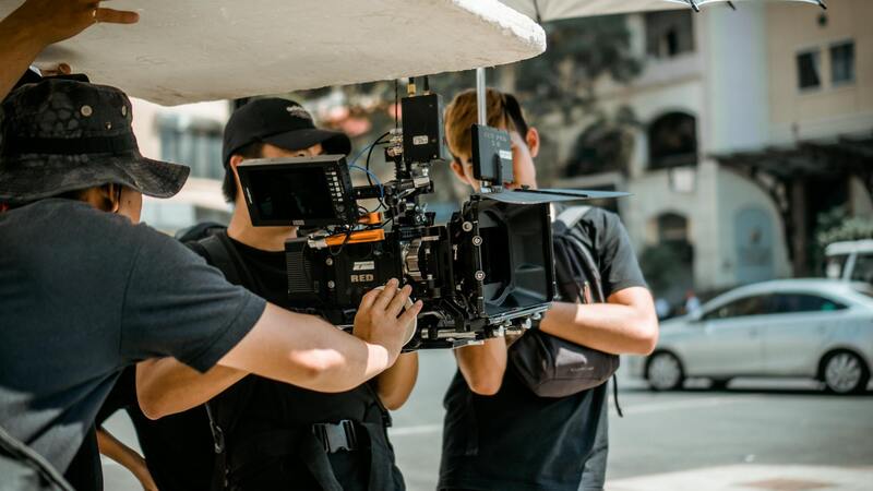
In addition to securing permits, employing certified drone pilots with proper licensing is vital. These operators adhere to established safety standards, conduct thorough pre-flight checks, and maintain communication with local authorities if required. This professional approach ensures that aerial real estate projects are completed smoothly, maintaining the integrity of the shoot while complying with all applicable rules.
Ultimately, a well-informed approach to the legal framework surrounding aerial photography not only safeguards the interests of all stakeholders but also enhances the credibility of the visual content. It establishes a foundation of trust with property owners and clients, while also preventing costly delays or penalties. Professional integration of these regulations ensures that aerial real estate imagery can be captured ethically, responsibly, and with the highest standards of quality in Miami's dynamic market.
Legal Regulations and Permits for Aerial Filming in Miami
Securing the right permissions for aerial real estate photography in Miami involves navigating a structured process designed to ensure safe and compliant drone operations. One of the primary steps includes obtaining an FAA Part 107 certification, which confirms that the drone pilot has demonstrated the knowledge required for responsible drone flying, covering airspace rules, weather considerations, and operational limits. This certification is essential for commercial filming activities, including real estate showcases from the air.
Before any flight begins, a comprehensive flight plan must be submitted to the appropriate authorities, outlining the location, height, and duration of the operation. Miami-specific airspace regulations further specify which zones require additional authorization, particularly around airports, heliports, and certain urban districts. Pilots must check for temporary flight restrictions, especially during special events or high-profile occasions, to avoid disruptions and ensure compliance.
In addition to federal regulations, Miami enforces local ordinances that govern drone activities within city limits. These often include restrictions on flying over private property without prior consent, maintaining safe distances from crowds, and avoiding flight in designated no-fly zones. For real estate projects, it is crucial to work with licensed drone operators who understand these local standards thoroughly, as well as any specific property restrictions that may be in place.
Proper documentation, including permits and proof of certification, should be securely maintained and available upon request. This documentation demonstrates adherence to all operational standards and preserves the integrity of the project. Engaging licensed professionals who maintain ongoing communication with local authorities helps streamline approval processes, reduces potential delays, and fosters trust with property owners and stakeholders.
By understanding and strictly following the official procedures for drone use in Miami, real estate professionals can access unparalleled aerial perspectives while ensuring safety, privacy, and regulatory compliance. This disciplined approach enables the creation of high-quality visual content that elevates property marketing efforts and aligns with industry standards.
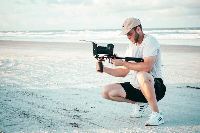
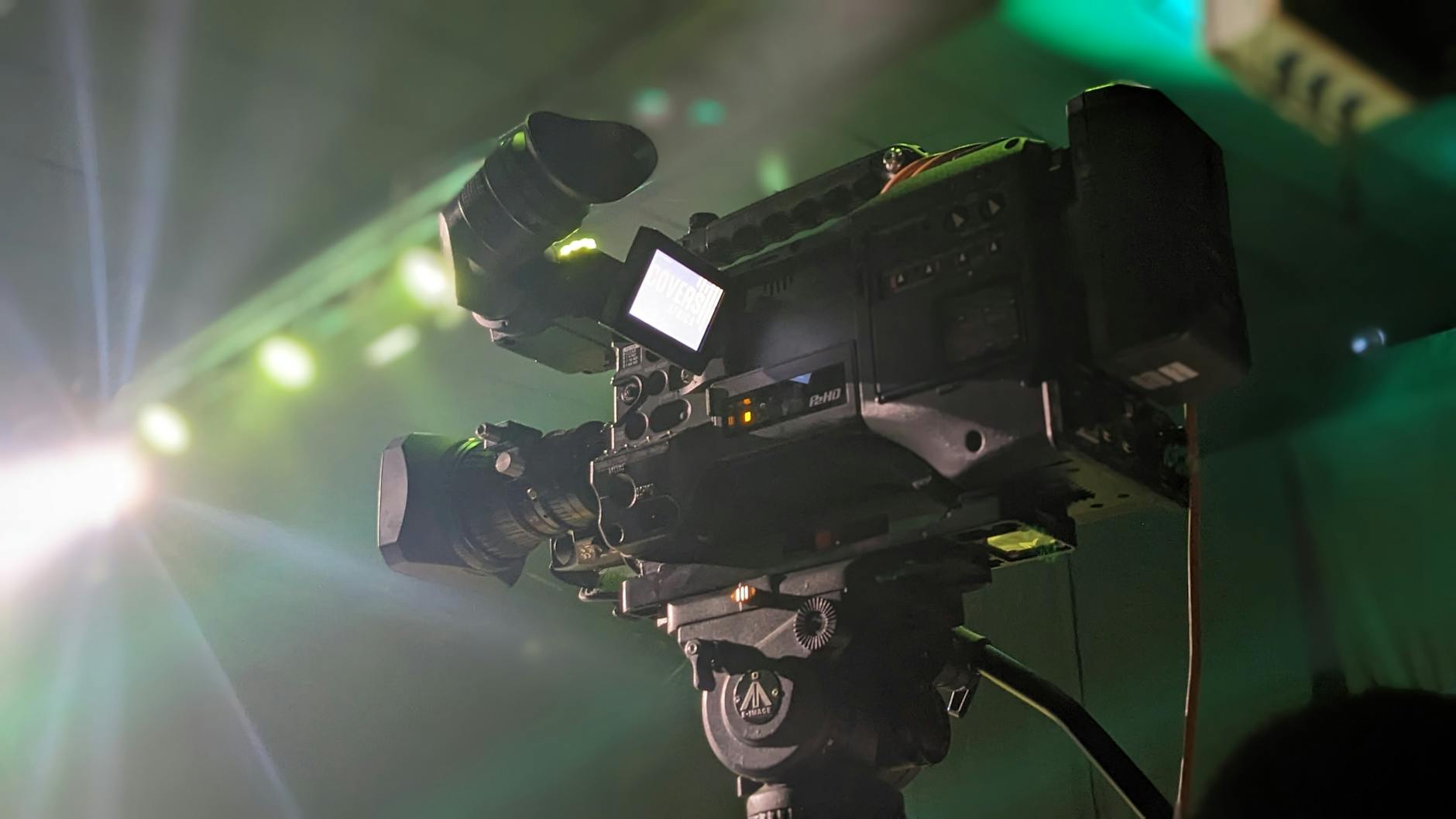
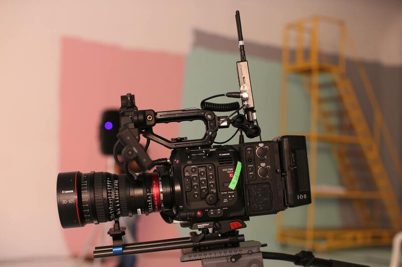
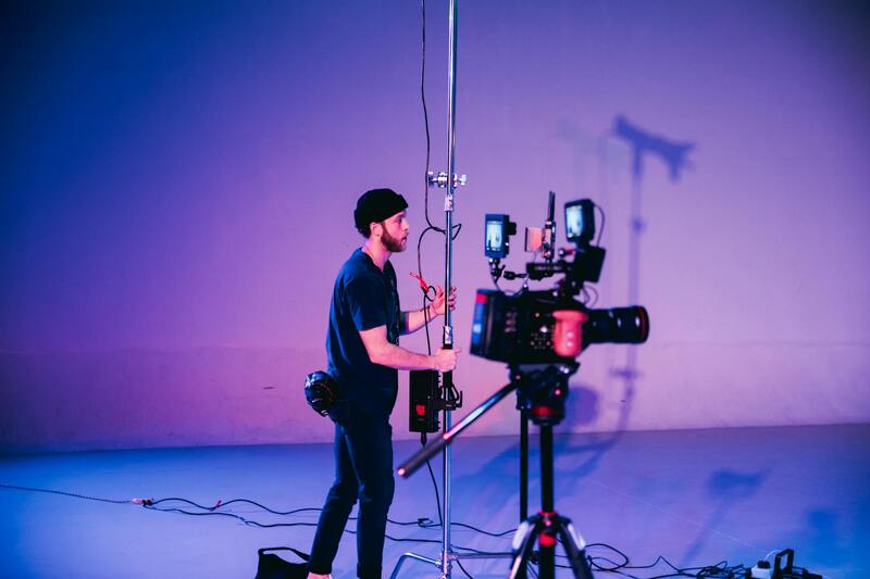
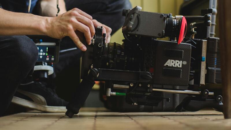
Key Equipment and Technology for Aerial Real Estate Shots
Achieving professional-grade aerial real estate footage in Miami necessitates utilizing advanced equipment that ensures clarity, stability, and safety. The foundation of high-quality aerial visuals begins with selecting the right drone platform. Modern drones equipped with high-performance flight controllers and GPS-enabled stabilization systems provide smooth, cinematic footage even in challenging wind conditions prevalent in Miami's coastal climate.

Camera systems mounted on these drones should feature high-resolution sensors, ideally 4K or higher, to deliver sharp, detailed images that highlight every architectural detail of Miami properties. Gimbal stabilization systems are critical to eliminate camera shake during flight, ensuring fluid footage that accurately portrays the property’s layout and surroundings.
For real estate projects, where images may be showcased in promotional materials or online listings, investing in drones with interchangeable lenses allows for versatile shots—from wide-angle vistas to close-up details. Additionally, thermal imaging and night-vision capabilities may be employed for certain commercial or luxury property presentations, providing comprehensive visual coverage under various conditions.
Post-production editing software constitutes a vital part of the aerial real estate content creation process. Professional editing tools enable color correction, image stabilization, and seamless stitching of aerial clips, enhancing overall visual quality. HDR (High Dynamic Range) processing ensures that both shadowed and brightly lit areas are displayed vividly, capturing the true essence of Miami's vibrant property market.
Combining cutting-edge drone hardware with sophisticated imaging and editing technologies empower Miami real estate agents and filmmakers to produce compelling visual narratives. This high level of technical integration is critical for showcasing luxury condominiums, beachfront estates, and commercial properties with precision and aesthetic appeal, ultimately enhancing marketing effectiveness and client engagement.
Legal Regulations and Permits for Aerial Filming in Miami
Engaging in aerial real estate photography within Miami mandates adherence to a structured framework of operational guidelines. The city enforces specific procedures designed to ensure that drone flights are conducted responsibly and safely, respecting both the privacy of residents and the integrity of urban airspace. Employing certified drone pilots who possess the requisite training and experience is fundamental. These professionals are well-versed in the city's regulations, enabling them to navigate the complexities of airspace permissions seamlessly.
Before conducting any aerial shoot, securing the necessary permissions is crucial. This involves submitting detailed flight plans outlining the intended flight paths, altitudes, and times, which helps authorities assess potential risks and coordinate airspace usage. Such documentation should account for local restrictions, including no-fly zones around sensitive areas like airports, government buildings, and densely populated neighborhoods. Planning flights during daylight hours with optimal weather conditions not only ensures safety but also maximizes the quality of footage captured.
Miami's urban landscape and proximity to major aviation corridors necessitate meticulous planning. The use of supplemental tools such as NOTAMs (Notices to Airmen) and real-time airspace monitoring platforms can aid drone operators in maintaining compliance. These tools provide updated information about temporary flight restrictions or special events that might influence flight availability. By integrating these resources, operators can preemptively avoid unauthorized airspace intrusions, ensuring a smooth operational process.
In addition to local regulations, drone operators should familiarize themselves with federal guidelines issued by the Federal Aviation Administration (FAA). These rules govern operational safety standards, pilot certification requirements, and altitude limitations. Maintaining detailed flight logs and following best practices in data security further enhance the professionalism and accountability of the project. Regular training sessions and updates on regulatory changes are recommended for all personnel involved in aerial real estate photography, ensuring continuous adherence to evolving standards.
Compliance not only safeguards legal interests but also upholds the reputation of real estate agencies and professional photographers. When operations are executed within the legal framework, clients are assured of high-quality, reliable visuals, fostering trust and strengthening market positioning. As Miami continues to grow as a vibrant real estate hub, adhering to these aerial operation standards becomes integral to producing impactful, compliant property showcase content.
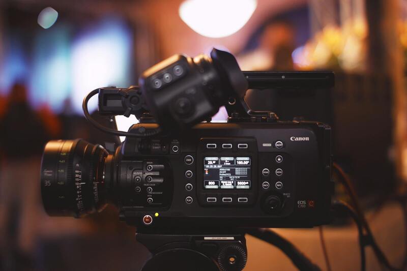
Key Equipment and Technology for Aerial Real Estate Shots
Achieving high-quality aerial images and videos of Miami real estate requires more than just flying a drone. The selection of advanced equipment and cutting-edge technology is fundamental to capturing stunning visuals that highlight the property's best features. Modern aerial real estate photography leverages a combination of sophisticated drones, high-resolution cameras, stabilization systems, and software tools to deliver professional results.
Drone Platforms and Flight Capabilities
The core of aerial real estate photography is a reliable drone platform capable of stable flight and precise maneuvering. Multi-rotor drones equipped with GPS and obstacle avoidance systems enable smooth, controlled flight paths, even in complex urban environments like Miami. These drones typically offer extended flight durations, often exceeding 30 minutes, allowing photographers to capture comprehensive footage from multiple angles without interruption.
Camera Technologies and Image Quality
Leading aerial photographers utilize drones fitted with high-resolution cameras, often 4K or higher, to ensure sharp, detailed visuals. Some setups incorporate interchangeable lenses for different focal lengths, giving flexibility in framing shots. Beyond resolution, features such as HDR (High Dynamic Range), panoramic stitching, and gimbal stabilization help mitigate vibration and movement, resulting in crystal-clear images that showcase the property's architecture and surroundings.
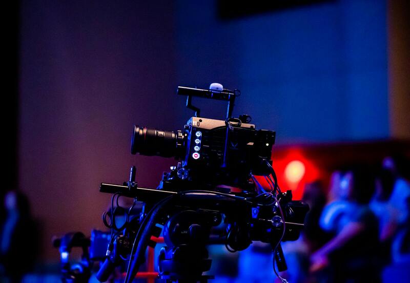
Stabilization and Gimbal Systems
Gimbal stabilization is essential in providing steady footage, especially when capturing video content of Miami's vibrant neighborhoods and waterfronts. Advanced gimbals counteract drone movements, producing smooth, cinematic sequences that elevate the visual appeal of property listings. Stabilized footage is particularly compelling on digital platforms and enhances the overall professionalism of marketing materials.
Software and Post-Processing Tools
Beyond the hardware, software plays a vital role in delivering polished final products. Real estate photographers rely on editing platforms to enhance colors, correct luminance, and optimize contrast, making properties appear more inviting. Additionally, software solutions facilitate aerial image stitching and 3D mapping, enabling the creation of comprehensive virtual tours or detailed site plans that attract prospective buyers.
Safety and Data Security Features
Incorporating safety protocols and data protection measures into the drone setup ensures a seamless and secure operation. Flight planning tools with real-time airspace information guide pilots around restricted zones. Secure data handling practices protect visual content from unauthorized access, supporting a trustworthy relationship with clients and reinforcing professional standards in Miami’s competitive real estate market.
Utilizing Advanced Imaging and Software for Enhanced Aerial Visuals
To achieve the highest quality aerial imagery, professionals employ sophisticated imaging techniques combined with cutting-edge software tools. High-dynamic-range (HDR) imaging captures a broader spectrum of light, ensuring bright areas are not overexposed while retaining details in shadows. This technique is especially valuable in Miami’s sunny climate, where intense sunlight can obscure architectural features and landscape intricacies.
Post-processing software plays a crucial role in refining aerial footage. Color correction and luminance adjustments help highlight a property's true visual appeal, making structures stand out against vibrant Miami backdrops like beaches, cityscapes, and lush gardens. For marketers seeking to produce immersive virtual tours or detailed site plans, 3D modeling and aerial stitching software compile multiple images into seamless panoramas or interactive models. These digital enhancements allow potential buyers to explore properties remotely with a sense of realism and depth, fostering greater engagement.

Safety Protocols and Secure Data Management
Maintaining safety during drone operations is paramount, especially when operating in densely populated or restricted airspace areas within Miami. Professionals implement rigorous pre-flight planning, including detailed site assessments and real-time airspace monitoring, to prevent accidents and ensure smooth operation. These measures help protect both people and property, minimizing disruptions or inadvertent breaches of airborne corridors.
Security also encompasses data handling practices. High-resolution aerial footage and images contain valuable insights that require proper storage and transfer protocols. Secure cloud-based platforms or encrypted drives are often used to retain digital content, safeguarding client assets and building trust. Clear data management strategies ensure that proprietary visuals are accessible only to authorized personnel, reinforcing the integrity of the marketing process and client relationships.
Maximizing the Impact of Aerial Real Estate Content in Miami
For real estate professionals aiming to elevate their marketing strategies, understanding how to properly incorporate aerial visuals is crucial. One effective approach is to combine high-quality drone footage with traditional marketing materials, creating a cohesive presentation that highlights property features and the surrounding environment. Using aerial shots in virtual tours, online listings, and social media campaigns can significantly enhance viewer engagement and drive interest in Miami’s competitive property market.
Enhancing Online Listings with Aerial Perspectives
Property listings that include compelling aerial images or videos often stand out amidst a sea of standard photographs. These visuals provide unique vantage points, showcasing the property's scale, landscape, and proximity to key amenities. Potential buyers appreciate gaining a comprehensive view of the property's placement within Miami's vibrant neighborhoods, including nearby parks, waterfronts, and cityscape features. Incorporating aerial footage into online listings increases transparency and fosters trust, enabling prospective buyers to make more informed decisions.
Creating Immersive Virtual Tours with Aerial Views
Many real estate agents are turning to virtual tours that incorporate aerial footage to offer prospective buyers an immersive experience. Integrating dynamic drone shots with interior walkthroughs gives a well-rounded perspective of the property and its environment. This method allows viewers to visualize how the home interacts with its surroundings and assess overall appeal remotely. High-quality aerial visuals can be synchronized with interactive elements, such as clickable points of interest, to further engage viewers and encourage in-depth exploration.
Strategic Deployment on Social Media Platforms
Social media provides an excellent avenue for showcasing aerial real estate content to a broad audience. Short clips, reels, and teaser videos featuring sweeping drone shots can capture attention quickly and generate buzz around Miami properties. Consistent branding and high-resolution visuals aligned with targeted advertising campaigns can optimize reach and attract qualified buyers. Platforms like Instagram, Facebook, and Twitter serve as powerful tools for distributing aerial content and establishing a digital presence within competitive markets.
Leveraging Aerial Content in Printed Marketing Materials
While digital platforms dominate real estate marketing, printed materials such as brochures, postcards, and magazine ads benefit from high-quality aerial images. These visuals convey the property's scale and landscape features with clarity, leaving a lasting impression on potential clients. Integrating aerial shots into printed collateral offers a tangible connection to the property, complementing digital efforts and expanding outreach efforts. Ensuring the images are professionally captured and processed enhances the perceived value of both the property and the branding effort.
Building Credibility and Authority with Professional Aerial Footage
High-caliber aerial visuals highlight a seller's commitment to quality and transparency. Real estate agents who invest in professional aerial photography set themselves apart by demonstrating expertise and attention to detail. It also reassures clients about the reliability of the marketing strategy, fostering stronger trust and increasing the likelihood of successful transactions. Consistent use of elegant drone footage can be incorporated into branding efforts, reinforcing a reputation of excellence within Miami’s real estate sector.