Overview of Aerial Photography in Real Estate
Aerial photography has revolutionized the way properties are showcased in the real estate market. By capturing expansive views from above, it allows potential buyers to gain a comprehensive perspective of a property's layout, surrounding environment, and unique features that ground-level images might not effectively convey. This imaging technique offers a competitive edge, enabling real estate professionals and homeowners to highlight property assets such as large acreages, scenic landscapes, or proximity to key amenities in a compelling visual format.
As digital real estate marketing continues to evolve, high-quality aerial visuals have become almost indispensable in property listings. They not only attract more attention but also encourage higher engagement rates, increasing the likelihood of sales and quicker transactions. Today's aerial photography frequently involves advanced drone technology and professional-grade aircraft, which help produce striking images with remarkable clarity and detail.
The significant role of aerial imagery in real estate marketing lies in its ability to provide buyers with a clearer understanding of a property's scale, the surrounding neighborhood, and accessibility factors. For properties located in scenic or expansive areas, aerial views can reveal features like sprawling gardens, waterfront access, or downtown vistas, which are often challenging to showcase through traditional photography methods.
Overall, integrating aerial images into real estate listings enhances credibility and professional presentation, making listings more persuasive and trustworthy. As technology advances, pricing structures for aerial photography services have also shifted, offering a range of options tailored to different property types, locations, and marketing goals. This evolving landscape emphasizes the importance of understanding the various factors that influence the cost of aerial photography services.
Factors Influencing Aerial Photography Costs
Understanding the expenses associated with aerial photography for real estate is essential for accurate budgeting and maximizing marketing efforts. Several key factors directly impact the overall cost, including the quality of drone equipment, the complexity of the images required, the size and accessibility of the property, and the scope of the project.
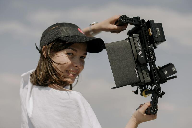
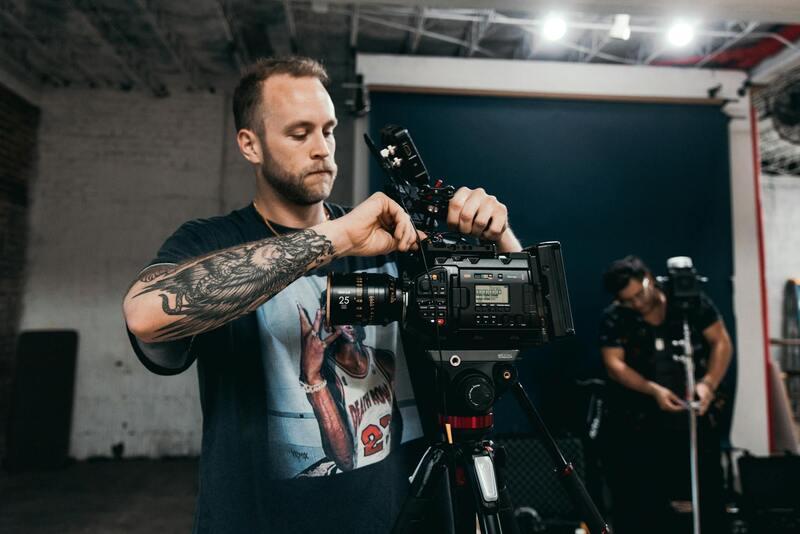
Quality of Drone Equipment
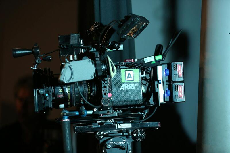
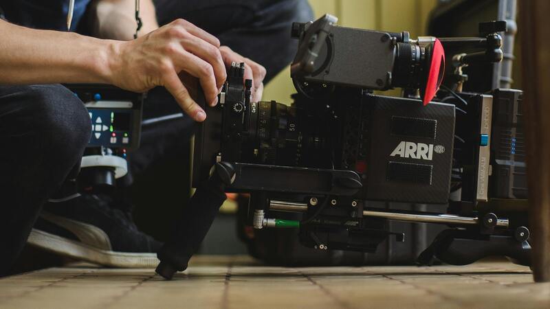
The technology used in capturing aerial images varies considerably. High-end drones equipped with 4K or 8K cameras, advanced stabilization technology, and obstacle avoidance features tend to command higher rates. These sophisticated tools enable clear, detailed, and professional-grade images that can significantly enhance property listings. Conversely, entry-level drones may reduce costs but might not provide the same visual impact or image quality.
Image Complexity and Shot Requirements
The intricacy of the desired shots impacts the fee structure. Simple overhead views of a property may cost less, while requiring multiple angles, cinematic shots, or the recording of additional elements like water features or surrounding landscapes can increase expenses. Custom shots, such as twilight photography or panoramic videos, typically involve extra planning, equipment, and time, leading to higher pricing.
Size and Accessibility of the Property
Larger properties often necessitate more extensive flight plans, additional equipment, and longer shoot durations, thereby raising the cost. Furthermore, properties located in difficult-to-access areas or with restricted airspace may require special permissions or more advanced drone operation skills, which can add to the overall expense.
Project Scope and Usage Rights
The scope of the project influences costs, especially when multiple deliverables are involved, such as high-resolution images, videos, or 3D mapping. Licensing and usage rights, including how many platforms or promotional materials will incorporate the images, also affect pricing structures. More extensive licensing terms typically entail additional costs to accommodate different marketing channels and durations.
Average Price Range for Aerial Real Estate Photography
The cost for aerial photography services in the real estate sector generally ranges from $200 to $1,000 or more per project. Budget-friendly options tend to include basic overhead shots suitable for smaller properties, while luxury or large-scale properties may require extensive shoots involving multiple images and videos, thereby pushing towards the higher end of the spectrum.
Additional Charges and Customization Fees
Additional services such as twilight shots, aerial videos, or dedicated editing may involve extra fees. Charging policies may also account for requests like expedited delivery, customized framing, or specific editing styles, which contractors often price separately to accommodate tailored marketing needs.
Impact of Location and Property Size on Costs
Pricing often varies based on geographical factors. In busy urban areas like Miami, where airspace restrictions and busy flight zones are common, services might involve permits or special permissions, increasing costs. Larger properties demand more extensive flight plans and post-processing work, which can further elevate the overall expense.
Choosing a Production Agency in Miami
Selecting an experienced and reputable aerial photography provider in Miami involves weighing service quality, portfolio quality, and price. Local agencies familiar with the specific regulations, weather patterns, and unique property characteristics can deliver superior results. Comparing quotes, reviewing portfolios, and understanding included services are crucial steps to ensure value for money.
Budgeting for Aerial Photography in Real Estate Marketing
Setting a realistic budget involves analyzing the property type, marketing objectives, and desired image quality. Incorporating aerial shots as a core part of the listing strategy often warrants allocating a dedicated budget to ensure high-quality, impactful visuals that resonate with target buyers and stand out in a competitive market.
Cost-Saving Tips and Best Practices
- Plan your shoots during optimal weather conditions to avoid rescheduling costs.
- Limit the number of shots to focus on the most impactful visuals, reducing editing and capture time.
- Leverage package deals offered by local providers that bundle multiple services for a fixed price.
- Coordinate with the agency to streamline the shot list and avoid duplicated efforts.
- Invest in clear communication to specify exactly what images are needed, saving time and money.
Average Price Range for Aerial Real Estate Photography
In Miami, the cost for aerial photography services tailored for real estate listings typically varies depending on multiple factors, including the property's size, location, and the complexity of the shoot. Standard packages generally start around $200 to $400 for single images or basic coverage of smaller properties. These packages often include a set number of high-resolution aerial shots captured during a single session, along with basic post-processing to enhance visual clarity and color accuracy.
For more comprehensive marketing campaigns, clients might opt for premium packages that provide extensive aerial coverage, multiple angles, videos, and virtual tours. Such packages can range from $500 to $1,000 or more, reflecting the added scope and production value. These comprehensive options are particularly beneficial for luxury listings or large-scale properties, where the aesthetic quality of visuals can significantly impact potential buyer engagement.
It's important to recognize that these estimates serve as general benchmarks. Actual costs may vary depending on the specific workload, accessibility of the property, and the level of customization required. For instance, properties located in hard-to-reach areas or with unique architectural features may incur additional charges due to specialized equipment needs, extended flight times, or additional post-production work.
Engaging with a professional aerial photographer in Miami capable of delivering high-quality visuals is essential for ensuring the investment translates into effective marketing tools. High-resolution images, color accuracy, and compelling compositions are critical in capturing the attention of prospective buyers and standing out within a competitive real estate market.
Additionally, clients should consider the potential for value-added services such as drone videography, 4K footage, and interactive virtual tours, which can further elevate the property's presentation. While these enhancements may increase upfront costs, they typically result in more engaging listings that attract higher levels of interest and faster sales.
Prospective clients are encouraged to request detailed quotes from multiple local service providers in Miami and review their portfolios thoroughly. Comparing offered packages, understanding what is included in each, and assessing previous work quality are essential steps toward selecting an aerial photography provider that aligns with their marketing goals and budget constraints.
Ultimately, balancing investment with expected marketing outcomes is key. Well-executed aerial visuals not only enhance the presentation of a property but also serve as a strategic tool in attracting discerning buyers, especially in a vibrant real estate market like Miami's.
Additional Charges and Customization Fees
When planning an aerial photography project for real estate, clients should be aware of potential additional charges beyond the base price. These costs are often associated with specific project requirements that enhance the final visual assets. For instance, high-resolution images demand more advanced equipment and longer processing times, leading to increased fees. Post-production editing is another factor that can influence the overall cost; complex editing, color grading, and retouching to ensure the visuals meet high standards can incur extra charges.
Extended shooting times are common in situations where multiple angles or comprehensive coverage of a property are needed. Additional flight hours not only increase operational costs but may also require specialized permits, especially if the property is in a densely populated or restricted airspace. Clients opting for drone videography or 4K footage should anticipate higher rates, reflecting the superior quality and equipment involved.
Moreover, companies offering dedicated interactive virtual tours or 3D mapping services often include these features as part of premium packages. While they come at an increased expense, such enhancements significantly boost property visibility and engagement online. Clients should request detailed quotes that clearly itemize these extra services to understand the full scope of the investment.
Impact of Location and Property Size on Costs
The geographical placement and physical dimensions of the property being photographed are essential factors influencing overall costs. Properties situated in remote or hard-to-access areas may require additional logistical planning, specialized equipment, or longer setup times, all of which can increase fees. Similarly, larger properties with extensive grounds demand more comprehensive coverage, which translates into additional flight time and editing efforts.
In urban settings or densely populated neighborhoods, drone operators may need to navigate tighter airspaces and adhere to specific altitude restrictions, possibly influencing the complexity of the shoot. Conversely, expansive estates benefit from broader aerial perspectives but require more extensive flight plans, increasing the project's scope and expenses.
Understanding these variables allows clients to better anticipate potential cost fluctuations and tailor their budgets accordingly. Discussing property specifics upfront with local aerial photography providers can help in developing a more accurate estimate that aligns with marketing objectives and budget constraints.
Impact of Location and Property Size on Costs
When commissioning aerial photography for real estate, several logistical factors directly influence the total cost. The location of the property is a primary determinant; properties in urban centers or densely populated areas often require more careful planning due to airspace restrictions and the potential need for special permissions or coordination with local authorities. These measures can add to the overall expense, as they might involve additional permits or longer pre-shoot preparations.
Remote or hard-to-reach locations necessitate extra logistical arrangements. These can include specialized transportation for equipment and personnel, extended flight planning to avoid obstacles, and potentially longer setup times. Such complexities inevitably elevate costs, especially if the shoot involves rugged terrain or environmentally sensitive zones that demand extra caution or equipment modifications.
Property size also plays a crucial role. Larger estates or properties with extensive grounds require more extensive coverage. This translates into longer flight times and increased editing efforts to produce comprehensive visuals that showcase the property's full scope. Larger projects also often need multiple drone setups or additional crew members to capture all desired angles and aspects efficiently.
Moreover, properties featuring unique or architecturally significant structures may warrant additional specialized shots, which can influence both time and resource allocation. Every layer of complexity, from property size to geographic location, contributes to shaping a precise budget that aligns with both marketing goals and logistical realities.
Impact of Location and Property Size on Costs
The geographic positioning of a property plays a significant role in determining aerial photography expenses. Properties situated in densely populated urban areas often require additional planning and coordination to navigate local airspace regulations, secure necessary permissions, and manage air traffic safely. These external factors can lead to increased planning time and associated costs. Conversely, properties located in remote or less accessible regions might incur higher logistical expenses due to the need for specialized transportation and longer setup periods.
Property size is another crucial consideration affecting costs. Larger estates or those with extensive grounds demand more comprehensive coverage, often necessitating multiple drone flights or extended flight durations. This expanded scope involves additional equipment, increased flight time, and more detailed post-shoot editing. When a property encompasses multiple structures or features, such as lakes, gardens, or outbuildings, capturing all these elements effectively requires meticulous planning and coordination, further influencing the overall budget.
Structures with distinctive architectural features or historically significant designs may require specialized filming techniques to highlight their unique characteristics. Such projects often demand additional time and precision, impacting the total cost. Essentially, both geographic and structural complexities contribute to a tailored approach in aerial photography, ensuring that the visual content aligns with the property's value and marketing objectives.
Organizations providing aerial real estate imagery must consider these factors when developing quotes, as each project’s logistical and technical requirements may vary substantially. This comprehensive understanding ensures that clients receive an accurate estimate that reflects the scope and complexity of the shoot, ultimately supporting effective property marketing initiatives.
Impact of Location and Property Size on Costs
Location plays a significant role in determining the cost of aerial photography for real estate. Urban environments with complex airspace regulations or busy air traffic often necessitate additional permits, flight planning, and coordination with local authorities. These factors can extend project timelines and incur extra fees, balancing the need for legal compliance with budget considerations. Conversely, rural or less congested areas typically allow for more straightforward flight operations, which may reduce costs.
Property size is another essential determinant of pricing. Larger estate parcels require more extensive flight coverage, especially if the goal is to showcase the full scope of the property and its surroundings. Extensive properties often demand multiple flight paths, higher drone flight durations, and detailed coverage of ancillary features like gardens, water bodies, and outbuildings. The additional time and effort directly influence the overall expense, with larger assets requiring meticulous planning to ensure comprehensive and high-quality footage.
Furthermore, properties located in areas with unpredictable weather conditions or challenging terrain can also impact costs. Inclement weather may delay shoots, necessitate rescheduling or additional trips, while difficult terrain requires specialized equipment or techniques. Planning for these variables ensures the delivery of professional results without unexpected expenses.
Choosing a Production Agency in Miami
In Miami, selecting an aerial photography provider involves evaluating expertise, equipment quality, and adherence to safety standards. Experienced agencies often have established relationships with local authorities, allowing smoother permit acquisition and flight operations. They employ advanced drone technology capable of capturing high-resolution images and videos, which enhances marketing content and justifies investment.
It is vital to consider the agency’s portfolio and client reviews to gauge reliability and quality. A proficient provider will tailor their services to align with the property's unique characteristics, ensuring the imagery highlights its best features. Additionally, providers offering flexible packages or customizable options can better meet budget and project-specific needs.
Factors That Affect the Cost of Aerial Photography in Real Estate
When evaluating the expenses associated with aerial photography for real estate, numerous factors come into play that influence overall costs. Understanding these elements helps property owners and real estate professionals plan effectively and make informed decisions that balance quality with budget considerations.
Type of Equipment Used
The sophistication and quality of the equipment deployed by aerial photography providers significantly impact costs. High-end drones equipped with 4K or higher resolution cameras, gimbal stabilization systems, and advanced flight controls offer superior image quality and cinematic footage. These technologies often come at a premium, but they ensure that marketing materials stand out with crisp, professional visuals that attract potential buyers.
Level of Service and Final Deliverables
Services range from basic still images to comprehensive packages that include videos, 360-degree panoramas, and virtual tours. The extent of post-processing, editing, and special effects directly alters the cost structure. Tailored services designed to create immersive and engaging content generally require more time and expertise, thus increasing the overall expense.
Permits and Regulatory Compliance
Adhering to local aviation regulations necessitates obtaining permits and sometimes performing additional administrative steps. Providers who handle these processes on behalf of clients include permit fees in their quotes, which can raise costs but streamline the entire project. The complexity of compliance increases for areas with dense urban environments or restricted airspaces, adding to expenses.
Experience and Reputation of the Service Provider
Established agencies with a track record of delivering consistent, high-quality results often command higher rates. Their expertise ensures efficient flying sessions, optimal framing, and technical support, reducing the need for re-shoots and saving money in the long run. Conversely, newer or less experienced providers may offer more competitive rates but could require additional sessions to achieve desired results.
Season and Weather Conditions
Timing also influences costs. Scheduling during optimal weather conditions minimizes delays and reshoots, thus controlling expenses. In contrast, adverse weather or unpredictable seasonal changes may necessitate multiple visits, prolonging the project timeline and increasing costs.
Summary of Cost Components
- Equipment quality and technology
- Service complexity and deliverables
- Permits and regulatory fees
- Provider experience and reputation
- Weather and seasonal scheduling
Summary
Having a clear understanding of these key factors allows real estate professionals and property owners in Miami to allocate budgets more accurately. Carefully selecting a provider that matches one’s project scope and budget constraints ensures that the aerial imagery contributes effectively to marketing efforts and property visibility.