Overview of Aerial House Photography
Aerial house photography has become an essential component of modern real estate marketing, offering a unique perspective that traditional ground-level images cannot provide. By capturing properties from the sky, real estate professionals and homeowners can showcase the entirety of the property, including expansive yards, landscaped gardens, and nearby amenities. This comprehensive visual presentation helps potential buyers gain a clear understanding of a property's scale and surroundings, which can significantly influence their purchasing decisions.
Utilizing advanced imaging techniques, aerial photography emphasizes key features such as architectural design, outdoor living spaces, and scenic environments. Moreover, it enhances the aesthetic appeal of property listings, making them stand out in competitive markets like Miami. The vibrant urban landscape combined with tropical scenery creates a compelling backdrop for aerial shots, drawing prospective buyers and investors.
Whether for luxury estates, commercial properties, or residential homes, aerial photography provides a strategic advantage by adding depth and context to property marketing efforts. High-quality aerial images can also be integrated into virtual tours and promotional videos, expanding reach across digital platforms.
Types of Aerial Photography Equipment
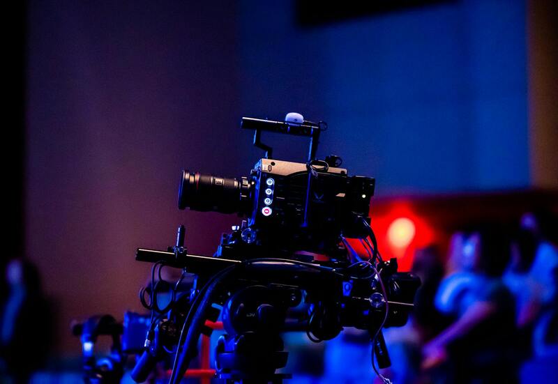
When considering aerial house photography, selecting the appropriate equipment is essential to capturing high-quality images that showcase a property's unique features. The primary tools used include drones, helicopters, and unmanned aerial vehicles (UAVs), each offering specific advantages suited to different property types and shooting conditions.
Consumer-grade drones have become increasingly popular for residential property photography. They offer versatility, cost-effectiveness, and the ability to access tight spaces or difficult angles with ease. High-end drones equipped with stabilization technology and high-resolution cameras can produce sharp, detailed images suitable for marketing materials. Additionally, drones with advanced gimbal systems ensure smooth footage and stable shots, even in windy conditions typical of coastal Miami areas.
For larger estates or properties requiring extensive coverage, professional drone operators may utilize specialized UAVs or coaxial drones capable of longer flight times and higher payload capacities. These devices often feature integrated GPS systems for precise navigation and automated flight paths, ensuring comprehensive coverage of large lands or sprawling outdoor spaces.
Helicopters and fixed-wing aircraft are traditional alternatives for aerial photography, especially for expansive landscapes or commercial properties. Although they tend to be more costly and require licensed pilots, these options can cover large areas efficiently, offering expansive views that are difficult to replicate with smaller devices.
Ultimately, the choice of equipment hinges on the specific requirements of each property, including size, location, and desired visual style. Modern drone technology has democratized aerial imagery, allowing real estate professionals and property owners to achieve stunning visuals without the need for extensive investment in aircraft or specialized crew.
Legal and Privacy Considerations in Miami
Capturing aerial house photography in Miami involves navigating a framework of regulations designed to balance aerial imaging opportunities with individual privacy rights and local safety standards. Aerial photographers working in this vibrant city are advised to familiarize themselves with specific protocols and procedural guidelines that govern drone operations, especially in densely populated neighborhoods or areas with high-rise buildings.
Permitting processes are an integral part of executing aerial photography projects legally. Photographers must often obtain specific authorizations from relevant municipal agencies before commencing shoots, particularly when flying over private property or near public spaces. These permits help ensure that flights are conducted within designated flight zones and during approved timeframes, minimizing disruptions to residents and other airspace users.
Respect for private property boundaries and privacy expectations is paramount. Aerial photographers should avoid capturing images of private homes or neighboring properties without proper consent, especially when such images could reveal sensitive details or violate homeowner privacy. Maintaining awareness of restricted airspace zones, such as near airports or military areas, is critical for operational safety and compliance.
To ensure adherence to these considerations, professionals often collaborate with licensed pilots who are experienced in navigating Miami’s airspace and acquainted with local regulations. Employing certified operators reduces the risk of inadvertent violations and helps produce high-quality images that meet both artistic and legal standards.
Developing a comprehensive understanding of Miami’s specific aerial imaging guidelines not only facilitates smooth project execution but also fosters positive relationships within the community. By prioritizing safety, legality, and privacy, aerial house photography can effectively showcase Miami's stunning real estate landscapes while respecting the rights and well-being of residents and visitors alike.
Choosing the Right Equipment for Aerial House Photography
Securing high-quality aerial images of residential properties in Miami requires deploying appropriate and reliable equipment. The most commonly used hardware includes unmanned aerial vehicles (UAVs) equipped with high-resolution cameras that can capture detailed images from various altitudes and angles. Professional-grade drones are capable of stabilizing shots for sharp, clear visuals, even in challenging weather conditions prevalent in Miami's climate.
Camera specifications play a crucial role in the outcome of aerial shots. Cameras with larger sensors and higher megapixel counts enable photographers to capture more detailed and vibrant images, which are essential for property marketing materials. Additionally, adjustable lenses, such as wide-angle or fisheye lenses, allow for expansive views of the property's surroundings, highlighting landscaping, architectural features, and nearby amenities.
Gimbals or stabilization mounts are essential accessories that ensure smooth footage by compensating for drone movement during flight. For static images, multi-directional gimbals facilitate versatile framing, allowing photographers to capture the property from various perspectives seamlessly.
Another critical aspect involves the selection of flying platforms capable of autonomous navigation or manual control, depending on the complexity of the shooting plan. Advanced GPS-enabled drones facilitate precise positioning, enabling repeatable shots from the same vantage points, vital for comparative property assessments or listing updates.
Utilizing Official Drone Airspace Management and Certification Programs
To ensure the highest standards and seamless integration into Miami's dynamic airspace, professionals involved in aerial house photography rely on official drone airspace management programs and certification initiatives. These programs establish a structured framework for drone operation, providing clear guidelines for airspace usage, altitude restrictions, and operational safety. Certified pilots participate in comprehensive training and obtain recognized credentials, which validate their expertise and adherence to best practices.
Participation in authorized training courses and certification programs equips photographers with detailed knowledge of Miami's specific airspace regulations, including designated no-fly zones, temporary flight restrictions, and altitudinal limits around sensitive areas such as airports and government facilities. This proficiency reduces the risk of unauthorized operations and helps maintain smooth flight paths, minimizing disruptions to other airspace users.
Moreover, drone operators often utilize official registration platforms mandated for UAV operations, ensuring that their flights are tracked and managed through verified channels. Such registration processes involve providing operator credentials, drone identification details, and flight plans, which are submitted via authorized portals or apps. This system fosters transparency, accountability, and compliance with established protocols, fostering trust among clients and regulatory entities alike.
Adopting these verified methods not only aligns with official standards but also enhances the operational precision of aerial house photography projects. As Miami continues to grow as a vibrant real estate market, maintaining strict adherence to authorized procedures ensures high-quality imagery while safeguarding safety and operational integrity.
Engaging with Certified Drone Service Providers
Partnering with certified drone service providers guarantees that aerial house photography projects are executed by experienced operators who possess the necessary official credentials and adhere to prescribed practices. These providers often maintain strong relationships with local authorities and airspace regulators, facilitating smooth permission processes for each project.
Certified providers utilize documented flight plans and pre-approved flight paths, minimizing unexpected disruptions and ensuring comprehensive coverage of the property. Their familiarity with Miami's unique landscape and airspace regulations allows for optimized scheduling, especially when capturing properties in restricted zones or high-demand areas.
Additionally, working with licensed operators reduces liability concerns and enhances the reliability of the service, paving the way for long-term collaborations in the real estate sector. Clients can then focus on the strategic aspects of property marketing, confident in the professionalism and compliance of their aerial photography providers.
Post-Processing and Image Optimization
Following the capture of high-quality aerial footage, the importance of meticulous post-processing cannot be overstated. This phase involves refining raw images to enhance clarity, color accuracy, and overall visual appeal, which are pivotal for effective property marketing in Miami’s competitive real estate landscape. Skilled editors utilize advanced software tools to adjust brightness, contrast, saturation, and sharpness, ensuring each image accurately represents the property's features and surroundings.
In the realm of aerial house photography, attention to detail during editing translates directly into impactful visual storytelling. For instance, removing minor aerial artifacts or distracting elements in the background ensures the focus remains on the property’s architectural design and landscaping. Color correction plays a significant role in showcasing the property under optimal lighting conditions, making images more enticing and engaging for prospective buyers or tenants.
Beyond basic adjustments, high dynamic range (HDR) processing can be employed to balance different exposure levels, especially when capturing properties during dawn, dusk, or in varying weather conditions. This technique produces images that exhibit rich detail in both shadowed and brightly lit areas, providing a comprehensive view of the property's exterior. Additionally, panoramic stitching can combine multiple shots into a single expansive image, capturing the full grandeur of large properties or sprawling estates.
Optimizing images extends to file format selection and compression techniques. Using high-quality formats like RAW during editing preserves maximum detail, while converting to WebP or optimized JPEGs ensures faster loading times on online platforms without sacrificing image quality. This balance enhances user experience and increases engagement levels in digital marketing efforts.
In addition to visual enhancements, incorporating geotagging and metadata into aerial images supports their strategic deployment across various marketing channels. Accurate metadata allows for precise location targeting in online listings, maps, and virtual tours, thereby elevating the property's visibility within Miami's vibrant real estate marketplace.
Finally, certified aerial photographers often provide comprehensive image packages tailored for different marketing mediums — from high-resolution print materials to dynamic digital presentations. This curated approach guarantees visual consistency across channels, reinforcing branding efforts and attracting discerning clientele seeking premium properties in Miami's diverse neighborhoods.
Applications of Aerial House Photography in Miami Real Estate
In the competitive landscape of Miami’s real estate market, aerial house photography has become an industry-standard for showcasing properties at their best. The sweeping views captured from above enable potential buyers to appreciate the full scale and unique features of a residence, from intricate landscaping to surrounding amenities. High-definition aerial imagery highlights property contours, architectural details, and exterior design elements that traditional ground-level photos may overlook, creating a compelling visual narrative that attracts more interest and engagement.
Real estate professionals utilize aerial imagery to craft immersive virtual tours and interactive listings, elevating the property’s appeal amidst a sea of options. This approach is particularly effective for large estates, waterfront properties, and properties with distinctive outdoor features such as pools, gardens, or custom landscaping. By integrating aerial views into marketing campaigns, agents can convey the property's context within its neighborhood, showcasing proximity to key locations like beaches, parks, and commercial centers.
Beyond initial sales efforts, aerial photographs serve as valuable documentation for property development, renovation assessments, and insurance. For example, detailed shots of a property's exterior can assist in planning landscape enhancements or verifying construction progress over time. Moreover, aerial images are instrumental in creating detailed site analyses for investors and developers assessing land value, zoning compatibility, and environmental features.
Enhancing Marketing Strategies with Aerial Photography
Incorporating aerial house images into digital marketing channels significantly boosts online visibility. High-quality aerial photographs are ideal for virtual tours, listing websites, and social media campaigns, where visual impact directly influences consumer engagement. When paired with compelling property descriptions, these images help create a stronger narrative that resonates with prospective buyers.
Additionally, aerial photography complements other marketing materials such as brochures, signage, and print advertisements. The panoramic perspective lends a sense of grandeur and exclusivity, which is especially valuable for luxury properties seeking to attract high-net-worth individuals.
Environmental and Contextual Benefits
Beyond aesthetic appeal, aerial house photography offers an environmental perspective, allowing viewers to understand the property's relationship with its surroundings. This includes the orientation of the home relative to sunlight, body of water, and neighboring structures, which can influence perceived value and desirability. Such insights are beneficial for both marketing and sustainable planning activities.
In sum, aerial house photography is a vital asset in Miami’s real estate toolkit, providing dynamic visual content that enhances property presentation, strategic marketing, and development planning, ultimately facilitating faster sales and increased market competitiveness.
Advanced Techniques and Future Outlook in Aerial House Photography
As the field of aerial house photography continues to evolve, professionals are increasingly adopting cutting-edge techniques to elevate the quality and impact of their images. One prominent advancement is the integration of high-dynamic-range (HDR) imaging, which captures multiple exposures to produce images with balanced lighting and enhanced detail in both shadows and highlights. This technique ensures that the intricate features of a property and its surroundings are vividly represented, making listings more attractive to prospective buyers.
Furthermore, the use of panoramic and 360-degree imaging has gained popularity, offering viewers immersive experiences that showcase entire property exteriors and landscapes in a single interactive view. This approach enables potential clients to virtually explore the property from various angles, fostering a deeper connection and understanding of the home's layout and its contextual environment.
Technological innovations such as real-time image processing and the utilization of artificial intelligence (AI) are also transforming aerial photography. AI-powered tools can automate aspects of image enhancement and correction, ensuring consistency and professionalism across extensive portfolios. Additionally, drone flight automation allows for precise, repeatable shot sequences, which is especially valuable for presenting multiple properties or updating listings efficiently.
Looking ahead, the integration of advanced geospatial mapping tools will enable professionals to capture hyper-detailed topographical data alongside aerial imagery, broadening the scope of uses for aerial house photography beyond marketing. These developments could facilitate more accurate property assessments, land development planning, and environmental monitoring, which align with Miami’s ongoing urban expansion and sustainable development initiatives.
Emerging drone technologies such as autonomous flight systems and AI-guided navigation are expected to streamline operations further while improving safety and image quality. As these innovations become more accessible, a wider array of real estate professionals and production companies will engage in aerial house photography, shaping Miami’s property presentation landscape in increasingly sophisticated ways.