Introduction to 3D Real Estate Photography
In the highly competitive realm of property marketing, the adoption of advanced visual presentation techniques has become essential for real estate professionals. One such innovation that has significantly transformed how properties are showcased is 3D real estate photography. This technology creates immersive, interactive images that allow prospective buyers or renters to explore a property in a three-dimensional space from the comfort of their own devices.
3D photos for real estate are rapidly gaining prominence due to their ability to provide a comprehensive view of a property’s layout, design, and features without the need for physical visits. This method offers a realistic virtual experience, which can enhance engagement, generate more qualified leads, and facilitate a smoother decision-making process for clients.
As the digital landscape continues to evolve, traditional photography alone no longer suffices in capturing the full appeal and spatial dynamics of a property. Incorporating 3D visualizations into marketing strategies helps real estate agents and developers stand out in crowded markets, particularly in vibrant and competitive regions like Miami. Moreover, these virtual representations facilitate remote viewing, a feature especially valuable in today’s fast-paced, globalized market environment.
Development in 3D imaging technology has been made possible through sophisticated hardware and software solutions. These innovations enable the creation of detailed, accurate, and aesthetically pleasing virtual tours and images that forge a deeper connection between potential clients and property listings. As a result, properties listed with 3D visuals tend to receive increased attention, higher engagement rates, and quicker sales or lease turnovers.

In summary, the rise of 3D real estate photography marks a significant advancement in property marketing. By providing immersive and detailed visual content, it empowers real estate professionals to more effectively showcase their listings, attract a broader audience, and stay ahead in a dynamic marketplace. This innovative approach not only elevates the aesthetic appeal of property presentations but also streamlines the engagement process, paving the way for more successful transactions across the real estate sector.
Different Methods to Create 3D Photos for Real Estate
Creating high-quality 3D photos for real estate involves a variety of official, proven techniques that showcase properties with precision and vivid detail. These methods are designed to produce immersive virtual representations that accurately reflect the physical space, providing prospective buyers and renters with confidence in their property searches. Understanding the core approaches enables real estate professionals to select the most suitable options for their specific needs and market demands.
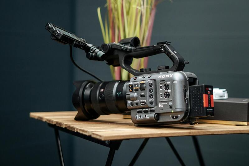
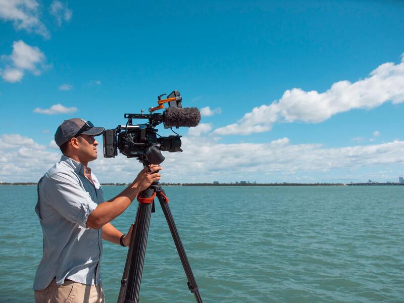
One of the most prevalent approaches is the use of **LiDAR scanning**, a method that employs Light Detection and Ranging technology to produce highly accurate 3D point clouds of interior and exterior spaces. LiDAR-equipped devices, often integrated with high-end cameras or available as standalone scanners, emit laser pulses that bounce off surfaces, capturing detailed spatial data. The resulting point clouds serve as foundational elements for creating precise 3D models and virtual tours, particularly useful for complex layouts or properties requiring detailed architectural visualization.
Another vital technique is **photogrammetry**, which involves capturing multiple overlapping photographs of a property from various angles. Software algorithms process these images to generate highly accurate 3D models, mesh structures, and textures. Photogrammetry is particularly effective for outdoor spaces, landscapes, and large-scale property visuals where detailed surface replication enhances realism.
**360-degree virtual tours** also play a significant role, combining panoramic photography with digital stitching techniques to produce interactive experiences. By capturing 360-degree images inside rooms, agents can create virtual walkthroughs that users navigate through online platforms. These virtual tours often incorporate hotspots or clickable zones, allowing viewers to explore specific areas in detail, simulating an in-person visit.
In addition to these, **computer-generated 3D rendering** involves creating detailed architectural visualizations through sophisticated software. Developers and designers utilize this approach to produce realistic representations of upcoming or renovated properties, providing prospective buyers with a clear understanding of the final look.
These official methods are supported by advanced software platforms like Matterport, iGUIDE, or Zenutra, which streamline the process while maintaining high standards of accuracy and aesthetic appeal. When properly executed, they offer potential clients an immersive, reliable view of a property, facilitating better decision-making and reducing the need for physical visits in early stages.
How to Use Official Methods for Producing 3D Photos in Real Estate
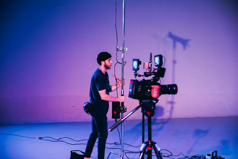
Creating high-quality 3D photos for real estate involves sticking to recognized, professional techniques that ensure accuracy, consistency, and a polished appearance. One of the primary official approaches utilizes specialized hardware and software workflows designed specifically for real estate imaging. This includes high-resolution 3D cameras, laser scanning devices, and photogrammetric software that precisely capture spatial data and surface textures. These tools are calibrated to produce detailed models that accurately reflect the intricacies of a property, both interior and exterior.
For indoor spaces, 3D scanning devices such as structured light or laser scanners generate precise point clouds, which are then processed through dedicated software. These programs align and stitch the data seamlessly, creating a detailed digital twin of the physical environment. The models can be further refined with texture mapping, lighting adjustments, and color correction to enhance realism and visual clarity.
For outdoor scenes and larger-scale properties, photogrammetry remains a dominant official method. Photogrammetric software processes overlapping images captured from drone or camera setups, translating multiple perspectives into cohesive 3D meshes. By utilizing precise algorithms and calibration parameters, this method accurately represents terrain features, landscaping, and building exteriors.
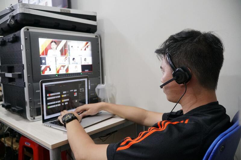
Leading platforms like Matterport, iGUIDE, and Zenutra provide integrated solutions that combine hardware compatibility with cloud-based software. These systems adhere to strict standards for data integrity, spatial accuracy, and visual fidelity, ensuring that real estate professionals can deliver trustworthy visuals to potential buyers and investors.
When deploying these methods, it is essential to follow best practices, including optimal lighting conditions, thorough image capture, and precise camera calibration. This meticulous process guarantees that the resulting 3D images and virtual tours accurately portray the property and serve as reliable tools for marketing and sales.

In addition, many official methods incorporate the use of comprehensive data management practices—such as maintaining accurate georeferencing, metadata documentation, and version controls—which further solidify the reliability of 3D visualizations. Real estate agents and developers rely on these standardized procedures to showcase properties with consistent quality and impressive detail, ultimately supporting better client engagement and informed decision-making.
Types of 3D Photos and Virtual Tours
Within the realm of real estate marketing, several official and standardized methods are employed to produce accurate and immersive 3D visual content. These techniques primarily include photogrammetry, laser scanning, and specialized virtual tour platforms. Each approach offers distinct advantages and is selected based on the specific needs of the property and the marketing strategy.
Photogrammetry involves capturing numerous overlapping photographs of a property from multiple angles. Using sophisticated software, these images are processed to generate highly detailed 3D models that accurately represent the property's exterior and interior spaces. This method is especially effective for creating precise representations of complex architectural features and landscaping elements, ensuring prospective buyers receive a comprehensive visual experience.
Laser scanning, also known as LiDAR in some contexts, utilizes laser beams to measure distances with exceptional accuracy. The resulting point cloud data is then converted into detailed 3D models. This technique is particularly suitable for large or complex properties, such as commercial buildings or expansive estates, where precision is paramount. Moreover, laser scanning can capture difficult-to-photograph areas, such as intricate ceiling details or structural elements.
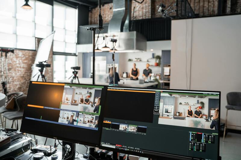
For virtual tours that integrate seamlessly with real estate listings, specialized platforms like Matterport, iGUIDE, and Zenutra provide comprehensive solutions. These platforms combine high-quality hardware—such as 360-degree cameras and laser scanners—with cloud-based software to deliver a smooth, professional experience. They adhere to strict standards for data integrity, spatial accuracy, and visual fidelity, reinforcing the trustworthiness of the virtual models produced.
Many of these systems utilize standardized procedures for data collection, including optimal lighting, thorough site scanning, and accurate calibration. These practices maximize the quality and reliability of the resulting 3D images and virtual tours. Additionally, the use of validated hardware and software ensures that the virtual representations are consistent across different properties and projects, supporting effective real estate marketing efforts.
Incorporating official methods of 3D imaging involves meticulous planning and precise execution. This includes maintaining accurate spatial references, documenting metadata, and applying version controls, which uphold the integrity of the digital models. These standardized processes provide real estate professionals with dependable visual assets, streamline the marketing workflow, and empower buyers with an authentic understanding of the properties they are interested in.
Ensuring Accuracy and Consistency in 3D Photo Production
To achieve high-quality 3D images for real estate, it is essential to employ meticulous techniques that guarantee spatial accuracy and visual fidelity. Proper calibration of equipment, including 360-degree cameras and laser scanners, is fundamental. These devices must be calibrated regularly to maintain precision, which is especially important when capturing complex property layouts or intricate interior features.
Furthermore, standardized data collection protocols should be adhered to, such as consistent lighting conditions, comprehensive site coverage, and stable positioning during scans. Documenting metadata, such as timestamp, device settings, and environmental conditions, helps in maintaining an audit trail and ensuring that the virtual models produced are reliable and reproducible across multiple projects.
Documentation extends beyond raw data collection. Maintaining detailed project records, including images, scanner calibration logs, and step-by-step workflows, enhances transparency and ensures that each virtual tour aligns with the actual property conditions. This practice fosters greater trust with clients by providing correct representations of the property’s condition and layout.
Utilizing Technology and Software for Model Validation
Validated software tools are vital for processing the captured data into accurate 3D models. These applications apply algorithms that correct distortions, align scans, and fill in missing data to produce cohesive virtual spaces. They often include quality assurance modules that analyze the completeness and accuracy of the model before finalization.
In addition, the integration of spatial referencing systems, such as Geographic Information System (GIS) data or property boundary markers, helps in maintaining precise location details within virtual models. This strict adherence to software-based validation processes ensures that virtual tours are not only visually appealing but also reliable and consistent with real-world measurements.
By following these official procedures and leveraging specialized software, real estate professionals ensure their 3D images meet high standards of accuracy, which is critical when clients rely on these visuals for decision-making.
Maintaining Confidentiality and Data Security
Handling property data with integrity involves adhering to strict security protocols during both the scanning process and data storage. Secure data transmission methods, encryption, and access controls are essential to protect sensitive information associated with property layouts and personal details of clients and homeowners.
To uphold data integrity, it is important to follow standardized procedures for data backup and storage. Cloud platforms or local servers should incorporate robust security measures, including firewalls and regular audits, to prevent unauthorized access or data breaches.
Implementing these official measures not only safeguards the property data but also bolsters the credibility of the real estate professional performing the 3D imaging. Clients can trust that their property information remains confidential and that the virtual tours are constructed from securely managed data sets.
How to Ensure Accurate and Trustworthy 3D Photos for Real Estate
When it comes to generating 3D photos for real estate, adherence to precise and verified procedures is essential to produce reliable virtual representations. To achieve this, professionals utilize high-caliber equipment combined with rigorous validation techniques that uphold the accuracy of spatial measurements. These methods include employing calibrated laser scanners, which capture comprehensive data on property dimensions with pinpoint precision, and sophisticated software that processes this data into detailed 3D models.
During the creation of 3D images, it’s vital to implement a series of standardized procedures—such as proper calibration of hardware, systematic data collection, and meticulous post-processing—to eliminate potential errors or distortions. These steps ensure the virtual tours reflect real-world conditions faithfully, giving prospective buyers and tenants an authentic preview of the property.

Furthermore, employing advanced validation software enhances the fidelity of the virtual tour by cross-checking dimensional data and confirming the completeness of all visual elements. These tools analyze the integrated measurements, ensuring consistency and adherence to the actual property features. Implementing such validated procedures not only increases the confidence of clients and prospective buyers but also maintains a high standard of professionalism within real estate marketing efforts.
Data security plays a crucial role in this process, especially when handling proprietary property layouts and sensitive client information. Secure transmission channels, encryption protocols, and restricted access controls are integral to safeguarding the integrity of the data throughout its lifecycle. Regular backups, coupled with robust cybersecurity measures, protect against unauthorized access or data corruption, reinforcing the credibility of the image creation process.
Real estate agents and professionals benefit from these official methods by delivering virtual tours that are both visually impressive and rigorously accurate. This combination ensures prospective buyers receive an honest and transparent view of the property, which fosters trust and streamlines the decision-making process.
Ensuring Accuracy and Authenticity in 3D Property Visualizations
When implementing 3D photos in real estate, precision and authenticity are paramount. The process begins with the use of sophisticated equipment, such as calibrated laser scanners, which capture detailed spatial data of the property. These high-precision devices create comprehensive point clouds that form the foundation of the 3D model. The data collected then undergoes rigorous processing using specialized software designed to generate accurate virtual environments.
To verify and enhance the fidelity of the virtual representations, professionals employ advanced validation tools. These applications cross-check measurements against actual property dimensions, ensuring that every element aligns perfectly with real-world specifications. This meticulous process not only guarantees the spatial accuracy of the 3D models but also helps identify any discrepancies before finalization.
Maintaining data integrity throughout the modeling process is essential. Secure transmission channels, encryption protocols, and access controls are established to prevent unauthorized alterations or breaches. Regular data backups safeguard against potential loss, and cybersecurity measures defend sensitive property details from external threats. Adhering to these protocols helps preserve the quality and trustworthiness of the visual content delivered to clients and prospects.
Advantages of Accurate and Secure 3D Photography in Real Estate Marketing
Delivering virtual tours that are both precise and visually compelling enhances the credibility of the marketing efforts. Clients and potential buyers can explore properties with confidence, knowing that what they view online closely mirrors the physical space. This level of transparency fosters trust and expedites the decision-making process.
Additionally, the use of validated data elevates the professionalism of real estate practitioners. It demonstrates a commitment to quality and integrity, distinguishing agents and agencies within competitive markets like Miami. Secure, accurate 3D visuals also serve as a reliable reference point during negotiations or inspections, reducing misunderstandings and increasing satisfaction on all sides.
Implementing these rigorous, official methodologies in creating 3D property visuals ensures a seamless blend of technical excellence and marketing effectiveness. As the industry evolves, these practices will remain central to delivering virtual tours that are both trustworthy and impactful, supporting the evolving needs of the Miami real estate sector.
Integration of 3D Photos into Real Estate Listings and Marketing Strategies
For real estate professionals, integrating high-quality 3D photos into property listings has become an essential aspect of modern marketing. These visual assets are typically embedded directly within online property listings, providing prospective buyers with an immersive experience that closely replicates a physical tour. The inclusion of 3D images enhances the online presentation of properties, making listings more attractive and engaging, which in turn can increase user interaction and lead to higher conversion rates.
Beyond listings, 3D visualizations can be strategically employed across various marketing channels such as social media campaigns, email marketing, and digital advertisements. The ability to showcase detailed, interactive virtual views ensures potential buyers or tenants gain a comprehensive understanding of the property’s layout and features. This approach supports targeted marketing efforts, allowing agents to reach specific demographics or client segments effectively.
Best Practices for Displaying 3D Photos in Real Estate Campaigns
- Ensure high-resolution visuals that capture the property's details with clarity and accurate color reproduction.
- Embed 3D tours seamlessly within property listings, offering an intuitive user experience that encourages exploration without technical barriers.
- Combine 3D images with professional floor plans and high-quality photographs to provide a complete visual narrative.
- Optimize image loading times to prevent delays that may frustrate viewers, especially on mobile devices.
- Utilize analytics tools to track user engagement with 3D content, refining marketing tactics based on data insights.
The Role of 3D Photos in Client Engagement and Decision Making
The immersive quality of 3D photography significantly impacts how clients perceive a property. By allowing potential buyers to virtually walk through spaces at their own pace, these visuals address common objections related to distance or inability to visit in person. As a result, buyers develop a clearer expectation of the property’s true appearance and layout, reducing surprises during physical visits and increasing confidence in their purchase decision.
For sellers, showcasing a property with advanced 3D visuals can elevate the listing’s perceived value. It signals a commitment to quality and professionalism, which can attract more serious inquiries. The enhanced transparency provided by 3D tours helps build trust and fosters a smoother transaction process, streamlining negotiations and final approvals.
Legal and Ethical Considerations in Deploying 3D Virtual Content
While employing 3D imaging technology offers numerous benefits, it is vital to adhere to accurate representation standards. This involves verifying that virtual tours and images reflect the true state of a property, including dimensions, layouts, and finishes. Just as with traditional photography, ensuring the authenticity of digital visuals maintains client trust and upholds industry standards.
Additionally, safeguarding sensitive property information is essential. Secure methods of data collection and storage should be employed to prevent unauthorized access or misuse of detailed virtual models. Transparency about the scope and accuracy of 3D representations further reinforces professional integrity and enhances the overall credibility of marketing efforts.