Benefits of Drone Photography in Real Estate
In the competitive landscape of property marketing, high-quality visuals are crucial for capturing potential buyers' attention. Drone photography has emerged as a transformative tool in real estate, offering a range of benefits that elevate property listings beyond traditional photography. Utilizing drones allows real estate professionals and homeowners to showcase properties with dynamic, wide-angle shots that highlight the full scope of the estate, including outdoor features, surroundings, and landscape details.
One of the most significant advantages of drone photography is its ability to provide aerial views, granting prospective buyers a comprehensive perspective of the property and its environment. These images are particularly effective for large estates, waterfront properties, or homes with extensive landscaping. By capturing the property from above, realtors can demonstrate the scale, layout, and unique geographical features that may be difficult to convey through ground-level photos alone.
Enhancing property visibility is vital in attracting qualified buyers quickly. Drone footage can be integrated into virtual tours, online listings, and promotional videos, ensuring the property stands out in digital marketplaces. The high-definition aerial shots not only draw attention but also generate a sense of transparency and trust, as buyers receive a thorough view of the property's exterior and surroundings.
Traditional listing photos often fail to convey the full potential and context of a property, especially in markets where visual appeal significantly influences buyer interest. Drone photography fills this gap by offering a fresh, engaging perspective that can make listings more memorable. Furthermore, aerial images can emphasize proximity to amenities, schools, parks, or waterfronts, providing viewers with a more complete understanding of the property's environment.
In addition to improving aesthetic appeal, drone photos help real estate professionals tell a more compelling story about each property. This storytelling capability can evoke emotional responses, inspire buyer imaginations, and ultimately lead to a faster sale. High-quality drone footage acts as a visual differentiator, making listings more competitive in active markets where buyers have numerous options.
Beyond residential sales, drone photography benefits commercial properties by highlighting extensive land holdings, infrastructure, and accessibility features. For developers and investors, aerial footage can showcase development projects, construction progress, and zonal layouts, providing valuable insights to stakeholders.
In essence, drone photography extends the reach of traditional imagery. It captures compelling visuals that are not only eye-catching but also informative, building confidence and excitement among prospective buyers. This approach supports more effective marketing strategies, fostering faster sales cycles, and maximizing listing visibility across various digital channels.
Legal Regulations and Permits for Drone Use in Miami
When incorporating drone photography into real estate marketing efforts in Miami, adherence to proper regulatory procedures is essential for smooth operation and professional integrity. The operation of drones for commercial purposes, such as real estate imagery, involves specific protocols to maintain safety, privacy, and operational standards. These protocols encompass obtaining necessary permits, following flight restrictions, and respecting local privacy laws.
In Miami, drone pilots engaged in commercial activities generally need to secure approval from relevant authorities, which include registering the drone with the Federal Aviation Administration (FAA). Registration is straightforward and ensures that the drone meets safety standards specified by the agency. Apart from FAA registration, pilots must obtain a Part 107 Remote Pilot Certificate, which certifies their understanding of drone operation rules and safety regulations.
Operational altitude restrictions typically limit drone flights to below 400 feet to avoid conflict with manned aircraft. Establishing temporary flight restrictions may also be necessary around sensitive or busy zones, including airports, busy streets, and government buildings. These restrictions help mitigate interference with other airspace users and maintain safety standards.
Local Miami ordinances may address additional operational considerations, such as privacy zones and no-fly areas, which must be respected during drone flights. Proper pre-flight planning involves assessing specific property locations, obtaining any required permits or permissions from property owners, and notifying relevant authorities when necessary.
Pilots must also develop comprehensive safety protocols, including maintaining line-of-sight visibility of the drone, avoiding populated areas, and having contingency plans in place in case of technical failures or adverse weather conditions. Using professional-grade equipment and conducting thorough pre-flight risk assessments further enhances safety and professionalism.

Official Methods for Drone Photography in Miami Real Estate
To ensure that drone photography practices align with established standards, real estate professionals must adhere to official procedures that govern aerial imaging activities in Miami. This begins with thorough pre-flight planning, which includes identifying designated no-fly zones, particularly near airports, government buildings, and other sensitive areas. Obtaining the necessary permissions from property owners and local authorities is an essential step before any flight operation. This often involves submitting detailed flight plans that specify the location, purpose, drone specifications, and safety measures intended for the aerial session.
Prior to executing drone flights, professionals should conduct comprehensive site assessments to identify potential obstacles, adverse weather conditions, and other hazards that could impact safety and image quality. Utilizing official resources, such as Miami's regulatory maps and airspace management tools, can aid in planning compliant routes that avoid restricted zones. Additionally, it is crucial to confirm that all drone operators hold appropriate certifications or licenses, which validate their expertise in managing unmanned aerial systems responsibly.

During flights, maintaining line-of-sight with the drone is a best practice, preventing unauthorized deviations and facilitating immediate response to any operational issues. Continuous monitoring of weather conditions, such as wind speed and visibility, ensures that flights proceed safely and within operational limits. Most importantly, having contingency protocols in place—such as emergency landing procedures—can mitigate risks and protect both personnel and property.
Post-flight, it is vital to compile flight logs and adhere to record-keeping standards, documenting permission approvals, flight paths, and safety checklists. These records demonstrate a commitment to responsible drone usage and can serve as important references for future operations or audits. Properly following these official methods reflects professionalism and builds client confidence, reinforcing the value of high-quality, compliant aerial imagery in the competitive Miami real estate landscape.
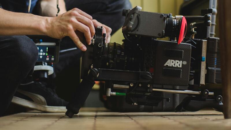
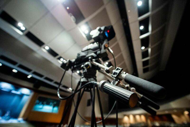
Choosing the Appropriate Drone Equipment for Real Estate Photography
Making an informed choice about drone equipment is essential for capturing high-quality imagery that accurately represents a property’s value. Professionals in Miami seeking to maximize the impact of their listings should prioritize drones equipped with high-resolution cameras capable of capturing detailed images and smooth 4K videos. These specifications ensure that potential buyers can appreciate intricate architectural details, spacious interiors, and appealing landscape features from aerial perspectives. Opt for drones that feature stable gimbal systems, which significantly improve image sharpness and fluidity during flight. This stability is particularly crucial for creating visually appealing videos and panoramic shots that evoke a sense of space and grandeur. Battery life is another critical factor; longer flight times allow for comprehensive coverage of large properties or multiple angles without frequent interruptions. Additionally, consider the drone’s ease of operation, including intuitive controls and responsive flight characteristics, to achieve optimal shot composition with minimal difficulty. For real estate-specific applications, incorporating drones with obstacle avoidance technology helps maintain safe flight paths, especially when navigating around complex property layouts or dense greenery. Polyvalent drones with customizable settings also provide flexibility for different lighting conditions and shooting scenarios. Moreover, selecting equipment that complies with local regulations—such as specific weight classifications and operational capabilities—helps streamline integration into your existing workflow. Properly chosen gear not only enhances image quality but also facilitates professional, efficient, and compliant aerial photography tailored for Miami’s dynamic real estate market.
Best Practices for Drone Photography in Real Estate
When integrating drone photography into real estate marketing strategies, adherence to established best practices ensures high-quality results that elevate property listings and attract discerning buyers. These practices encompass pre-flight preparation, optimal flight techniques, and post-flight processing, all aimed at producing compelling visual content.
Pre-Flight Planning and Site Assessment
Before launching a drone, it is essential to conduct a thorough assessment of the property and surrounding environment. This includes analyzing weather conditions, assessing natural light angles, and identifying potential obstacles such as trees, power lines, or adjacent structures. Mapping out specific flight paths that maximize the property's key features ensures comprehensive coverage while maintaining safety and image consistency.
Optimal Flight Techniques
Executing controlled, steady flights is crucial for capturing sharp, professional-grade images. Utilize autonomous waypoint flights to guarantee consistent framing, especially for aerial panoramas or multiple property angles. Maintaining stable altitude and camera orientation minimizes distortions and ensures clarity in final images.
During flights, adjusting altitude and camera angles can emphasize specific features such as landscaped gardens, pool areas, or architectural details. Employing techniques like high-overhead shots combined with frontal aerial views provides a comprehensive visualization that appeals to prospective buyers.
Post-Flight Processing
Processing drone footage involves meticulous editing to elevate the quality of images and videos. Color correction enhances natural hues, ensuring the property appears vibrant and inviting. Stabilization tools remove jitters or shakes, resulting in fluid footage that professional viewers expect. Additionally, stitching panoramic images or creating virtual tours from multiple footage segments provides immersive experiences for potential buyers.
Maintaining Consistency and Branding
To build a recognizable brand identity, it is vital to implement consistent shooting S techniques across all listings. Utilizing similar color grading, framing styles, and editing presets fosters a cohesive aesthetic that reinforces your authority in the Miami real estate market.
Legal Compliance in Filming and Data Management
While technical excellence is paramount, staying aligned with local operational guidelines ensures seamless workflow integration. Maintaining detailed records of flight logs, footage archives, and permission documentation enhances credibility and supports any future marketing or promotional endeavors.
Implementing Workflow Protocols for Drone Photography in Real Estate
To maximize the value of drone imagery in real estate marketing, establishing clear and efficient workflow protocols is essential. This approach ensures consistent results, enhances safety measures, and maintains professionalism across all project stages. A well-structured workflow begins with comprehensive planning, including site assessment and flight path mapping to optimize shot angles while considering environmental conditions such as wind speed and prevailing weather patterns.
Pre-flight preparations also involve verifying drone equipment functionality, battery levels, and data storage capacity. Preparing detailed shot lists aligned with the property’s unique features helps maintain focus during the flight, reducing turnaround time and increasing shot quality. Ensuring all necessary permissions and documentation are in place before flying minimizes disruptions and supports smooth operations.
Executing the flight requires precision piloting skills and adherence to predefined flight paths. Utilizing automated flight modes, such as waypoint navigation and orbit modes, allows for consistent, repeatable shots, which are particularly useful for multiple property listings. During the flight, continuous monitoring of the drone’s status ensures that any unforeseen issues are promptly addressed.
Post-flight processing involves detailed review of footage for quality assurance. Transferring data securely, organizing files systematically, and backing up all footage safeguard against data loss. Properly cataloged media facilitates a streamlined editing process and expedites delivery timelines to clients.

Effective workflows extend beyond individual projects, incorporating ongoing analysis and feedback to refine techniques continuously. Conducting post-mortem reviews of completed shoots helps identify areas for improvement, whether in equipment handling, flight planning, or editing processes. This iterative approach enhances future performance and ensures that drone representations of properties are always aligned with market standards and expectations.
Incorporating standardized procedures not only elevates the professionalism of your services but also fosters trust with clients by demonstrating consistency and adherence to best practices. When integrating drone photography into your overall real estate marketing strategy, these protocols become the backbone that supports scalable, reliable, and compelling visual content creation.
Effective Data Management for Drone Photography in Real Estate
As drone photography becomes an integral part of real estate marketing, establishing a robust system for managing aerial footage is essential. Organizing files methodically ensures quick access, streamlined editing workflows, and consistent delivery to clients. Use a dedicated, well-structured digital storage solution, such as cloud-based platforms or high-capacity external drives, to keep raw footage, edits, and final images separate and easily identifiable.
Label files with descriptive naming conventions, including property addresses, shoot dates, and version numbers. This practice prevents confusion and facilitates efficient retrieval. Additionally, maintaining a detailed logbook or metadata record for each shoot—covering camera settings, flight conditions, and specific areas captured—enhances the quality control process and supports future revisions.
Security is equally important when handling drone footage. Implement strong access controls and regular backup routines to safeguard data from loss or unauthorized access. Encrypt sensitive files if necessary, especially when sharing with clients or collaborating with external teams.
Adopting these organizational strategies not only improves operational efficiency but also elevates your professionalism. Clients appreciate a seamless experience, from initial scheduling through to final delivery, reflecting a well-managed and reliable service.
Continually reviewing and optimizing data management procedures ensures your methods adapt to evolving technology and project demands. Regular audits help identify bottlenecks, redundant files, or security gaps, contributing to a smoother execution process. Implementing standardized protocols across your team fosters consistency and quality assurance, reinforcing your reputation as a trusted provider of drone-based real estate imagery.
Advanced Tips for Maximizing Drone Photography in Real Estate
To leverage drone photography for real estate at its fullest potential, professionals must adopt advanced techniques that elevate the visual storytelling of property listings. This requires a comprehensive understanding of flight planning, camera operation, and post-production workflows. Strategic flight paths should be carefully designed to capture the property's unique features from multiple angles, including aerial shots that highlight landscaping, surrounding amenities, and proximity to key locations. Utilizing automated flight modes where available can streamline complex shot sequences, ensuring consistency and precision across multiple property shoots.
Optimal camera settings are essential to produce clear, high-quality images in various lighting conditions. It’s advisable to shoot in RAW format to retain maximum detail for post-processing, allowing adjustments to exposure, white balance, and contrast without degrading image quality. Employing gimbals for stabilization ensures smooth footage, especially when capturing dynamic angles or video. The use of polarized lenses can reduce reflections and glare, providing clearer views of windows, pools, and other reflective surfaces.
Post-Production Enhancement
Post-flight editing plays a crucial role in transforming raw drone footage into compelling marketing material. Color correction can correct anomalies caused by weather or lighting conditions, ensuring accurate yet aesthetically appealing images. Adding overlays like property boundaries or location markers can help prospective buyers better understand the property's layout and surroundings. Advanced software solutions also enable creating cinematic walkthroughs or virtual tours, adding an immersive experience that encourages buyer engagement.
Safety and Privacy Considerations
Maintaining safety protocols during drone operation is critical to prevent accidents or disruptions. When conducting drone flights, pilots should conduct pre-flight risk assessments, checking for obstructions, weather conditions, and other environmental factors. Respect for privacy ensures that neighboring properties are not inadvertently captured, which can lead to discomfort or misinterpretation. Using flight plans that focus solely on the property minimizes these concerns while producing professional footage tailored for marketing purposes.
Integrating drone footage into your broader marketing strategy enhances the property's visibility across various platforms. Embedding high-resolution images or videos on listing websites, social media campaigns, and virtual tours can significantly boost viewer interest. To maximize return on investment, consider creating comprehensive packages that combine aerial photography, interior shots, and 3D virtual walkthroughs, providing a full viewing experience for potential buyers. This multi-modal approach helps to build a compelling narrative around the property, highlighting its best features throughout the marketing funnel.
Training and Certification
Investing in specialized training programs and obtaining certifications in drone operation can further elevate your service quality. Certified operators demonstrate professionalism and expertise, which can instill greater confidence in clients. Regularly updating skills with the latest technology and industry best practices ensures your business remains competitive and capable of delivering cutting-edge visual content that meets evolving market standards.